Helene makes landfall in northwestern Florida as a Category 4 hurricane
Forecasters warned that the enormous system could create a "nightmare" storm surge and bring dangerous winds and rain across much of the southeastern U.S.

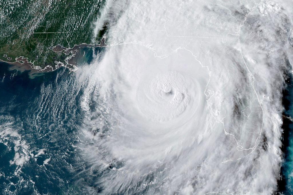
This GOES-16 GeoColor satellite image taken at 5:46 p.m. EDT and provided by National Oceanic and Atmospheric Administration (NOAA) shows Hurricane Helene in the Gulf of Mexico moving towards Florida, Thursday, Sept. 26 2024. (NOAA via AP)
CRAWFORDVILLE, Fla. (AP) — Hurricane Helene made landfall Thursday night in northwestern Florida as a Category 4 storm as forecasters warned that the enormous system could create a “nightmare” storm surge and bring dangerous winds and rain across much of the southeastern U.S.
The National Hurricane Center in Miami said Helene roared ashore around 11:10 p.m. EDT near the mouth of the Aucilla River in the Big Bend area of Florida’s Gulf Coast. It had maximum sustained winds estimated at 140 mph ( 225 kph).
Helene prompted hurricane and flash flood warnings extending far beyond the coast up into northern Georgia and western North Carolina. Before it made landfall, strong winds had already cut power to nearly 900,000 homes and businesses in Florida, according to the tracking site poweroutage.us. The governors of Florida, Georgia, Alabama, the Carolinas and Virginia all declared emergencies in their states.
One person was killed in Florida when a sign fell on their car and two people were reported killed in a possible tornado in south Georgia as the storm approached.
“When Floridians wake up tomorrow morning, we’re going to be waking up to a state where very likely there’s been additional loss of life and certainly there’s going to be loss of property," Florida Gov. Ron DeSantis said at a news conference Thursday night.
The National Weather Service in Tallahassee had issued an “extreme wind warning” for the Big Bend as the eyewall approached: “Treat this warning like a tornado warning,” it said in a post on X. “Take shelter in the most interior room and hunker down!”
Two people were reported killed in a possible tornado in south Georgia as the storm approached.

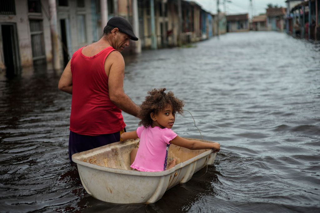
Jesus Hernandez guides his granddaughter Angelina via a container through a street flooded in the passing of Hurricane Helene, in Batabano, Mayabeque province, Cuba, Thursday, Sept. 26, 2024. (AP Photo/Ramon Espinosa)
The hurricane's eye was about 90 miles (145 kilometers) south of Tallahassee, Florida, and had sustained winds of 140 mph (225 kph), according to the U.S. National Hurricane Center. It was moving north-northeast at 24 mph (39 kph), and life-threatening storm surges of up to 20 feet (6 meters) were expected in the Big Bend area of Florida.
The National Weather Service in Tallahassee issued an “extreme wind warning” for the Big Bend as the eyewall approached: “Treat this warning like a tornado warning,” it said in a post on X. “Take shelter in the most interior room and hunker down!”
Helene arrives barely a year since Hurricane Idalia slammed into Florida’s Big Bend and caused widespread damage. Idalia became a Category 4 in the Gulf of Mexico but made landfall as a Category 3 near Keaton Beach, with maximum sustained winds near 125 mph (205 kph).
The storm's wrath was felt widely, with sustained tropical storm-force winds and hurricane-force gusts along Florida's west coast. Water lapped over a road in Siesta Key near Sarasota and covered some intersections in St. Pete Beach. Lumber and other debris from a fire in Cedar Key a week ago crashed ashore in the rising water.

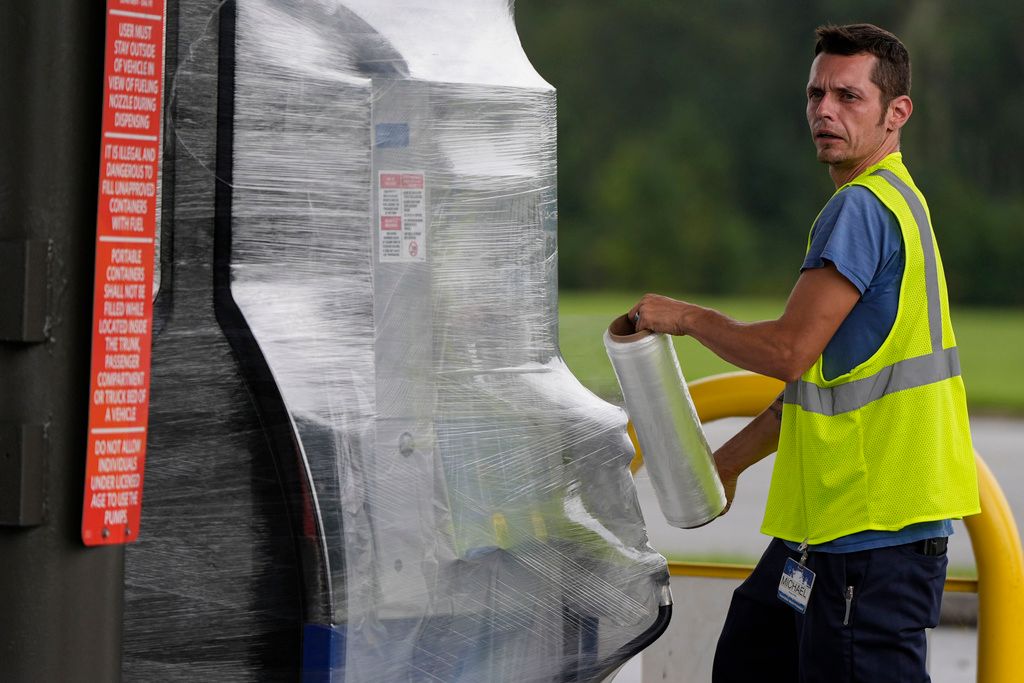
A Sam's Club employee wraps wraps fuel pumps ahead of Hurricane Helene, expected to make landfall Thursday evening, Thursday, Sept. 26, 2024, in Valdosta, Ga. (AP Photo/Mike Stewart)
Beyond Florida, up to 10 inches (25 centimeters) of rain had fallen in the North Carolina mountains, with up to 14 inches (36 centimeters) more possible before the deluge ends, setting the stage for flooding that forecasters warned could be worse than anything seen in the past century.
Heavy rains began falling and winds were picking up in Valdosta, Georgia, near the Florida state line. The weather service said more than a dozen Georgia counties could see hurricane-force winds exceeding 110 mph.
In south Georgia, two people were killed when a possible tornado struck a mobile home on Thursday night, Wheeler County Sheriff Randy Rigdon told WMAZ-TV. The damage was reported as heavy thunderstorms raked much of the state. Wheeler County is about 70 miles (113 kilometers) southeast of Macon.
Forecaster Dylan Lusk said the National Weather Service issued a tornado warning for Wheeler County at 8:47 p.m. on Thursday. He said it’s one of 12 tornado warnings the office near Atlanta issued for parts of Georgia between 1 p.m. and 11 p.m.
Florida Gov. Ron DeSantis said that models suggest Helene will make landfall further east than earlier forecast, lessening the chances for a direct hit on the capital city of Tallahassee, whose metro area has a population of around 395,000.
The shift has the storm aimed squarely at the sparsely-populated Big Bend area, home to fishing villages and vacation hideaways where Florida’s Panhandle and peninsula meet.

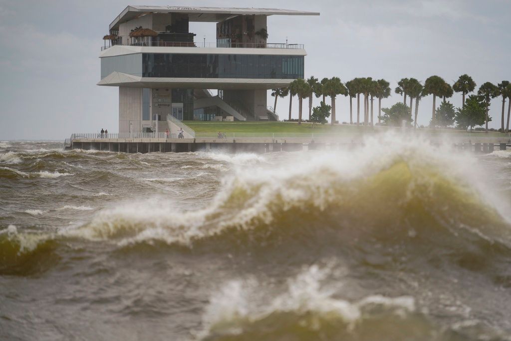
The St. Pete Pier is pictured among high winds and waves as Hurricane Helene makes its way toward the Florida panhandle, passing west of Tampa Bay, Thursday, Sept. 26, 2024 in St. Petersburg, Fla. (Martha Asencio-Rhine/Tampa Bay Times via AP)
“Please write your name, birthday, and important information on your arm or leg in a PERMANENT MARKER so that you can be identified and family notified,” the sheriff's office in mostly rural Taylor County warned those who chose not to evacuate in a Facebook post, the dire advice similar to what other officials have dolled out during past hurricanes.
Still, Philip Tooke, a commercial fisherman who took over the business his father founded near the region’s Apalachee Bay, planned to ride out this storm like he did during Hurricane Michael and the others – on his boat. “If I lose that, I don’t have anything,” Tooke said. Michael, a Category 5 storm, all but destroyed one town, fractured thousands of homes and businesses and caused some $25 billion in damage when it struck the Florida Panhandle in 2018.
Many, though, were heeding the mandatory evacuation orders that stretched from the Panhandle south along the Gulf Coast in low-lying areas around Tallahassee, Gainesville, Cedar Key, Lake City, Tampa and Sarasota.
Among them was Sharonda Davis, one of several gathered at a Tallahassee shelter worried their mobile homes wouldn’t withstand the winds. She said the hurricane’s size is “scarier than anything because it’s the aftermath that we’re going to have to face.”
Federal authorities were staging search-and-rescue teams as the weather service forecast storm surges of up to 20 feet (6 meters) and warned they could be particularly “catastrophic and unsurvivable” in Apalachee Bay.
“Please, please, please take any evacuation orders seriously!” the office said, describing the surge scenario as “a nightmare.”
This stretch of Florida known as the Forgotten Coast has been largely spared by the widespread condo development and commercialization that dominates so many of Florida’s beach communities. The region is loved for its natural wonders — the vast stretches of salt marshes, tidal pools and barrier islands.
“You live down here, you run the risk of losing everything to a bad storm,” said Anthony Godwin, 20, who lives about a half-mile (800 meters) from the water in the coastal town of Panacea, as he stopped for gas before heading west toward his sister’s house in Pensacola.
School districts and multiple universities canceled classes. Airports in Tampa, Tallahassee and Clearwater were closed Thursday, while cancellations were widespread elsewhere in Florida and beyond.
While Helene will likely weaken as it moves inland, damaging winds and heavy rain were expected to extend to the southern Appalachian Mountains, where landslides were possible, forecasters said. The hurricane center warned that much of the region could experience prolonged power outages and flooding. Tennessee was among the states expected to get drenched.
Helene had swamped parts of Mexico’s Yucatan Peninsula on Wednesday, flooding streets and toppling trees as it passed offshore and brushed the resort city of Cancun. In western Cuba, Helene knocked out power to more than 200,000 homes and businesses as it brushed past the island.
Areas 100 miles (160 kilometers) north of the Georgia-Florida line expected hurricane conditions. The state opened its parks to evacuees and their pets, including horses. Overnight curfews were imposed in many cities and counties in south Georgia.
“This is one of the biggest storms we’ve ever had,” said Georgia Gov. Brian Kemp.
For Atlanta, Helene could be the worst strike on a major Southern inland city in 35 years, said University of Georgia meteorology professor Marshall Shepherd.
Helene is the eighth named storm of the Atlantic hurricane season, which began June 1. The National Oceanic and Atmospheric Administration has predicted an above-average Atlantic hurricane season this year because of record-warm ocean temperatures.
In further storm activity, Tropical Storm Isaac formed Wednesday in the Atlantic and was expected to strengthen as it moves eastward across the open ocean, possibly becoming a hurricane by the end of the week, forecasters said. Officials said its swells and winds could affect parts of Bermuda and eventually the Azores by the weekend.
In the Pacific, former Hurricane John reformed Wednesday as a tropical storm and strengthened Thursday back into a hurricane as it threatened areas of Mexico’s western coast with flash flooding and mudslides. Mexico President Andrés Manuel López Obrador raised John’s death toll to five as communities along the country’s Pacific coast prepared for the storm to make a second landfall.