


 Philippines
National
Tropical depression Gener's landfall possible in Isabela or Aurora within 24 hours — PAGASA
Philippines
National
Tropical depression Gener's landfall possible in Isabela or Aurora within 24 hours — PAGASA
Tropical depression Gener's landfall possible in Isabela or Aurora within 24 hours — PAGASA


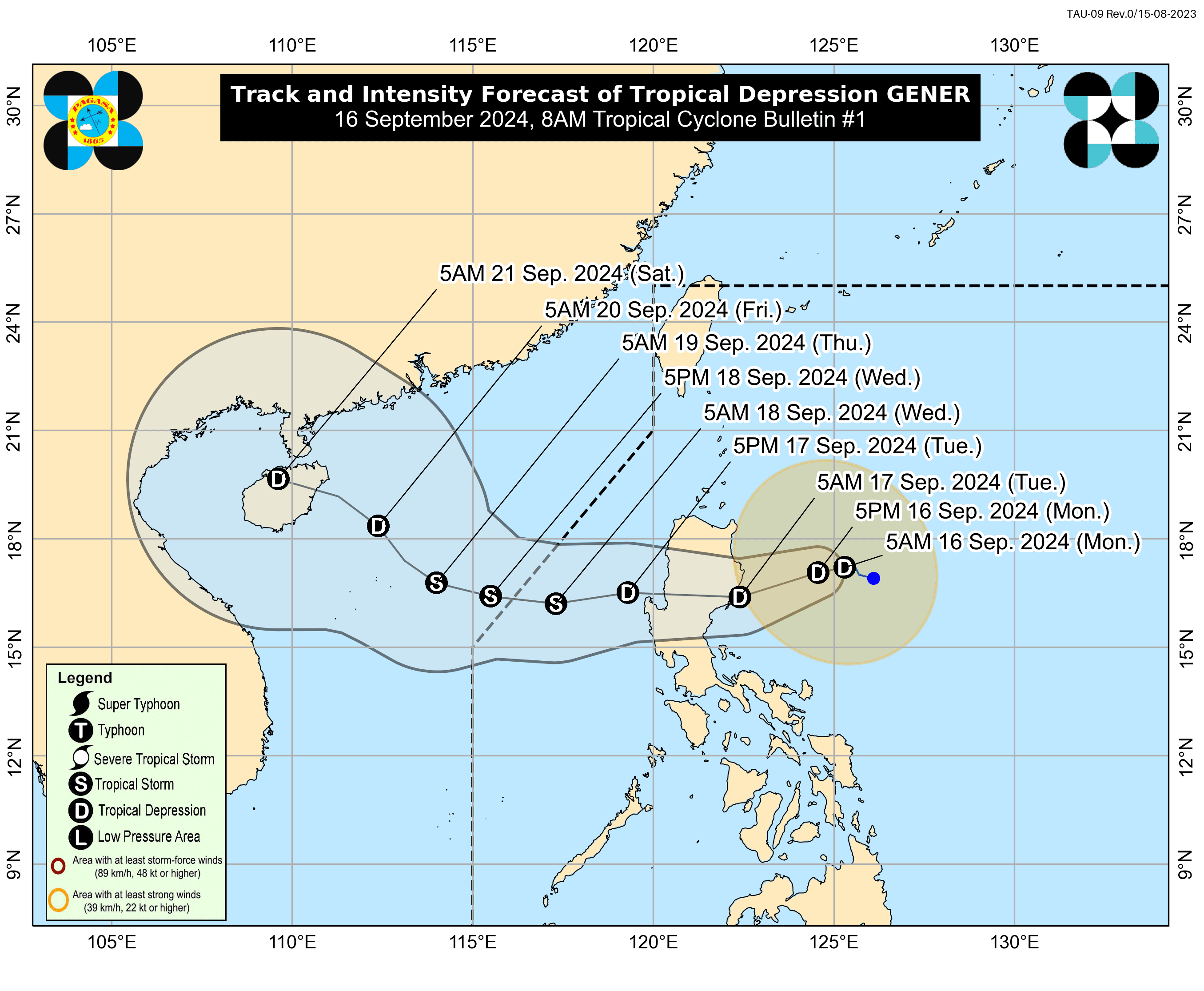
The Philippine Atmospheric, Geophysical and Astronomical Services Administration (PAGASA) warned on Monday, Sept. 16 of stormy weather over several parts of Luzon due to the possible landfall of Tropical Depression “Gener” in Isabela or Aurora within the next 24 hours.
As of 8 a.m., the center of the tropical depression was located 315 kilometers east-northeast of Casiguran, Aurora.
In anticipation of Gener’s strong winds, Tropical Cyclone Wind Signal No. 1 has been raised over the eastern and central portions of mainland Cagayan, Isabela, Quirino, eastern portion of Nueva Vizcaya, eastern and southern portions of Apayao, Kalinga, eastern and central portions of Mountain Province, Ifugao, Aurora, eastern portion of Nueva Ecija, and northern portion of mainland Quezon, including Polillo Islands.
PAGASA also warned of heavy to intense rainfall (100 to 200 millimeters) in Cagayan, Isabela, and Aurora.
Meanwhile, moderate to heavy rainfall (50 to 100 millimeters) may affect Cordillera Administrative Region and the rest of Cagayan Valley.
Gener has intensified from a Low Pressure Area (LPA) at 5 a.m. on Monday.
It has maximum sustained winds of 45 kilometers per hour (kph) near the center and gusts of up to 55 kph and is expected to move westward at 10 kph.
PAGASA said Gener is expected to move generally westward to west-southwestward until Wednesday afternoon, Sept. 18, before turning west-northwestward to northwestward for the rest of the forecast period.
It may exit the Philippine Area of Responsibility (PAR) by Wednesday.
PAGASA said Gener is likely to experience limited intensification over the next two days but is expected to reach tropical storm category by Wednesday after emerging over the West Philippine Sea.
However, due to its proximity to the Luzon landmass, changes in intensity and track are likely while crossing Luzon.