


 Philippines
National
LPA approaching Luzon may develop into tropical depression within 24 hours
Philippines
National
LPA approaching Luzon may develop into tropical depression within 24 hours
LPA approaching Luzon may develop into tropical depression within 24 hours


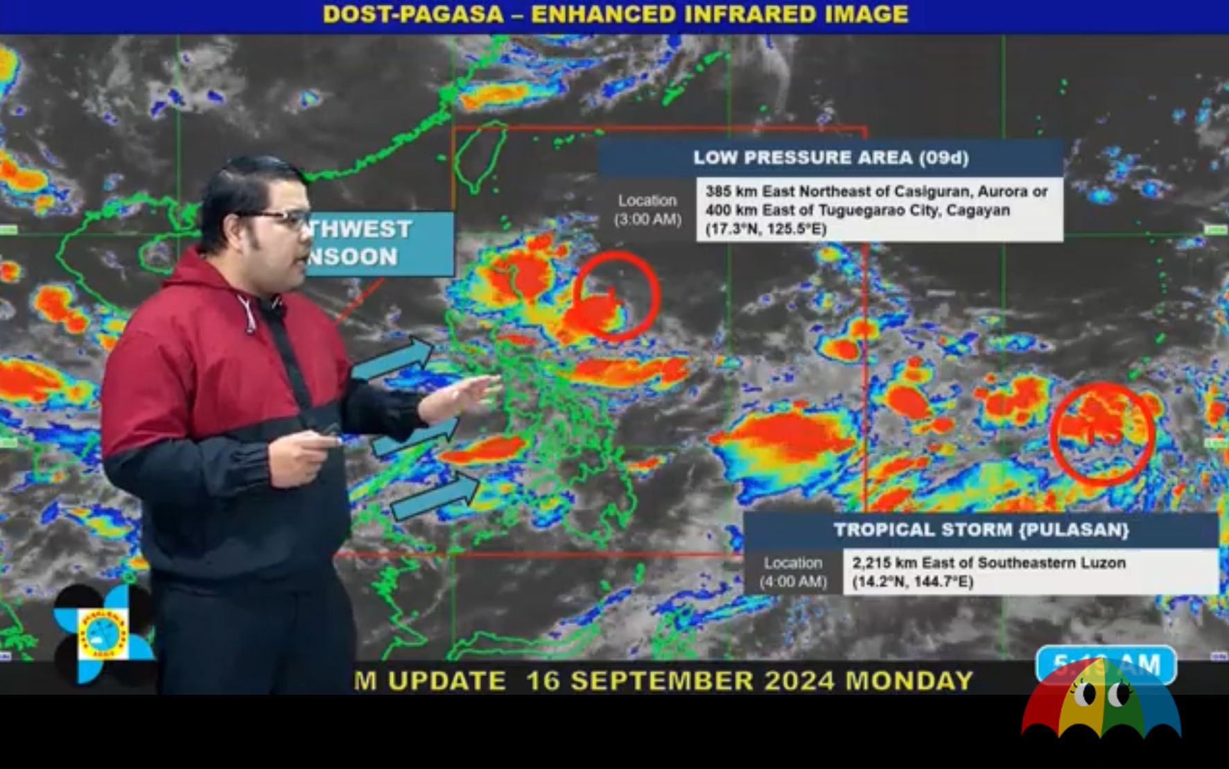
The Philippine Atmospheric, Geophysical and Astronomical Services Administration (PAGASA) warned that tropical cyclone wind signals may be raised over parts of Cagayan Valley as the Low Pressure Area (LPA) near Luzon has a “high” chance of developing into a tropical depression on Monday, Sept. 16.
If it strengthens into a tropical depression, it will be given the name “Gener.”
As of 3 a.m., the LPA was located 385 kilometers (km) east-northeast of Casiguran, Aurora, or 400 km east of Tuguegarao City, Cagayan.
There is a possibility that the potential cyclone could move close to land, PAGASA Weather Specialist Obet Badrina warned.
He added that once the LPA becomes a tropical depression, wind signals will be raised, particularly in parts of Cagayan Valley.
He also warned of moderate to heavy rainfall (50 to 100 millimeters) in Ilocos Region, Cagayan Valley, Cordillera Administrative Region (CAR), and Aurora.
‘Habagat’ persists
Aside from the LPA, Badrina said the western parts of the country are expected to experience rainy weather due to the southwest monsoon, or “habagat,” over the next 24 hours.
From Monday to Tuesday, Sept. 17, heavy to intense rainfall (100 to 200 millimeters) may affect northern Palawan, Occidental Mindoro, Aklan, Antique, and Negros Occidental.
Meanwhile, moderate to heavy rainfall may persist in the rest of Palawan, Oriental Mindoro, Marinduque, Romblon, Western Visayas, and Negros Island Region (NIR).
Cloudy skies with scattered rains and thunderstorms may also affect Metro Manila, Zamboanga Peninsula, BangsamoroAutonomous Region in Muslim Mindanao, Soccsksargen, Caraga, Northern Mindanao, and the rest of Luzon and Visayas.
The rest of Mindanao will be partly cloudy to cloudy with isolated rain showers or thunderstorms.
Based on PAGASA’s rainfall outlook, heavy rains may persist in parts of Mimaropa, Bicol Region, and Visayas in the next few days.
From Tuesday to Wednesday, Sept. 18, northern Palawan, Occidental Mindoro, Aklan, and Antique may receive heavy to intense rains, while NIR, Albay, Sorsogon, Masbate, the rest of Palawan, Oriental Mindoro, Marinduque, Romblon, and the rest of Western Visayas may experience moderate to heavy rains.
From Wednesday to Thursday, Sept. 19, heavy to intense rainfall may persist in Occidental Mindoro, while moderate to heavy rainfall may affect Zambales, Bataan, Aklan, Antique, Oriental Mindoro, Marinduque, Romblon, and Palawan.
PAGASA warned of possible flooding or landslides, especially in areas classified as “highly or very highly susceptible” to these hazards and areas that have received substantial rainfall in the past few days.