


'Bebinca' may enter PAR on Sept. 13, to enhance 'habagat'


At A Glance
- Once the tropical cyclone enters the PAR, it will be given the local name "Ferdie."
- It will enhance the effects of the southwest monsoon, potentially causing heavy rainfall over Bicol Region, Mimaropa, Visayas, and the northern and western portions of Mindanao.
The tropical storm with the international name “Bebinca” is expected to enter the country’s area of responsibility by Friday, Sept. 13, and will likely enhance the effects of the southwest monsoon (habagat) as the weekend approaches, the Philippine Atmospheric, Geophysical and Astronomical Services Administration (PAGASA) said on Wednesday, Sept. 11.
Before Wednesday noon, PAGASA said Bebinca continues to intensify while moving away from Guam.
As of 10 a.m., the center of the tropical storm was located 1,825 kilometers (km) east-northeast of Eastern Visayas or 1,955 km east of southeastern Luzon.
It has maximum sustained winds of 85 kilometers per hour (kph) near the center and gusts of up to 105 kph.
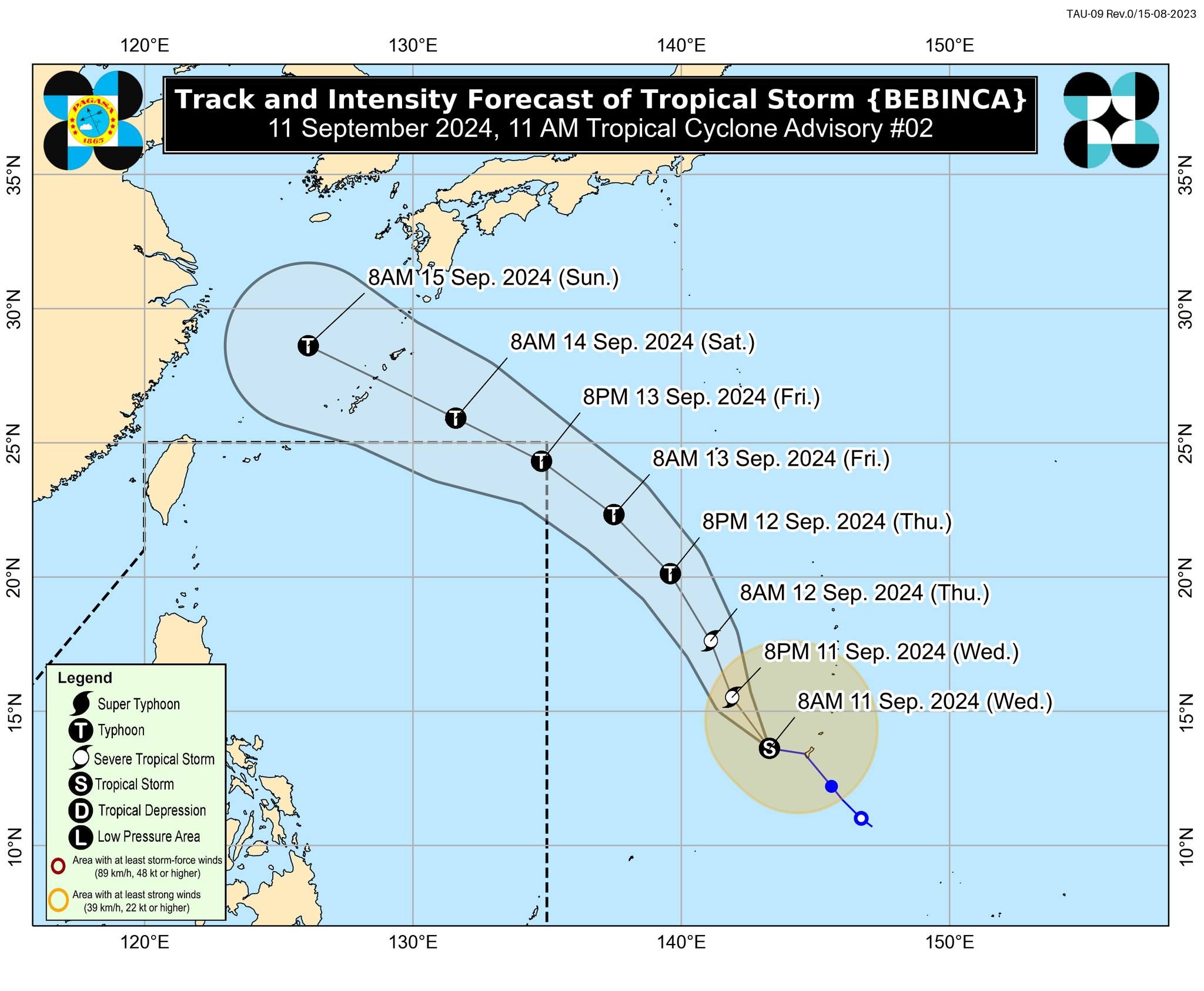
Bebinca is moving westward at 25 kph and is expected to enter the Philippine area of responsibility (PAR) on Friday afternoon or evening as a typhoon.
Once it enters, it will be given the local name “Ferdie.”
However, it may only briefly stay inside the PAR, likely exiting the area by Saturday morning, Sept. 14.
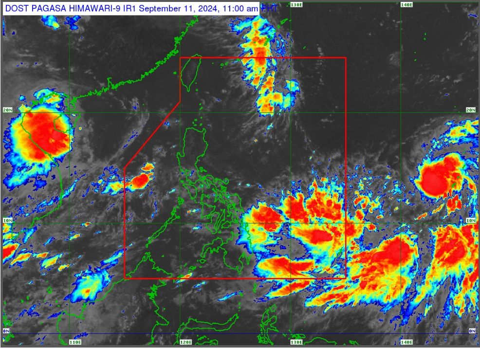
PAGASA said that despite its distance from the Philippine landmass and having no direct impact on the country, Bebinca will enhance the effects of the southwest monsoon, potentially causing heavy rainfall over Bicol Region, Mimaropa, Visayas, and the northern and western portions of Mindanao.
It warned of possible flooding or landslides, particularly in areas identified as "highly or very highly susceptible" to these hazards and areas that have received significant rainfall in the past few days.
Likewise, up to moderate seas are expected in the next 24 hours over the western seaboard of Palawan, including Kalayaan Islands, the eastern seaboard of southern Palawan, and the eastern seaboard of Mindanao due to the habagat.
PAGASA advised mariners of motorized bancas and similarly-sized vessels to take precautionary measures while at sea and, if possible, avoid navigating under these conditions.
READ MORE: https://mb.com.ph/2024/9/11/storm-trough-habagat-to-bring-rains-across-parts-of-the-philippines