LPA east of Visayas develops into tropical depression
At A Glance
- The tropical depression will be named "Ferdie" once it enters the PAR.
- It may gradually enhance the effects of the southwest monsoon (habagat) and could start bringing widespread rains across Southern Luzon, Visayas, and parts of Mindanao, potentially including Metro Manila, by Wednesday or Thursday, Sept. 11 or 12.

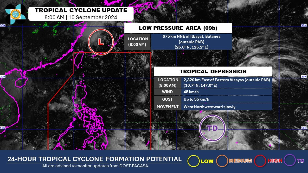
The low pressure area (LPA) being monitored by the Philippine Atmospheric, Geophysical and Astronomical Services Administration (PAGASA) has developed into a tropical depression at 8 a.m. on Tuesday, Sept. 10.
PAGASA said the tropical depression is still outside the Philippine area of responsibility (PAR) or about 2,320 kilometers east of Eastern Visayas.
It has maximum sustained winds of 45 kilometers per hour (kph) near the center and gusts of up to 55 kph and is slowly moving west-northwestward.
The tropical depression will be named “Ferdie” once it enters the PAR.
In the 5 a.m. live report, PAGASA Weather Specialist Rhea Torres said the weather disturbance may gradually enhance the effects of the southwest monsoon (habagat) and could start bringing widespread rains across Southern Luzon, Visayas, and parts of Mindanao, potentially including Metro Manila, by Wednesday or Thursday, Sept. 11 or 12.
The widespread rains due to the habagat may continue until the following week as the tropical depression will continue to traverse the waters east of the country, she added.
Meanwhile, PAGASA said the LPA, which exited the PAR on Monday evening and was located 675 kilometers north-northeast of Itbayat, Batanes at 8 a.m. on Tuesday, may still develop into a tropical cyclone.
However, Torres said that this weather disturbance is not expected to directly affect any parts of the country in the coming days.