


 Philippines
National
Signal No. 2 raised as 'Enteng' intensifies into tropical storm
Philippines
National
Signal No. 2 raised as 'Enteng' intensifies into tropical storm
Signal No. 2 raised as 'Enteng' intensifies into tropical storm


At A Glance
- Signal No. 2 has been hoisted over the eastern portion of Camarines Sur, Catanduanes, and the eastern portion of Isabela.
- PAGASA said the highest wind signal that may be raised during the passage of Enteng could be Signal No. 3.
- Heavy rains, brought by the tropical storm and the enhanced southwest monsoon, or "habagat," may affect parts of Luzon and Visayas in the next few days.
The Philippine Atmospheric, Geophysical and Astronomical Services Administration (PAGASA) raised Tropical Cyclone Wind Signal No. 2 as "Enteng" (international name: Yagi) intensified into a tropical storm late Sunday evening, Sept. 1.
In PAGASA’s bulletin issued at 11 p.m., Enteng has maximum sustained winds of 65 kilometers per hour (kph) near the center and gusts of up to 80 kph, up from 55 kph maximum winds and 70 kph gusts in the previous bulletin.
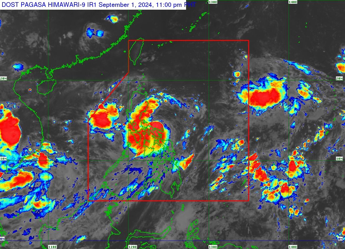
PAGASA earlier said the storm may either “make landfall or pass very close” to Catanduanes.
As of 10 p.m., the center of Enteng was located over the coastal waters of Bagamanoc, Catanduanes.
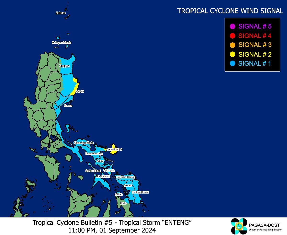
Due to the anticipated strong winds from the storm, Signal No. 2 has been hoisted over the eastern portion of Camarines Sur, Catanduanes, and the eastern portion of Isabela.
Meanwhile, Signal No. 1 has been raised in the eastern portion of Cagayan, including Babuyan Islands, the eastern and central portions of Isabela, eastern and southern portions of Quirino, southern portion of Nueva Vizcaya, Aurora, northern and southern portions of Quezon, including Polillo Islands, Camarines Norte, the rest of Camarines Sur, Albay, Sorsogon, Masbate, including Ticao and Burias Islands, Northern Samar, Samar, Eastern Samar, Biliran, and the northeastern portion of Leyte.
PAGASA said the highest wind signal that may be raised during the passage of Enteng could be Signal No. 3.
Over the next 24 hours, torrential rains (more than 200 millimeters) due to the storm are expected to affect Camarines Norte, Camarines Sur, Polillo Island, and the southern portion of mainland Quezon.
Meanwhile, the rest of Quezon, Catanduanes, Masbate, Albay, Sorsogon, Northern Samar, and Samar may experience heavy to intense rains (100 to 200 millimeters).
Moderate to heavy rains (50 to 100 millimeters) may prevail over Isabela, Quirino, Aurora, Bulacan, Metro Manila, Cavite, Laguna, Batangas, Rizal, Marinduque, Romblon, Eastern Samar, Biliran, and the northern portion of Leyte.
The storm-enhanced southwest monsoon, or “habagat,” may also bring heavy to intense rains to Occidental Mindoro, Oriental Mindoro, northern Palawan, including Calamian, Cuyo, and Cagayancillo Islands, and Antique.
Moderate to heavy rains due to the habagat may also affect Zambales, Bataan, Tarlac, Pampanga, Nueva Ecija, the rest of Palawan, the rest of Western Visayas, and Negros Island Region.
PAGASA warned that these conditions could cause flooding and rain-induced landslides, particularly in areas identified as highly vulnerable in official hazard maps and those that have recently received heavy rainfall.