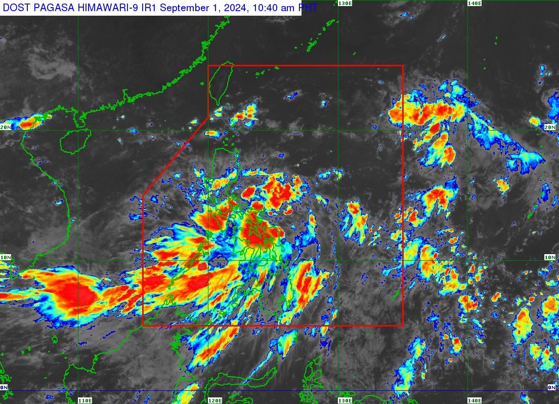
PAGASA raises Signal No. 1 due to TD Enteng
Tropical depression, 'habagat' to bring heavy rains
At A Glance
- The low pressure area east of Eastern Visayas developed into a tropical depression at 8 a.m. and has been named Enteng, making it the first tropical cyclone of September and the fifth this year.
- Signal No. 1 was hoisted over the eastern portion of Camarines Sur, Catanduanes, Albay, Sorsogon, Burias Island, Ticao Island, Northern Samar, Samar, Eastern Samar, Biliran, and the northeastern portion of Leyte.
- Heavy rains, brought by the tropical depression and the cyclone-enhanced southwest monsoon, or "habagat," may affect several areas as early as Sunday.

The Philippine Atmospheric, Geophysical and Astronomical Services Administration (PAGASA) raised Wind Signal No. 1 in at least 10 areas in Luzon and Visayas as of Sunday, Sept. 1 due to the development of a tropical depression named “Enteng.”
The low pressure area east of Eastern Visayas developed into a tropical depression at 8 a.m. and has been named Enteng, making it the first tropical cyclone of September and the fifth this year.
In PAGASA’s tropical cyclone bulletin issued at 11 a.m., Signal No. 1 was hoisted over the eastern portion of Camarines Sur, Catanduanes, Albay, Sorsogon, Burias Island, Ticao Island, Northern Samar, Samar, Eastern Samar, Biliran, and the northeastern portion of Leyte.
PAGASA said the highest wind signals that may be raised during the passage of Enteng could be Signal No. 2 or 3.
Rains due to ‘Enteng’, ‘habagat’
PAGASA Weather Specialist Veronica Torres warned that heavy rains, brought by the tropical depression and the cyclone-enhanced southwest monsoon, or “habagat,” may affect several areas as early as Sunday.
From Sunday to Monday, Sept. 2, heavy to intense rains (100-200 millimeters) are expected in Camarines Sur, Albay, Sorsogon, Masbate, Northern Samar, Samar, Eastern Samar, Biliran, Occidental Mindoro, northern Palawan (including Calamian, Cuyo, and Cagayancillo Islands), Antique, and Negros Occidental
Moderate to heavy rains (50-100 millimeters) may affect Quezon, Marinduque, Romblon, the rest of Eastern Visayas, Oriental Mindoro, Central Visayas, and the rest of Palawan, Western Visayas, and Negros Island Region.
From Monday to Tuesday, Sept. 3, heavy to intense rains may impact Isabela, Occidental Mindoro, Marinduque, Romblon, northern Palawan (including Calamian, Cuyo, and Cagayancillo Islands), Antique, and Negro Occidental.
Meanwhile, moderate to heavy rains may be experienced in Cagayan, Quirino, Apayao, Kalinga, Mountain Province, Ifugao, Abra, Ilocos Norte, Ilocos Sur, Zambales, Bataan, the rest of Palawan, Oriental Mindoro, and the rest of Western Visayas.
From Tuesday to Wednesday, Sept. 4, heavy to intense rains may occur in Babuyan Islands, Zambales, and Bataan, while moderate to heavy rains may persist in Batanes, mainland Cagayan, Apayao, Kalinga, Mountain Province, Abra, Ilocos Norte, Ilocos Sur, Benguet, La Union, Pangasinan, Metro Manila, Cavite, Batangas, Occidental Mindoro, and northern Palawan.
PAGASA warned that these conditions could lead to flooding and rain-induced landslides, particularly in areas highly susceptible to such hazards as identified in official hazard maps and locations with recent heavy rainfall.
Track, intensity outlook
As of 10 a.m., tropical depression Enteng was located 120 km north-northeast of Borongan City, Eastern Samar, or 150 km east of Catarman, Northern Samar.
It is expected to move north-northwestward at 30 kilometers per hour (kph) while packing maximum sustained winds of 45 kph near the center and gusts of up to 55 kph.
Enteng is projected to move generally northwestward to north-northwestward on Sunday and then shift more northward on Monday while intensifying gradually.
PAGASA said a landfall and passage over Bicol Region or Eastern Visayas within the next 48 hours is not ruled out.
It added that the tropical depression may reach tropical storm status by Monday.
From Tuesday to the end of the forecast period, Enteng is expected to move erratically near or over the Luzon Strait, with potential intensification to a severe tropical storm by Thursday, Sept. 5.