


 Philippines
National
'Enteng' nears landfall in Catanduanes; 20 areas under Signal No. 1
Philippines
National
'Enteng' nears landfall in Catanduanes; 20 areas under Signal No. 1
'Enteng' nears landfall in Catanduanes; 20 areas under Signal No. 1


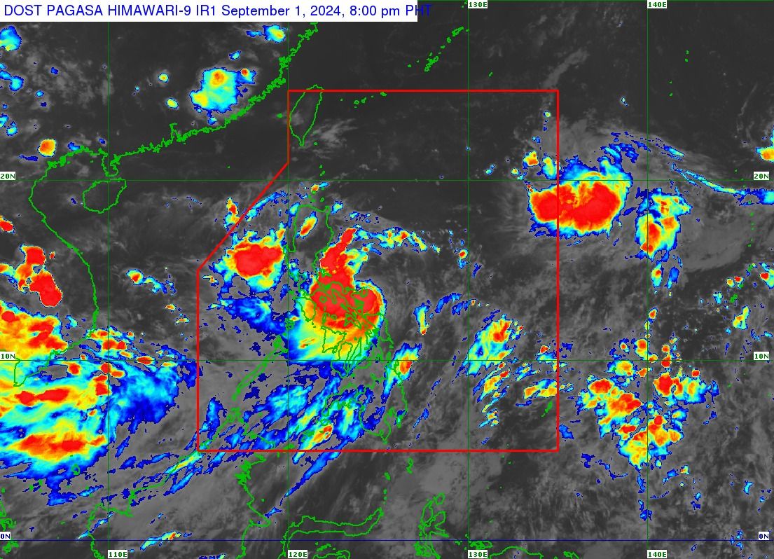
Tropical depression “Enteng” continues to approach Bicol Region and is about to make landfall or pass very close to Catanduanes, the Philippine Atmospheric, Geophysical and Astronomical Services Administration (PAGASA) said in its 8 p.m. bulletin on Sunday, Sept. 1.
PAGASA said the center of Enteng was located over the coastal waters of Baras, Catanduanes around 7 p.m.
The tropical depression has maximum sustained winds of 55 kilometers per hour (kph) near the center and gusts of up to 70 kph while moving northwestward at 15 kph.
Due to the anticipated approach of Enteng, Tropical Cyclone Wind Signal No. 1 was raised over the eastern portion of Cagayan, eastern portion of Isabela, southern portion of Quirino, southern portion of Nueva Vizcaya, Aurora, northern and southern portions of Quezon, including Polillo Islands, Camarines Norte, Camarines Sur, Catanduanes, Albay, Sorsogon, Masbate, including Ticao and Burias Islands, Northern Samar, Samar, Eastern Samar, Biliran, and the northeastern portion of Leyte.
PAGASA said the highest wind signals that may be raised during the passage of Enteng could be Signal No. 2 or 3.
Over the next 24 hours, torrential rains (more than 200 millimeters) may affect Camarines Norte, Camarines Sur, Polillo Island, and the southern portion of mainland Quezon.
Meanwhile, the rest of Quezon, Catanduanes, Masbate, Albay, Sorsogon, Northern Samar, and Samar may experience heavy to intense rains (100 to 200 millimeters).
Moderate to heavy rains (50 to 100 millimeters) may prevail over Isabela, Quirino, Aurora, Bulacan, Metro Manila, Cavite, Laguna, Batangas, Rizal, Marinduque, Romblon, Eastern Samar, Biliran, and the northern portion of Leyte.