Officials begin to assess damage following glacial dam outburst flooding in Alaska's capital city

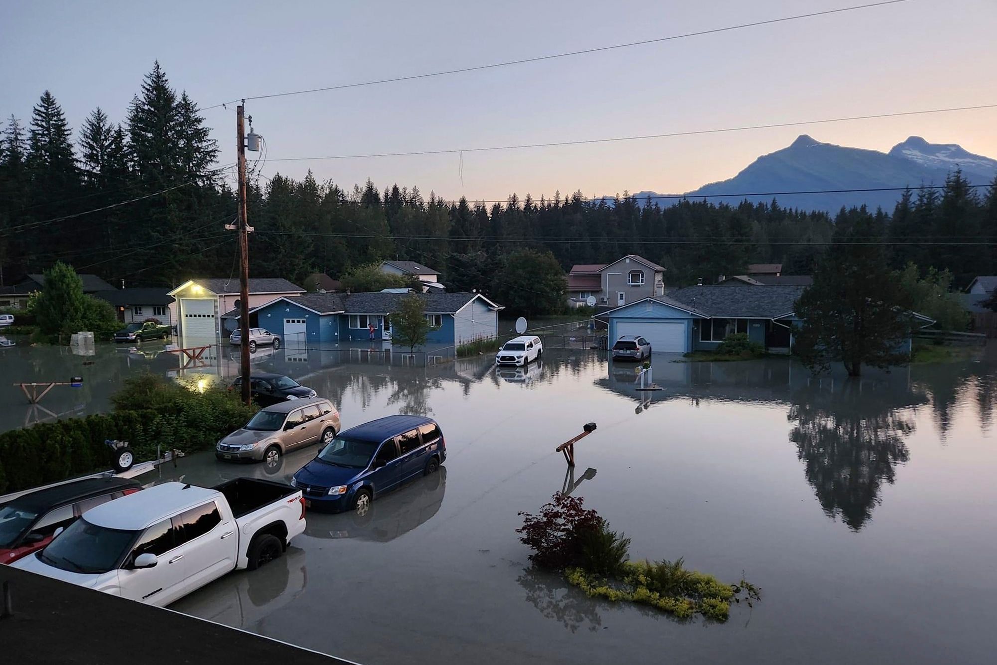
This image provided by the Alaska Department of Transportation and Public Facilities shows water in a neighborhood in Juneau, Alaska, Tuesday, Aug. 6, 2024, following an outburst of flooding from a lake dammed by the Mendenhall Glacier. (Alaska Department of Transportation and Public Facilities via AP)
JUNEAU, Alaska (AP) — More than 100 homes were damaged by flooding following a glacial dam outburst that has become a perennial hazard for neighborhoods near Juneau’s Mendenhall Glacier, officials estimated Tuesday as they began tallying the impacts amid the receding waters.
Local officials adopted an emergency resolution describing the extent of flooding as unprecedented, saying hundreds of homes were severely impacted, including some outside expected flood areas. But Deputy City Manager Robert Barr said officials were still trying to get good estimates on the scope of the damage.
“I would say over a hundred homes right now” were damaged by flooding, he said by email. “I’m less certain about multiple hundreds. Either still possible.”
The National Weather Service said the Mendenhall River crested early Tuesday at 15.99 feet (4.9 meters). That is above the 14.97-foot (4.6-meter) crest a year earlier during a ferocious flood event that devoured huge chunks of riverbank, sent at least one home crashing into the water, undercut the foundation of a condo building and flooded properties near the river.
This year's flooding reached farther into the Mendenhall Valley — there was “a lot more water in the valley, on the streets, in people's homes,” Barr said. Some streets at one point had 3 to 4 feet (0.9 to 1.2 meters) of water, possibly more, he said.
However there appeared to be less erosion than last year, he said. Some residents reinforced the riverbank near their houses after last year’s flooding.
No injuries were reported, the state emergency management office said. Gov. Mike Dunleavy issued a disaster declaration to aid the response and recovery.
The river level was dropping quickly Tuesday, the weather service said.
Since 2011, a side basin of the glacier has released water that has caused sporadic flooding along Mendenhall Lake and Mendenhall River. The National Weather Service late last week said the water level in the basin had reached the top of the glacier, which acts as a dam for the rain and melted snow that collect in the basin during the spring and summer.
The agency at that time urged residents near the lake and river to begin preparing for flooding that could occur once the basin began to drain — once a weak spot formed in the ice, creating a channel for the water to flow through. The agency issued detailed warnings as the release of water began.
The city also had urged residents in areas expected to be impacted to have an evacuation plan and make plans to spend Monday night elsewhere. The city opened an emergency shelter, and about 40 people were there overnight, Barr said.
He credited increased monitoring by agencies and use of technology with helping provide greater lead time to prepare this year.