


 Philippines
National
Tropical storm Dindo moves out of Philippine area of responsibility; new LPA forms
Philippines
National
Tropical storm Dindo moves out of Philippine area of responsibility; new LPA forms
Tropical storm Dindo moves out of Philippine area of responsibility; new LPA forms


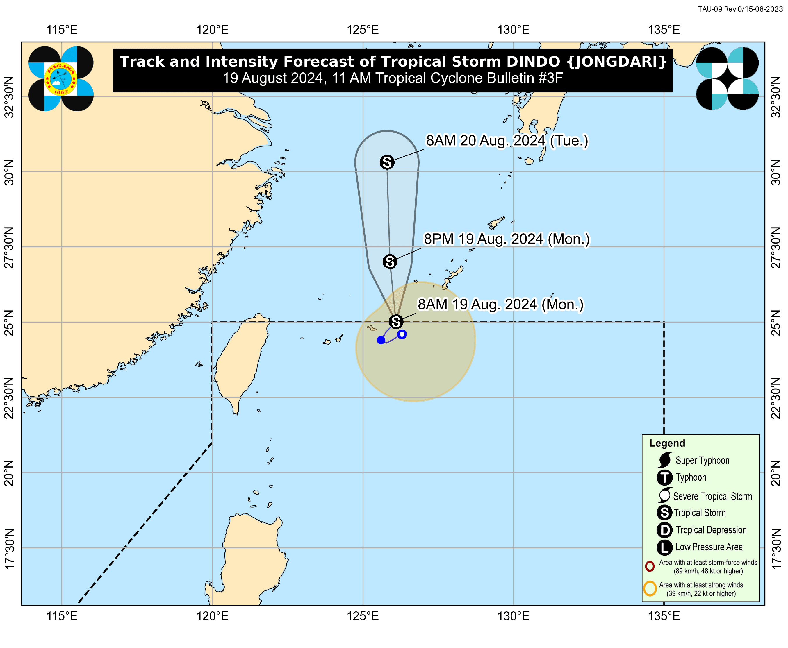
Tropical Storm “Dindo” (international name: Jongdari), which entered the country’s area of responsibility just last Sunday evening, Aug. 18, has exited the vicinity at around 9 a.m. on Monday, Aug. 19, said the Philippine Atmospheric, Geophysical and Astronomical Services Administration (PAGASA).
As of 10 a.m., the storm was located 670 kilometers northeast of Itbayat, Batanes, with maximum sustained winds of 65 kilometers per hour (kph) near the center and gusts reaching up to 80 kph.
It is moving slowly northeastward away from the country and is not expected to have an impact, said PAGASA Weather Specialist Aldczar Aurelio.
However, Dindo and the southwest monsoon (habagat) will cause moderate seas over the coastal waters of extreme Northern Luzon.
Mariners of motor bancas and similarly sized vessels are advised to take precautionary measures and, if possible, avoid venturing out to sea, especially if they are inexperienced or operating ill-equipped vessels.
The habagat may also bring scattered rains and thunderstorms to Batanes and Babuyan Islands, which may cause flash floods or landslides in these areas.
Meanwhile, Aurelio said PAGASA is also monitoring a new low pressure area (LPA) outside the Philippine area of responsibility (PAR).
It may enter the PAR either Monday or Tuesday, Aug. 20, and follow the same track as Dindo.
Aurelio said the LPA currently has a low chance of developing into a tropical depression and is not expected to affect the country at least until Tuesday.