


UP-MSI says oil spill may reach Batangas waters


The University of the Philippines-Marine Science Institute (UP-MSI) warned that the oil spill from the sunken MT Terra Nova in Bataan may soon extend to the coastal areas of Batangas, according to the latest analysis of the prevailing ocean currents and weather patterns.
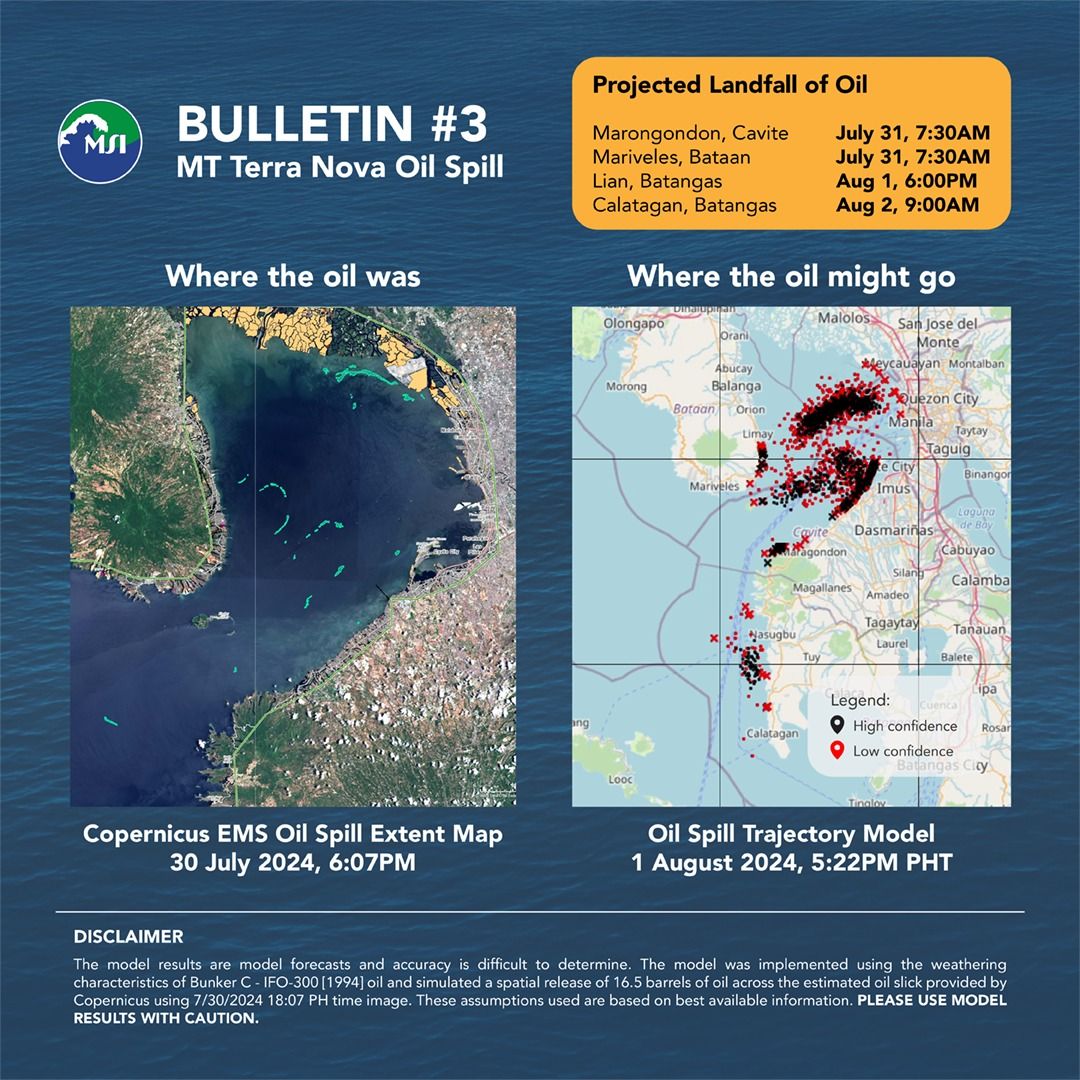
“Based on the map of the extent of the oil spill from satellite image dated July 30, 6:07 p.m., oil may be transported to the following coastal areas and are projected to landfall at these times,” UP-MSI said in its Bulletin No. 3 issued on Wednesday, July 31.
- Tanza, Cavite: July 30, 7:52 p.m.
- Cavite City, Cavite: July 30, 10:22 p.m.
- Ternate, Cavite: July 31, 1:52 a.m.
- Maragondon, Cavite: July 31, 7:37 a.m.
- Mariveles, Bataan: July 31, 7:37 a.m.
- Limay, Bataan: July 31, 7:52 a.m.
- Lucanin, Mariveles, Bataan: July 31, 1:37 p.m.
- Rosario, Cavite: July 31, 7:22 p.m.
- Noveleta, Cavite: Aug. 1, 9:52 a.m.
- Corregidor Island, Cavite: Aug. 1, 10:07 a.m.
- Luyahan, Lian, Batangas: Aug. 1, 6:07 p.m.
- Malabon, Metro Manila: Aug. 2, 8:37 a.m.
- Quilitisan, Calatagan, Batangas: Aug. 2, 8:52 a.m.
UP-MSI’s model uses data from the General NOAA Operational Modeling Environment (GNOME), which integrates surface velocity fields and wind patterns to predict the oil's movement.
While the model provides a crucial forecast for response planning, it does not account for real-time cleanup efforts or environmental changes that could influence the spill’s trajectory.
“Models are generated to inform the public on the potential direction of transport of the oil spill and help direct response efforts on the ground,” UP-MSI said.