


Bataan oil spill could reach Metro Manila — UP-MSI


The University of the Philippines-Marine Science Institute (UP-MSI) warned that oil spill trajectory models forecast the slick from the sunken tanker Terra Nova in Bataan could arrive in Metro Manila by Tuesday, July 30.
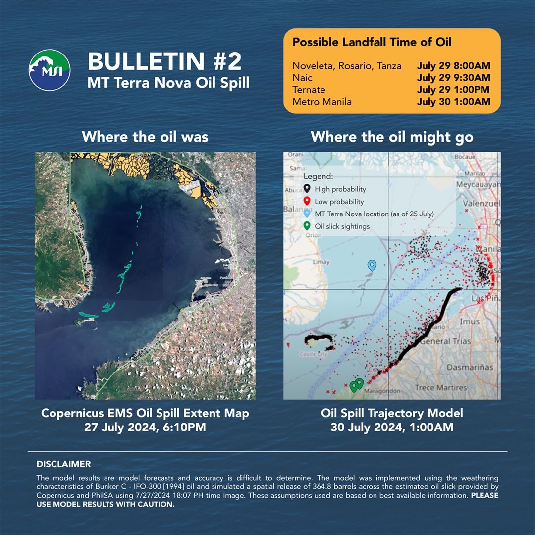
The trajectory was projected based on the oil slick's location on July 27 at 6:07 p.m., considering prevailing ocean currents and weather patterns.
According to the model, the slick was expected to impact the following areas at these times:
- Noveleta, Rosario, Tanza: July 29, 8 a.m.
- Naic: July 29, 9:30 a.m.
- Ternate: July 29, 1 p.m.
- Metro Manila: July 30, 1 a.m.
UP-MSI noted that while the models provide crucial information for public awareness and response planning, they come with uncertainties due to inherent assumptions and limitations.
It explained that the model used is the General NOAA Operational Modeling Environment (GNOME), designed to predict the fate and transport of pollutants, such as oil, spilled into the ocean.
The model for the MT Terra Nova spill incorporates surface velocity fields from the Global Ocean Physics Analysis and Forecast and surface winds from the National Center for Environmental Prediction Global Forecast System.
The spill's location was determined using the oil spill extent map provided by Copernicus and the Philippine Space Agency as of July 27 at 6:07 p.m.
The MT Terra Nova capsized and sank in Bataan's waters shortly after midnight on July 25, causing a leak of 1.4 million liters of industrial fuel oil into Bataan and Manila Bay.
The Philippine Coast Guard on Monday, July 29 said leaks from the sunken tanker have been sealed, but efforts to contain the oil spill are ongoing.