


 Philippines
National
Typhoon Carina continues to intensify as it heads toward Taiwan
Philippines
National
Typhoon Carina continues to intensify as it heads toward Taiwan
Typhoon Carina continues to intensify as it heads toward Taiwan


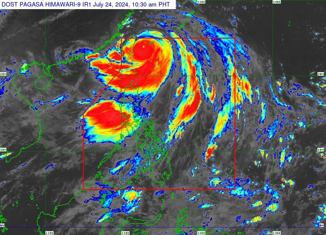
While typhoon “Carina” (international name “Gaemi”) is already heading toward Taiwan, the Philippine Atmospheric, Geophysical and Astronomical Services Administration (PAGASA) on Wednesday, July 24, said strong winds and heavy rains may persist over a large portion of Luzon in the next 24 hours.
PAGASA said the center of the eye of the typhoon was located 345 kilometers north-northeast of Itbayat, Batanes at 10 a.m.
Typhoon Carina further intensified, now packing maximum sustained winds of 165 kilometers per hour (kph) near the center and gusts of up to 205 kph, up from 155 kph maximum winds and 190 kph wind gusts recorded at 5 a.m.
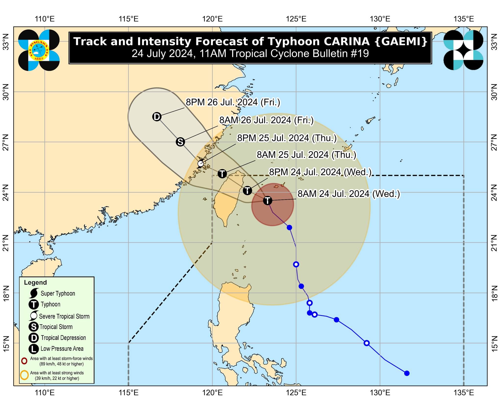
It is projected to move north-northwestward at 15 kph, slower than anticipated.
If it continues on this path, PAGASA said the typhoon will exit the Philippine area of responsibility by early Thursday morning, July 25, after landfall over northern Taiwan on Wednesday evening or Thursday morning.
Initially, Carina was expected to exit the PAR between Wednesday evening and Thursday morning.
Rainy weather
PAGASA said that Tropical Cyclone Wind Signal No. 2 remains in effect over Batanes.
At the same time, Signal No. 1 is still hoisted over Babuyan Islands, the northern portion of mainland Cagayan (Claveria, Santa Praxedes, Sanchez-Mira, Pamplona, Abulug, Ballesteros, Aparri, Camalaniugan, Buguey, Santa Teresita, Santa Ana, Gonzaga), and the northern portion of Ilocos Norte (Burgos, Bangui, Pagudpud, Dumalneg, Adams).
Until Thursday noon, July 25, Carina may continue to bring moderate to heavy rains (50 to 100 millimeters) to Batanes and Babuyan Islands.
The southwest monsoon, or “habagat,” enhanced by typhoon Carina, will also bring strong to gale-force gusts over other parts of the country.
Likewise, the habagat will continue to bring moderate to intense rains over parts of western Luzon until Friday, July 26.
On Wednesday, Metro Manila, Ilocos Region, Abra, Benguet, Zambales, Bataan, Rizal, and Occidental Mindoro may experience heavy to intense monsoon rains (100 to 200 millimeters), while moderate to heavy rains are expected over the rest of Cordillera Administrative Region, Tarlac, Nueva Ecija, Pampanga, Bulacan, Cavite, Laguna, Batangas, and Quezon.
By Thursday, Benguet and Abra may still experience heavy to intense rains due to the habagat.
Meanwhile, moderate to heavy rains may affect Metro Manila, Cavite, Batanes, Babuyan Islands, the rest of Ilocos Region, Abra, Benguet, Zambales, Bataan, and Occidental Mindoro.
By Friday, Zambales, Bataan, and Benguet could still experience moderate to heavy rains.
“Under these conditions, flooding and rain-induced landslides are possible, especially in areas that are highly or very highly susceptible to these hazards as identified in official hazard maps and in localities that experienced considerable amounts of rainfall for the past several days,” PAGASA warned.