


 Philippines
National
Signal No. 1 raised over parts of Cagayan, Isabela due to 'Carina'
Philippines
National
Signal No. 1 raised over parts of Cagayan, Isabela due to 'Carina'
Signal No. 1 raised over parts of Cagayan, Isabela due to 'Carina'


At A Glance
- As of 5 a.m., Signal No. 1 was in effect over the eastern portion of mainland Cagayan (Santa Ana, Gattaran, Baggao, Peñablanca, Lal-Lo, Gonzaga) and the northeastern portion of Isabela (Divilacan, Palanan, Maconacon).
- The southwest monsoon, or "habagat," which is being enhanced by Carina may bring moderate to heavy rains to La Union, Pangasinan, Benguet, Zambales, Bataan, Occidental Mindoro, Metro Manila, Ilocos Norte, Ilocos Sur, Abra, Tarlac, Pampanga, Bulacan, Nueva Ecija, Rizal, Cavite, Batangas, and Calamian Islands.
- Carina is expected to exit the Philippine area of responsibility by Wednesday evening or Thursday morning, July 25.
The Philippine Atmospheric, Geophysical and Astronomical Services Administration (PAGASA) hoisted Wind Signal No. 1 over parts of Cagayan and Isabela on Monday, July 22, due to the anticipated effects of severe tropical storm “Carina” (international name “Gaemi”).
As of 5 a.m., Signal No. 1 was in effect over the eastern portion of mainland Cagayan (Santa Ana, Gattaran, Baggao, Peñablanca, Lal-Lo, Gonzaga) and the northeastern portion of Isabela (Divilacan, Palanan, Maconacon).
“Minimal to minor impacts due to strong winds may be experienced within any of the localities where Wind Signal No. 1 is hoisted,” PAGASA said.
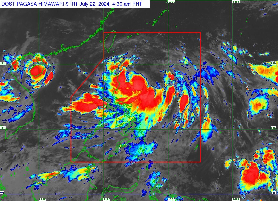
Heavy to intense rains (100 to 200 millimeters) may also affect the extreme northeastern portion of mainland Cagayan and moderate to heavy rains (50 to 100 millimeters) in Babuyan Islands and the eastern portions of mainland Cagayan and Isabela on Monday.
By Tuesday, July 23, heavy to intense rains may persist in Batanes and moderate to heavy rains in Babuyan Islands and the northeastern portion of mainland Cagayan.
By Wednesday, July 24, Batanes and Babuyan Islands may continue to experience moderate to heavy rains.
Likewise, PAGASA said the southwest monsoon, or “habagat,” which is being enhanced by Carina may bring moderate to heavy rains over parts of western Luzon, particularly La Union, Pangasinan, Benguet, Zambales, Bataan, Occidental Mindoro, Metro Manila, Ilocos Norte, Ilocos Sur, Abra, Tarlac, Pampanga, Bulacan, Nueva Ecija, Rizal, Cavite, Batangas, and Calamian Islands.
“Under these conditions, flooding and rain-induced landslides are possible, especially in areas that are highly or very highly susceptible to these hazards as identified in official hazard maps and in localities that experienced considerable amounts of rainfall for the past several days,” PAGASA warned.
Track, intensity outlook
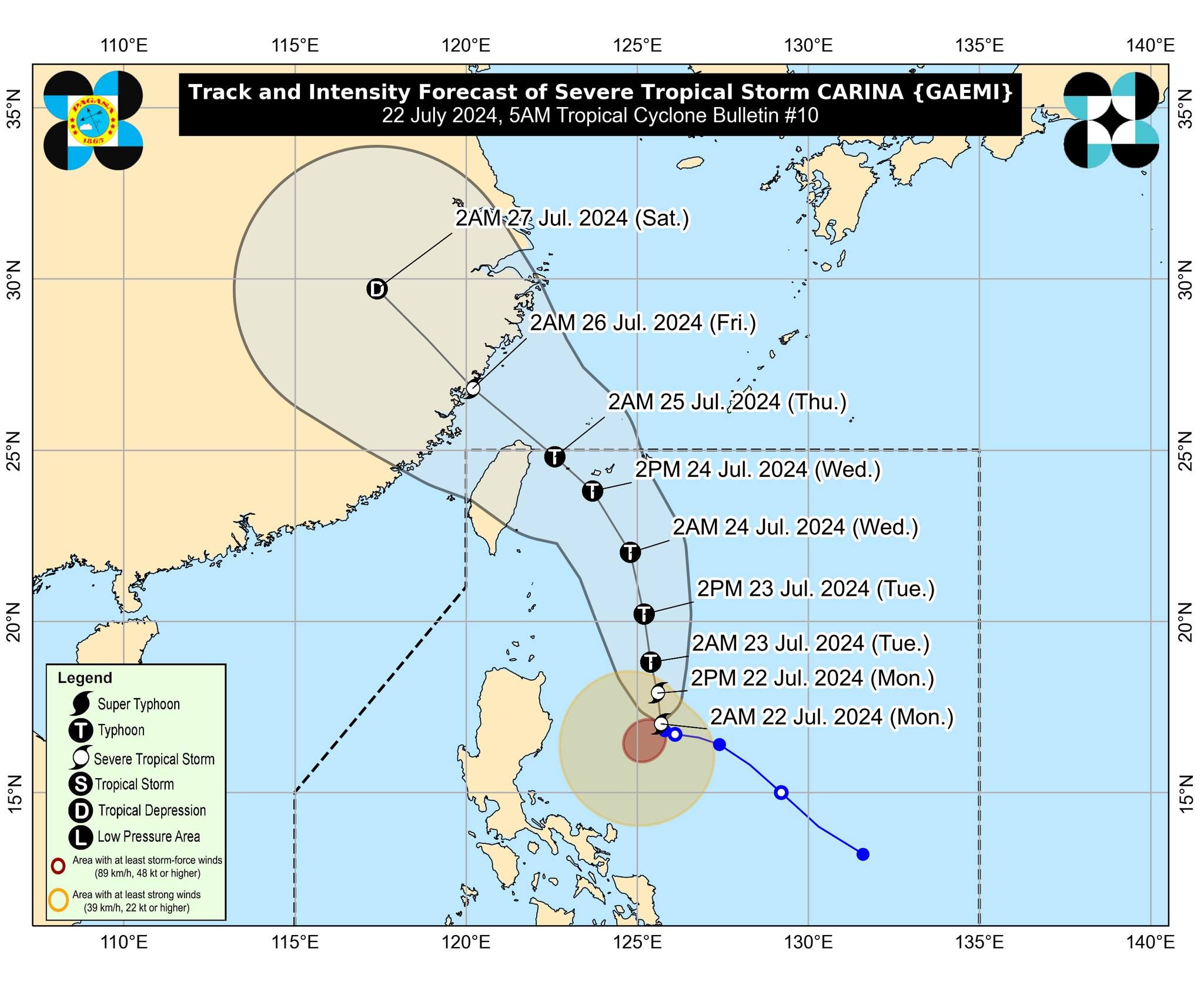
PAGASA still does not expect severe tropical storm Carina to make landfall.
It estimated the center of the severe tropical storm 420 kilometers east of Tuguegarao City, Cagayan at 4 a.m., with maximum sustained winds of 100 kilometers per hour (kph) near the center and gusts of up to 125 kph.
It continues to move slowly westward.
PAGASA said Carina will likely steadily intensify over the next four days due to favorable environmental conditions and may intensify into a typhoon within 24 hours.
It is expected to move generally north-northwestward to northward until mid-Wednesday over the Philippine Sea, while gradually accelerating before turning northwestward for the remainder of the forecast period.
Carina will exit the Philippine area of responsibility by Wednesday evening or Thursday morning, July 25.