


Up to 3 tropical cyclones possible in July, says PAGASA


The Philippine Atmospheric, Geophysical, and Astronomical Services Administration (PAGASA) on Wednesday, June 26, projected that two or three tropical cyclones may enter or form within the country's area of responsibility next month.
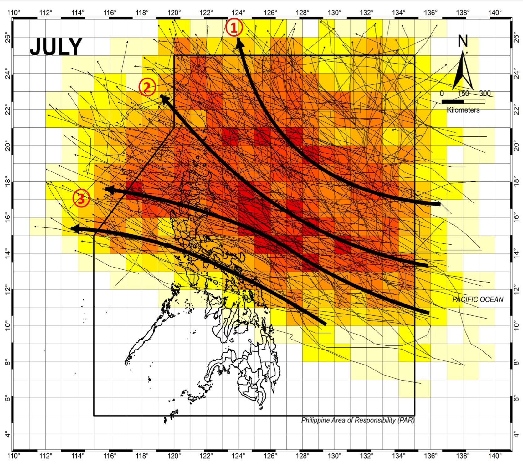
Based on historical climatological data, PAGASA identified three primary tracks that tropical cyclones may follow during this period.
Some cyclones are anticipated to recurve towards the northern part of the Philippine area of responsibility (PAR), potentially moving towards Taiwan without making landfall in the Philippines.
Other cyclones are predicted to make landfall in the extreme northern islands of the Philippines before progressing towards China or Hong Kong. This track suggests a potential impact on the northernmost areas of the country.
Meanwhile, some cyclones are expected to traverse the northern and central parts of Luzon island, making landfall before heading westward towards Vietnam. This track poses a potential risk to provinces in the north-central Luzon region.
PAGASA's average tropical cyclone frequency data from 1948 to 2023 shows that July, August, and September experience the highest number of cyclones.
Tropical cyclones are also more prone to making landfall or crossing land during the latter half of the year.
PAGASA said there may be 10 to 16 tropical cyclones until the end of 2024–two or three each in July, August, September, and October, and one or two each in November and December.
So far this year, the country has experienced only one tropical cyclone—Typhoon Aghon (Ewiniar)—in May.