


 Philippines
National
'Aghon' makes another landfall in Quezon; Signal No. 3 hoisted over Polillo Islands
Philippines
National
'Aghon' makes another landfall in Quezon; Signal No. 3 hoisted over Polillo Islands
'Aghon' makes another landfall in Quezon; Signal No. 3 hoisted over Polillo Islands


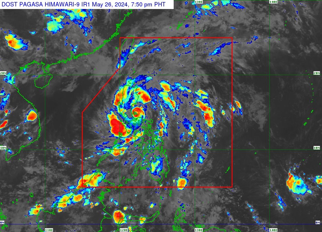
Severe Tropical Storm “Aghon” (international name: Ewiniar) made its 9th landfall over Patnanungan, Quezon on Sunday evening, May 26, as it continued its “meandering” path across eastern Luzon, said the Philippine Atmospheric, Geophysical and Astronomical Services Administration (PAGASA).
Before this, it had made landfall in Homonhon Island and Giporlos in Eastern Samar at 11:20 p.m. on May 24 and 12:40 a.m. on May 25, respectively; Basiao and Cagduyong Island in Catbalogan, Samar at 4 a.m. and 5 a.m. on May 25, respectively; Batuan and Masbate City in Masbate province at 10:20 a.m. and 10:45 a.m. on May 25, respectively; Torrijos, Marinduque at 10 p.m. on May 25; and Lucena City, Quezon at 4:30 a.m. on May 26.
In the tropical cyclone bulletin released at 8 p.m., Sunday, PAGASA located the eye of Aghon in the vicinity of Patnanungan, Quezon.
It was moving northeastward slowly while maintaining its maximum sustained winds of 100 kilometers per hour (kph) near the center and gusts of up to 150 kph.
Due to the severe tropical storm’s severe winds, Tropical Cyclone Wind Signal No. 3 has been raised over the Polillo Islands.
Meanwhile, Signal No. 2 remains in effect in Aurora, northern and central portions of Quezon, Laguna, the eastern portion of Batangas, the eastern portion of Rizal, and the northern portion of Camarines Norte.
Signal No. 1 is also still in place in Metro Manila, the eastern portion of Isabela, the eastern portion of Quirino, the eastern portion of Nueva Vizcaya, the eastern portion of Nueva Ecija, eastern portion of Pampanga, southeastern portion of Bataan, Bulacan, the rest of Rizal, Cavite, the rest of Batangas, the rest of Quezon, northeastern portion of Oriental Mindoro, Marinduque, the rest of Camarines Norte, and the northern portion of Camarines Sur.
Stormy weather persists
In the next 24 hours, PAGASA said Aurora, Quezon, Rizal, Laguna, and the eastern portion of Isabela may continue to experience stormy weather conditions due to Aghon.
The agency has issued warnings regarding potential flooding or landslides resulting from heavy to intense rainfall, along with a minor to moderate threat to lives and properties due to strong winds.
Meanwhile, rains and gusty winds may persist in Metro Manila, Nueva Ecija, Pampanga, Bulacan, Bataan, Cavite, Batangas, Oriental Mindoro, Marinduque, Camarines Norte, Camarines Sur, and the rest of Cagayan Valley.
There is also the possibility of flooding or landslides due to moderate to heavy rains, along with a minimal to minor threat to lives and properties due to strong winds.
The trough or extension of the severe tropical storm may also bring cloudy skies with scattered rain showers and thunderstorms to Western Visayas and the rest of Luzon.
PAGASA also warned of possible flooding or landslides due to moderate to heavy rains.
For the rest of the country, expect partly cloudy to cloudy conditions with isolated rain showers due to localized thunderstorms.
PAGASA said Aghon may leave the country’s area of responsibility by Wednesday, May 29.