


 Philippines
National
Stormy weather to persist in Metro Manila, other parts of Luzon due to 'Aghon'
Philippines
National
Stormy weather to persist in Metro Manila, other parts of Luzon due to 'Aghon'
Stormy weather to persist in Metro Manila, other parts of Luzon due to 'Aghon'
By Sonny Daanoy


Stormy weather conditions over parts of Luzon, including Metro Manila, are expected in the next 24 hours due to Tropical Depression Aghon, said the Philippine Atmospheric, Geophysical, and Astronomical Services Administration (PAGASA) on Saturday, May 25.
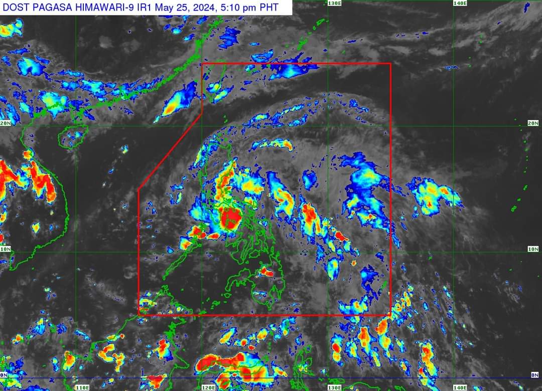
In its 5 p.m. weather update, PAGASA said eight areas may have 100 to 200 millimeters (mm) of rainfall from May 25 to 26.
These areas are Quezon, including Polillo Islands, the eastern portions of Laguna and Rizal, Marinduque, Romblon, Camarines Norte, Camarines Sur, and Catanduanes.
Meanwhile, areas such as the eastern portion of Isabela, Aurora, Metro Manila, the rest of CALABARZON, Oriental Mindoro, Occidental Mindoro, and the northern portion of Western Visayas may have rainfall of 50 to 100 mm from Saturday to Sunday.
"So, we are advising caution for the areas we've mentioned, as well as those that have been experiencing rain previously, due to the threats of flooding and landslides," PAGASA Weather Specialist Veronica Torres said in a mix of English and Filipino in the latest press briefing.
At 4 p.m., PAGASA monitored the location of "Aghon" over the coastal waters of Sibuyan Island, maintaining its maximum sustained winds of 45 kilometers per hour (kph) near the center and gusts of up to 70 kph.
Based on its bulletin, "Aghon" was moving west-northwestward at 20 kph.
Rainfall forecast for May 26 to 27
PAGASA has forecasted that Quezon, including Polillo Islands, Camarines Norte, Camarines Sur, and Catanduanes, may experience 100 to 200 mm of rainfall from May 26 to 27.
Fifty to 100 millimeters of rainfall is expected in Aurora, the rest of the Bicol Region, and the eastern portions of Isabela, Laguna, and Rizal, from Albay, and the northern portion of Masbate, including Burias Island, from Sunday to Monday.
"Forecasted rainfall is generally higher in elevated or mountainous areas," PAGASA said in its bulletin.
"Under these conditions, flooding and rain-induced landslides are possible, especially in areas that are highly or very highly susceptible to these hazards, as identified in hazard maps and in localities that experienced considerable amounts of rainfall for the past several days," it added.
Wind signals
PAGASA lifted the Tropical Cyclone Wind Signal (TCWS) in Visayas and Mindanao.
However, Signal No. 1 is still hoisted over the eastern portion of Quirino, the eastern portion of Nueva Vizcaya, Bulacan, the eastern portion of Nueva Ecija, the eastern portion of Pampanga, Aurora, Quezon including Polillo Islands, Metro Manila, the eastern portion of Cavite, Laguna, Rizal, the eastern portion of Batangas, Marinduque, and the northeastern portion of Oriental Mindoro.

A similar wind signal was up for areas such as the eastern portion of Occidental Mindoro, Romblon, Camarines Norte, Camarines Sur, Catanduanes, Albay, Sorsogon, and the northern portion of Masbate, including Burias and Ticao Islands.
Torres explained that local winds may be "slightly stronger" in coastal and mountainous areas exposed to winds.
Meanwhile, PAGASA said other areas in CALABARZON, MIMAROPA, Central Luzon, and Cagayan Valley may be placed under Wind Signal No. 1 in its next bulletin.
Torres said that Wind Signal No. 2 is the "highest possible" TCWS to be raised due to "Aghon."