


 Philippines
National
Magnitude 6 offshore quake hits Davao Oriental; no tsunami threat
Philippines
National
Magnitude 6 offshore quake hits Davao Oriental; no tsunami threat
Magnitude 6 offshore quake hits Davao Oriental; no tsunami threat


At A Glance
- Phivolcs said there is no tsunami threat because "the parameters of the earthquake do not warrant the issuance of a tsunami information."
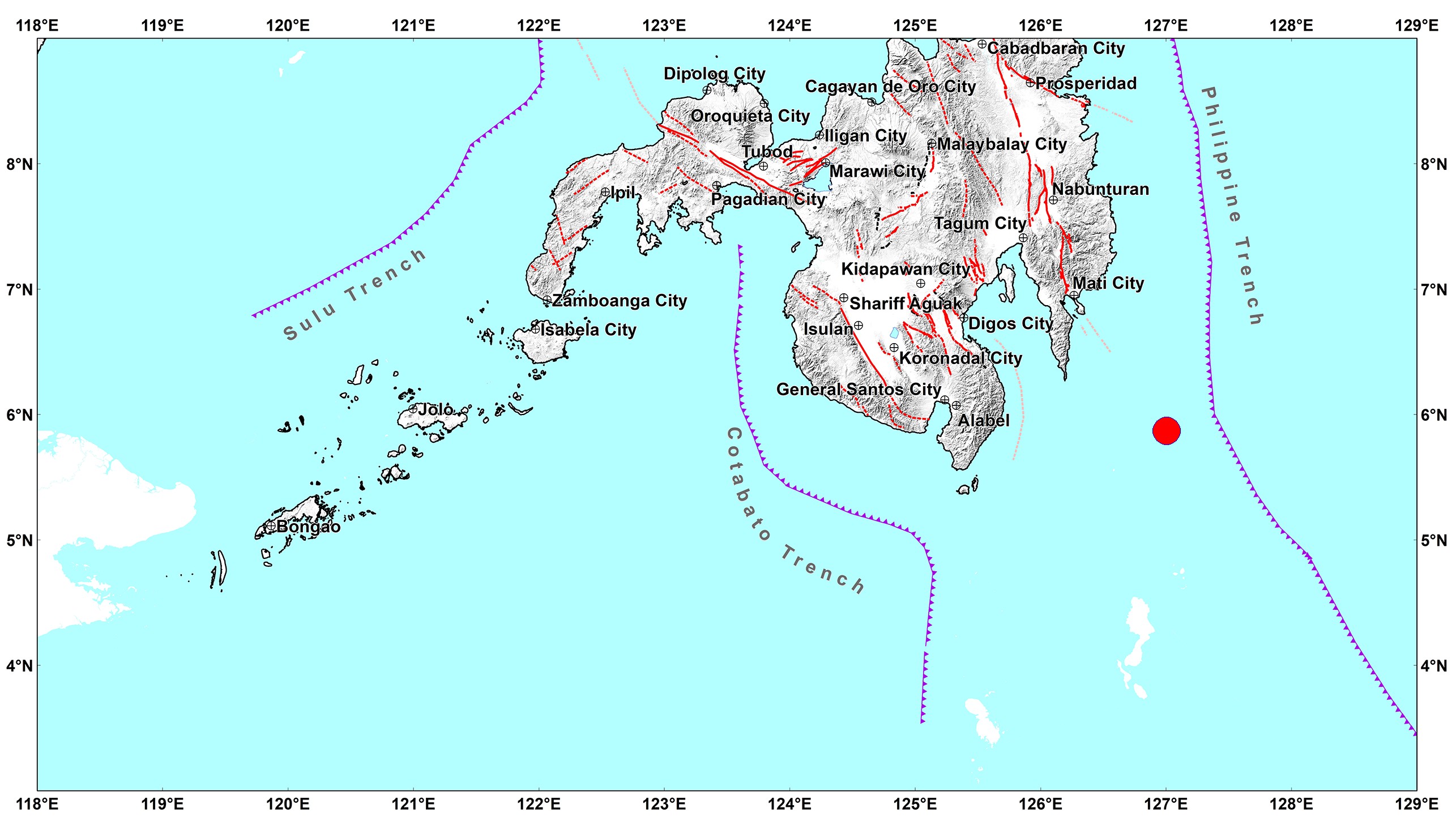
The Philippine Institute of Volcanology and Seismology (Phivolcs) recorded a magnitude 6 earthquake that struck near Davao Oriental on Friday afternoon, March 8.
Based on Phivolcs’ data, the earthquake hit at 5:11 p.m., with its epicenter located 135 kilometers (km) southeast of Governor Generoso, Davao Oriental.
The quake, which struck at a depth of 143 kilometers below the epicenter, was initially recorded at magnitude 6.1.
Phivolcs recorded the tremor at Intensity IV (moderately strong) in Malungon, Sarangani; Sarangani and Don Marcelino in Davao Occidental; and Davao City.
It was also felt at Intensity III (weak) in Digos City, Sta. Cruz and Matanao in Davao del Sur; Tagum City, Davao del Norte; Nabunturan and Pantukan in Davao de Oro; Glan, Sarangani; Tupi and Koronadal City in South Cotabato; and Lutayan, Sultan Kudarat.
Meanwhile, it was “slightly felt” at Intensity II in Magsaysay, Davao del Sur; General Santos City; Malapatan, Alabel, and Kiamba in Sarangani; Tampakan and Banga in South Cotabato; and Polomolok, Tantangan, Surallah, and Santo Niño in South Cotabato.
It was “scarcely perceptible” at Intensity I in President Quirino, Columbio, Isulan, Lambayong, and Senator Ninoy Aquino in Sultan Kudarat and Lake Sebu and Norala in South Cotabato.
Phivolcs said the earthquake was tectonic, which means it was caused by the movement of an active fault near the area.
It advised the public to exercise caution as aftershocks may occur.
However, Phivolcs said there is no tsunami threat because “the parameters of the earthquake do not warrant the issuance of a tsunami information.”