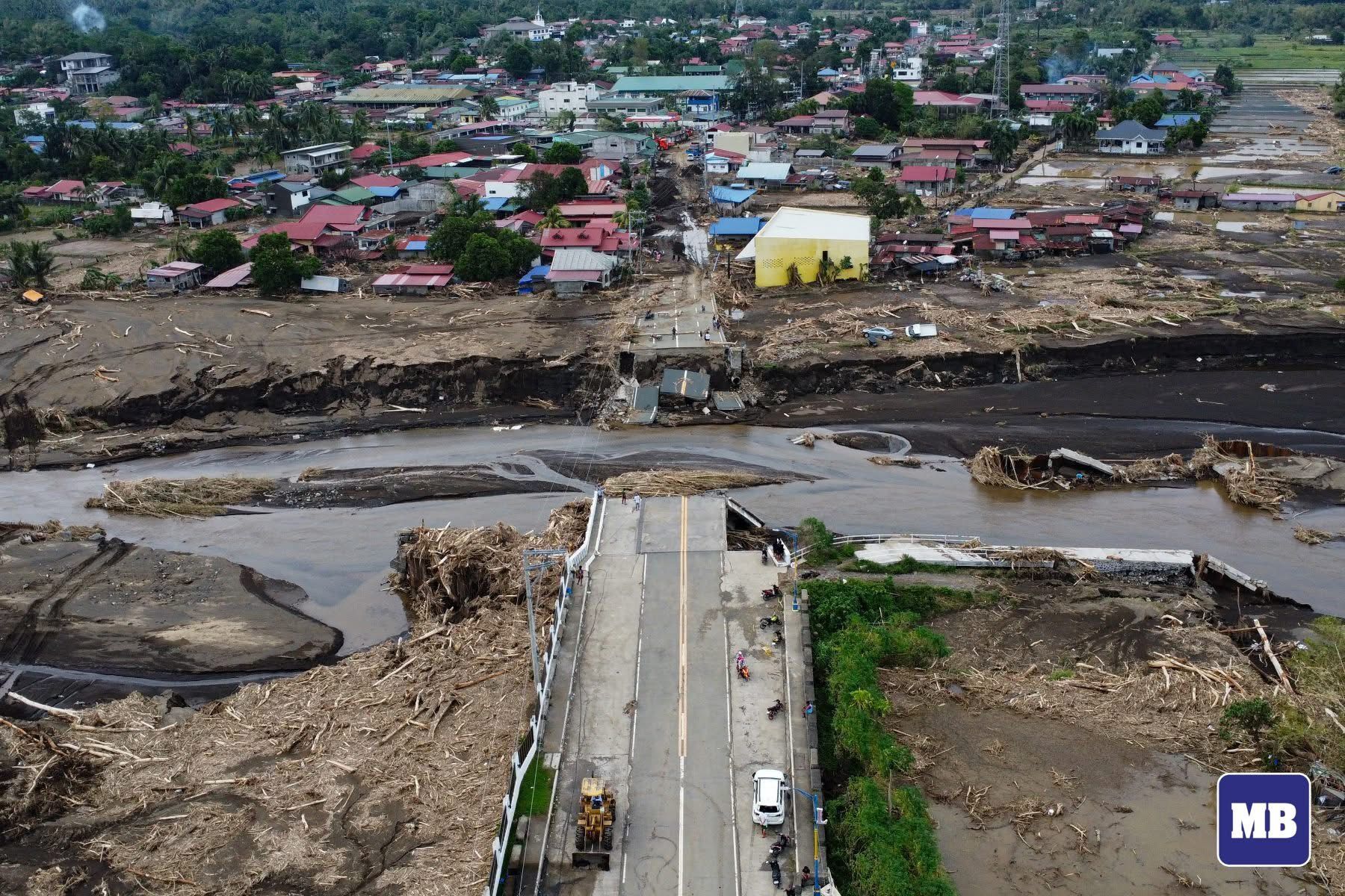
Philippines hit by unprecedented back-to-back cyclones, breaking records in 2024

In 2024, the Philippines experienced one of its most devastating storm seasons, with 18 tropical cyclones, including five that reached super typhoon strength.
The year started quietly, with the first tropical cyclone forming in May, followed by a calm period until July.
However, from late October through November, a series of powerful cyclones struck one after another, causing widespread damage across the country.
Overall, 2024 saw five tropical depressions—Butchoy, Gener, Igme, Querubin, and Romina; three tropical storms—Dindo (Jongdari), Ferdie (Bebinca), and Helen (Pulasan); two severe tropical storms—Enteng (Yagi) and Kristine (Trami); three typhoons—Aghon (Ewiniar), Marce (Yinxing), and Nika (Toraji); and five super typhoons—Carina (Gaemi), Julian (Krathon), Leon (Kong-rey), Ofel (Usagi), and Pepito (Man-yi).
Unprecedented onslaught of storms
The Philippine Atmospheric, Geophysical and Astronomical Services Administration (PAGASA) confirmed that, for the first time since 1951, four tropical cyclones were simultaneously active in the Western Pacific in November 2024.
PAGASA’s Climate and Agrometeorology Division Chief Thelma Cinco said the occurrence of consecutive, powerful cyclones “could be indicative of climate change.”
International experts have also linked the extraordinary cyclone season to the “supercharging” effects of climate change.
A study by the World Weather Attribution found that climate change has intensified storm strength, causing faster wind speeds driven by warmer oceans and a more unstable atmosphere.
Back-to-back cyclones’ formation
PAGASA explained that tropical cyclones form when certain environmental conditions, such as warm ocean waters, high humidity, and favorable atmospheric conditions, are present.
Warm ocean temperature, usually above 26.5 degrees Celsius (°C), provides the energy for cyclone formation, while high humidity contributes to cloud development.
In addition, low-pressure systems at the center of cyclones intensify winds, further fueling the cyclone's growth.
PAGASA noted that in the weeks leading up to the record event, ocean temperatures around the Philippines ranged from 28°C to 30°C—well above the threshold for cyclone formation.
“This is the main reason that fueled the series of tropical cyclones,” PAGASA said.
“The environment was generally favorable for tropical cyclone formation and intensification for the past weeks,” it added.
‘La Niña-like’ conditions
PAGASA also pointed to the “La Niña-like” conditions in the Pacific Ocean as a significant factor in the behavior of the cyclones.
The persistent conditions led to the warming of sea surface temperatures near the Philippines, which, in turn, triggered the formation of an unusually high number of cyclones.
PAGASA further explained that these climate conditions also amplified the effects of other rain-bearing weather systems across the country.
Climate outlook for 2025
Despite sea surface temperature anomalies in the monitored region remaining within the cool ENSO-neutral range, La Niña-like conditions are currently prevailing in the tropical Pacific, PAGASA said.
The agency also noted that a return to ENSO-neutral conditions—where neither La Niña nor El Niño is present—could occur during the March-April-May 2025 season.
PAGASA forecasts “near-normal to above-normal” rainfall conditions across most of the country in January 2025, with some exceptions in Northern Luzon.
From February to March, “generally above to way above-normal” rainfall is expected in most areas, while the western parts of Ilocos Region and Central Luzon may experience “below to near normal” rainfall.
From April to May, Mindanao and the Visayas could experience “near to below normal” rainfall conditions.
PAGASA pointed out that the probability of above-normal conditions remains high across most parts of the country during the next six months.
It added that two to eight tropical cyclones may enter or form within the country’s area of responsibility from January to June, with zero to one cyclone expected in January, February, March, and April, and one or two expected in May and June.