Kalayaan Islands under Signal No. 1 due to tropical depression outside PAR

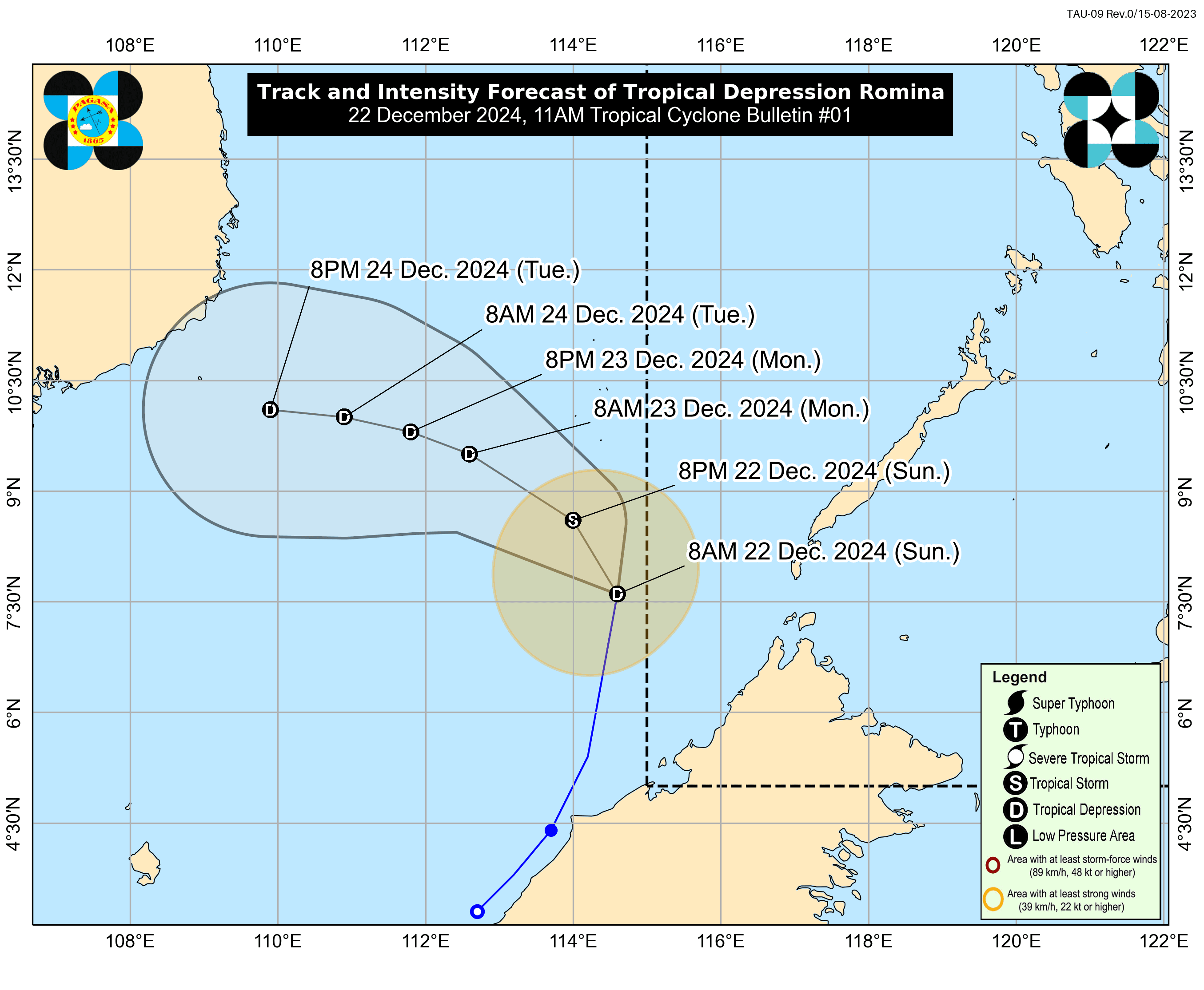
The Philippine Atmospheric, Geophysical and Astronomical Services Administration (PAGASA) on Sunday, Dec. 22 said tropical cyclone wind signal number 1 was raised over Kalayaan Islands, Palawan due to the anticipated direct impact from the tropical depression outside the Philippine area of responsibility (PAR).
In its 11 a.m. bulletin, PAGASA said the center of the tropical depression was located 365 kilometers south of Pag-asa Island, Kalayaan, Palawan, with maximum sustained winds of 55 kilometers per hour (kph) and gusts reaching 70 kph.
PAGASA raised Signal No. 1 due to “minimal to minor impacts” from strong winds. The highest wind signal that may be hoisted due to Romina is Signal No. 2.
It added that the tropical depression could briefly enter the PAR and be named “Romina.”
“Although currently moving north-northeastward, Romina is forecast to turn north-northwestward today (Dec. 22) before turning generally west-northwestward for the remainder of the forecast period,” PAGASA said.
“On the forecast track, Romina may pass near the southern portion of the Kalayaan Islands area in the next 24 hours,” it added.
PAGASA also noted that the cyclone could become a tropical storm within the next 12 hours before weakening into a tropical depression.
READ MORE: https://mb.com.ph/2024/12/22/tropical-depression-spotted-outside-par