LPA east of Mindanao develops into Tropical Depression Querubin --- PAGASA
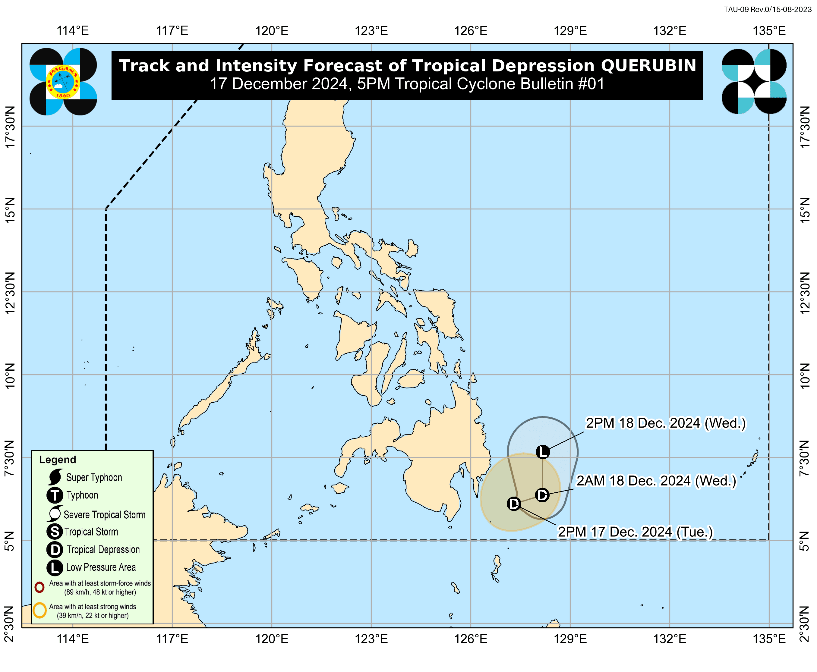
The low pressure area (LPA) being monitored by the Philippine Atmospheric, Geophysical, and Astronomical Services Administration (PAGASA) near Mindanao developed into a Tropical Depression (TD) named “Querubin” on Tuesday, Dec. 17.

PAGASA said “Querubin” is forecast to move east-northeastward while slowly moving away from the Davao Region over the next 12 hours, before turning northward by Wednesday, Dec. 18.
This weather disturbance, PAGASA noted, will traverse Mindanao and the Palawan area from Dec. 18 to 22 as a “remnant low.”
According to PAGASA, the center of TD Querubin was estimated at 215 km east-southeast of Davao City or 245 km east of General Santos City. It is moving south-southeastward slowly, with maximum sustained winds of 45 kilometers per hour (km/h) near the center and gustiness of up to 55 km/h.
The highest wind signal that may be raised during the occurrence of “Querubin” is Wind Signal No. 1, according to PAGASA.
Davao Oriental has been placed under Signal No. 1.
PAGASA added that throughout the forecast period, “Querubin” is expected to remain a Tropical Depression before weakening into a remnant low by Dec. 18.
“Re-intensification into a Tropical Depression after traversing Mindanao or Palawan is not ruled out,” PAGASA said.
Meanwhile, PAGASA emphasized that the shear line and “Querubin” may “potentially bring heavy to intense rainfall” over several areas in Visayas and Mindanao outside the radius of the Tropical Depression.
RELATED STORY:
https://mb.com.ph/2024/12/17/pagasa-monitors-lpa-near-mindanao