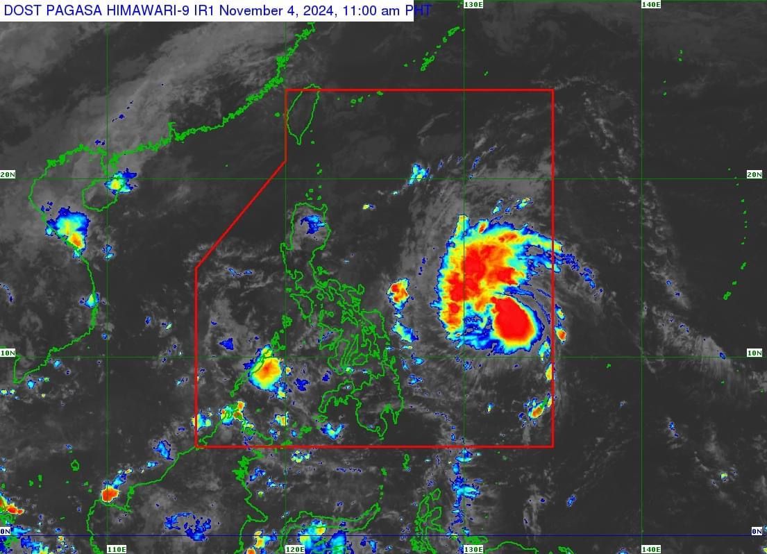
PAGASA: 'Marce' could strengthen into a typhoon before landfall
At A Glance
- Marce may make landfall over Babuyan Islands or mainland northern Cagayan on Thursday evening, Nov. 7, or early Friday morning, Nov. 8.
- PAGASA may issue Wind Signal No. 1 for parts of Cagayan by Tuesday.
- Meanwhile, the highest wind warning that could be raised during the passage of Marce is Signal No. 4.

Tropical Storm “Marce” (international name: Yinxing) is likely to make landfall north of Luzon towards the weekend and may strengthen into a typhoon before approaching Northern and Central Luzon, said the Philippine Atmospheric, Geophysical and Astronomical Services Administration (PAGASA).
In a press conference on Monday, Nov. 4, PAGASA Deputy Administrator for Research and Development Marcelino Villafuerte II said those affected by Super Typhoon “Leon” (Kong-rey) may again experience severe weather from Tropical Storm Marce.
“Kahapon ay sinusubaybayan lang natin bilang low-pressure area and then eventually naging tropical depression, and at 2 a.m. today ay pumasok sa Philippine area of responsibility na isa ng tropical storm (Yesterday, we were monitoring it as a low-pressure area, and it eventually developed into a tropical depression. As of 2 a.m. today, it entered the Philippine area of responsibility as a tropical storm),” Villafuerte said.
“Pinag-iingat natin ang ating mga kababayan kaya kahit nasa labas pa ng Philippine area of responsibility kahapon ay nag-issue na tayo ng advisories upang sa gayon ay mapaghandaan natin ang anumang hindi magandang maidulot sa atin ng Tropical Storm Marce (We are urging our fellow citizens to take precautions, so even while it was still outside the PAR yesterday, we issued advisories to prepare for any potential adverse effects that Marce may bring),” he added.
Forecast track, intensity
As of 10 a.m. on Monday, the center of Marce was located 775 kilometers east of Borongan City, Eastern Samar, with maximum sustained winds of 75 kilometers per hour (kph) and gusts reaching 90 kph.
The storm is moving west-northwestward at 35 kph.
PAGASA Weather Specialist Veronica Torres said Marce may make landfall over Babuyan Islands or mainland northern Cagayan on Thursday evening, Nov. 7, or early Friday morning, Nov. 8.
However, she said this will still depend on the strength of the high-pressure area (HPA) north of Marce.
If the HPA is strong, the storm’s track may shift lower, potentially changing its landfall to mainland Cagayan or Isabela, she added.
“As Marce moves northwestward within the PAR region, it may enhance the northeasterly wind flow which may occur within the week. This, and the trough of the tropical cyclone, will bring rains over extreme Northern Luzon and the eastern section of Luzon beginning today or on Tuesday,” she said.
Torres said the path it will take is situated between Severe Tropical Storm Kristine and Super Typhoon Leon, so areas previously affected by these two cyclones need to prepare.
From Wednesday to Thursday, she noted that Marce may slow down as it approaches the country, and if it lingers, the eastern sections of Northern and Central Luzon could experience stronger winds and heavy rainfall.
By the weekend, a significant portion of Northern and Central Luzon could be affected, she added.
Torres said Marce could become a severe tropical storm by Tuesday, Nov. 5, and may strengthen into a typhoon by Tuesday evening or early Wednesday morning, Nov. 6.
PAGASA may issue Wind Signal No. 1 for parts of Cagayan by Tuesday.
Meanwhile, the highest wind warning that could be raised during the passage of Marce is Signal No. 4.