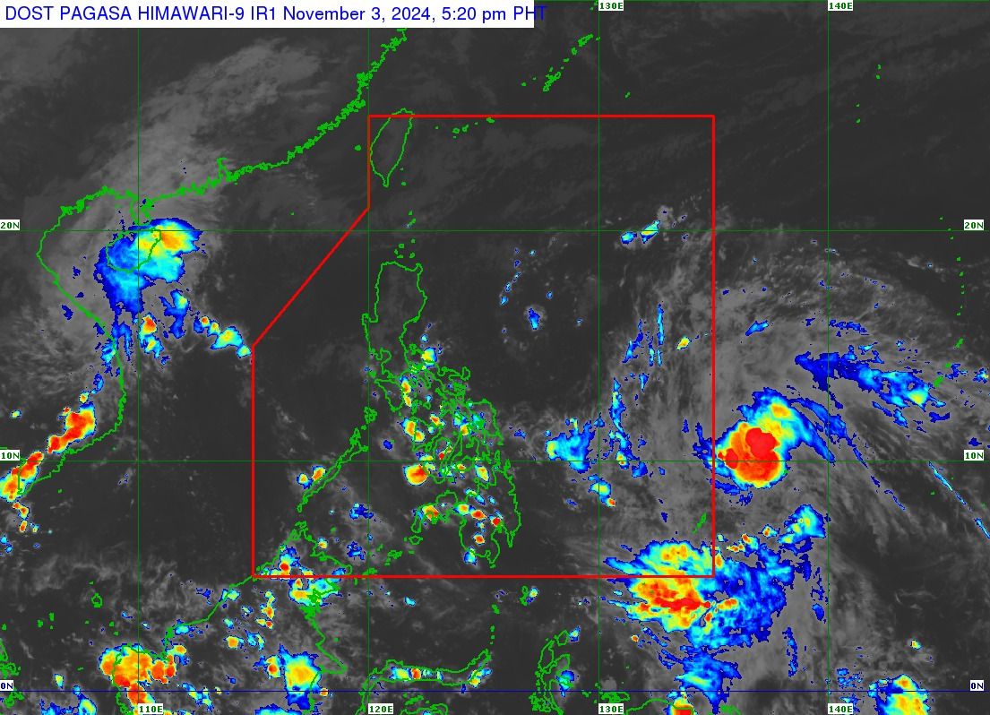
LPA develops into tropical depression, to enter PAR on November 4
At A Glance
- Once the cyclone enters the PAR on Tuesday, Nov. 4, it will be named "Marce."

The Philippine Atmospheric, Geophysical and Astronomical Services Administration (PAGASA) said the low-pressure area (LPA) outside the Philippine area of responsibility (PAR) developed into a tropical depression at 2 p.m. on Sunday, Nov. 3.
As of 4 p.m., the center of the tropical depression was located 1,315 kilometers east of Eastern Visayas, with maximum sustained winds of 55 kilometers per hour (kph) and gusts reaching 70 kph. It is moving northwestward at 30 kph.
Once the cyclone enters the PAR on Tuesday, Nov. 4, it will be named “Marce.”
PAGASA outlined two potential scenarios for this weather disturbance—it may either move westward toward extreme Northern Luzon or mainland Luzon or it drift erratically over the Philippine Sea to the east of extreme Northern Luzon.
Weather specialist Veronica Torres added that either the trough (extension) of the tropical depression or the tropical depression itself may bring heavy rainfall across parts of eastern Luzon as early as Tuesday.
Due to the system's distance, Torres pointed out that the forecast tracks could still change.
PAGASA said the northeasterly wind flow, easterlies, and localized thunderstorms will still be the dominant weather systems in the country in the next 24 hours.
Partly cloudy to cloudy skies with isolated light rains are expected over Batanes and Babuyan Islands due to the northeasterly wind flow, which brings the initial blast of cold air associated with the northeast monsoon, or “amihan.”
Bicol Region, Eastern Visayas, Aurora, Quezon, and the rest of Cagayan Valley may also experience partly cloudy to cloudy conditions with isolated rain showers or thunderstorms attributed to the warm winds from the Pacific Ocean, known as easterlies.
Meanwhile, the rest of the country will likely experience partly cloudy to cloudy skies with isolated rain showers due to localized thunderstorms.
The public is advised to remain vigilant for possible flash floods or landslides during severe thunderstorms.