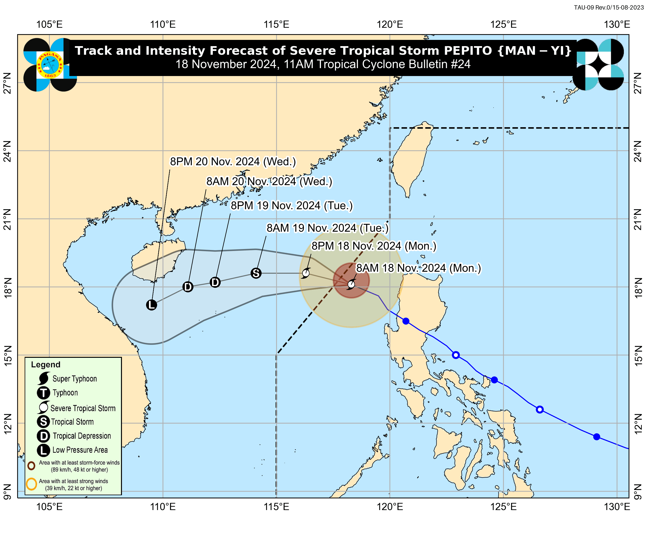
'Pepito' weakens into severe tropical storm, set to exit PAR

Typhoon “Pepito” (international name: Man-yi) has weakened further into a severe tropical storm and is expected to exit the Philippine area of responsibility (PAR) between Monday noon and afternoon, Nov. 18.
In its 11 a.m. bulletin on Monday, the Philippine Atmospheric, Geophysical and Astronomical Services Administration (PAGASA) said Pepito now has maximum sustained winds of 110 kilometers per hour (kph) near its center and gusts reaching 135 kph.
The storm is moving west-northwest at 20 kph and was last spotted 270 kilometers west of Batac, Ilocos Norte.
Signal No. 1 remains in effect over the following areas due to strong winds that could still cause minimal to minor impacts: Ilocos Norte, Ilocos Sur, La Union, western portion of Pangasinan (Burgos, Dasol, Sual, Mabini, Binmaley, San Fabian, Dagupan City, Lingayen, Labrador, City of Alaminos, Bolinao, Anda, Bani, Agno, Infanta, Bugallon, Mangaldan), and western portion of Abra (Danglas, Bangued, Langiden, La Paz, Pidigan, San Quintin, San Isidro, Pilar, Peñarrubia, Villaviciosa, Lagayan).
Meanwhile, PAGASA said the threat of storm surge inundation has “ceased” as Pepito moves away from the country.
A gradual improvement in weather conditions is expected, particularly in areas previously affected by the storm.