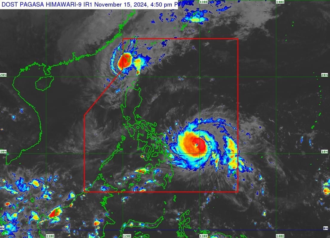
More areas under Signal No. 2 as 'Pepito' continues 'rapid intensification'

The Philippine Atmospheric, Geophysical and Astronomical Services Administration (PAGASA) has raised Tropical Cyclone Wind Signal No. 2 over more areas in Eastern Visayas as Typhoon “Pepito” (international name: Man-yi) continues its rapid intensification on Friday afternoon, Nov. 15.
In its 5 p.m. bulletin, PAGASA reported that Pepito now has maximum sustained winds of 150 kilometers per hour (kph) near its center and gusts reaching 185 kph.
Due to favorable environmental conditions, Pepito is likely to strengthen into a super typhoon before making landfall over Catanduanes between Saturday evening, Nov. 16, and Sunday morning, Nov. 17.
At 4 p.m. on Friday, the center of the eye of the typhoon was located 465 kilometers east of Guiuan, Eastern Samar.
Signal No. 2 has been raised over the eastern portion of Northern Samar (Mapanas, Gamay, Palapag, Lapinig, Silvino Lobos, Laoang, Catubig, Las Navas, Pambujan, Mondragon, San Roque, Catarman, Lope de Vega), northern portion of Eastern Samar (Arteche, Oras, San Policarpo, Dolores, Jipapad, Maslog, Can-Avid), and northeastern portion of Samar (San Jose de Buan, Matuguinao). Gale-force winds could cause “minor to moderate impacts” in areas under Signal No. 2.
Signal No. 1 is also in effect over Aurora, Quezon, eastern portion of Laguna (Santa Maria, Famy, Siniloan, Pangil, Mabitac, Pakil, Paete, Kalayaan, Lumban, Cavinti, Luisiana, Pagsanjan, Santa Cruz, Magdalena, Majayjay, Liliw, Nagcarlan, San Pablo City, Rizal), Marinduque, Camarines Norte, Camarines Sur, Catanduanes, Albay, Sorsogon, Masbate, the rest of Northern Samar, the rest of Eastern Samar, the rest of Samar, and Biliran. There are “minimal to minor impacts” from strong winds in areas under Signal No. 1.
PAGASA said the highest wind warning that may be issued is Signal No. 5, which means that extreme impacts from typhoon-force winds are likely.
“We should not just focus on where the center of the tropical cyclone will make landfall, especially when it is strong. The typhoon’s circulation is wide. Even if the center of the typhoon has not made landfall yet, because of its circulation, depending on its size (on average, about 500 kilometers in radius), its effects, such as heavy rainfall and strong winds, can already be felt several hours before landfall, especially in areas under at least Signal No. 2 and higher,” said PAGASA Administrator Nathaniel Servando in a press conference on Friday.
Typhoon Pepito may pass over or near the Bicol Region, Quezon, Central Luzon, and Pangasinan, and emerge into the West Philippine Sea on Sunday evening or Monday morning, Nov. 18.
PAGASA also pointed out that heavy rainfall, severe winds, and storm surges may still affect areas outside the landfall point and the forecast confidence cone.
READ MORE: https://mb.com.ph/2024/11/15/brace-for-landslides-flash-floods