Storm to be named 'Pepito' may head for central Philippines this weekend — PAGASA

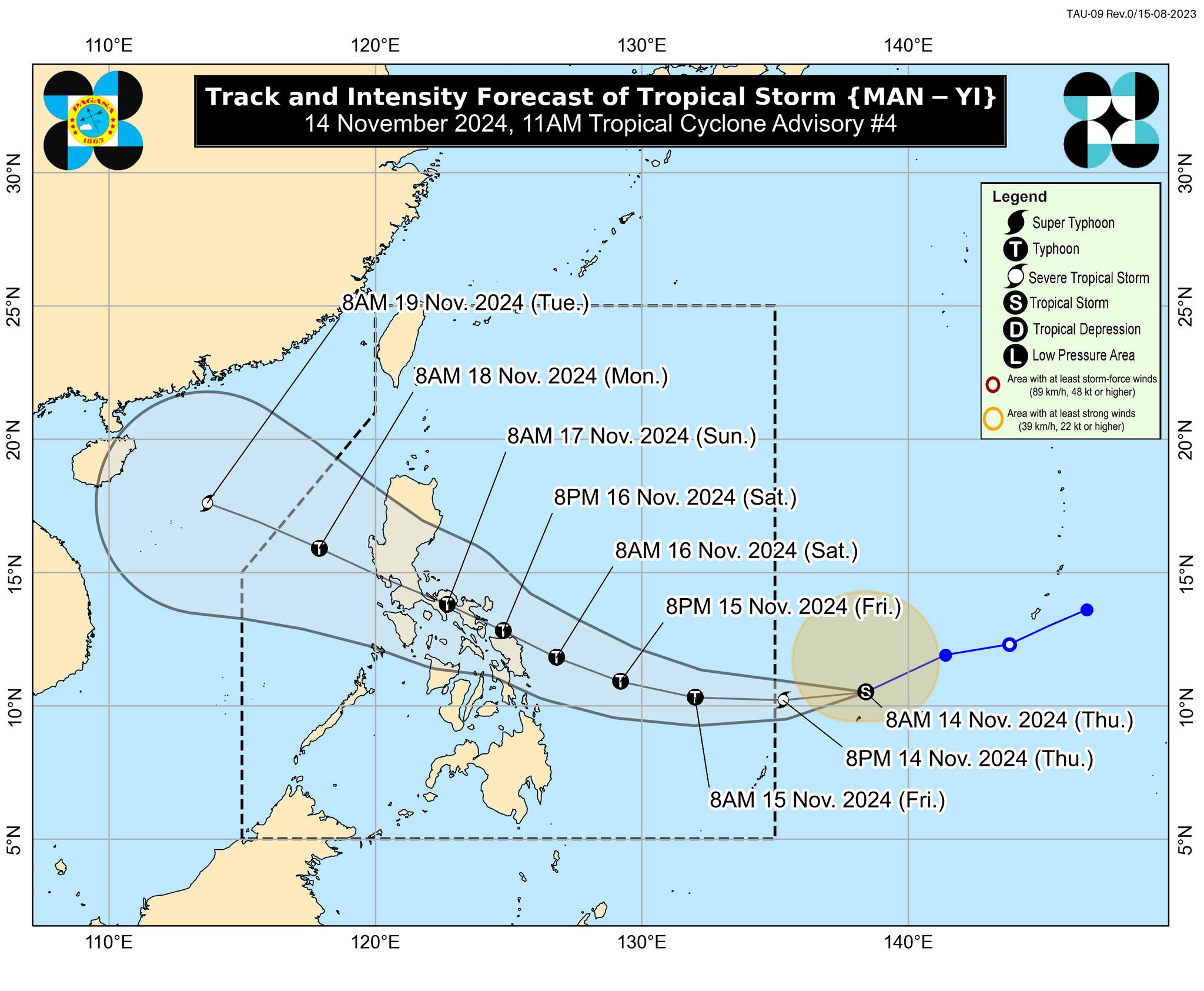
The tropical storm with the international name “Man-yi” has continued to intensify as it moves west-southwestward toward the Philippine area of responsibility (PAR) on Thursday morning, Nov. 14.
In its 11 a.m. advisory, PAGASA said the storm may enter the PAR Thursday evening and will be given the local name “Pepito.”
Due to a high-pressure area south of Japan, Man-yi is expected to move southwestward over the next 12 hours before turning generally westward as it approaches the eastern boundary of the PAR.
Once inside the PAR, the storm will likely move generally west-northwestward. It may make landfall over Bicol Region or Eastern Visayas by Saturday evening, Nov. 16, or Sunday morning, Nov. 17, said PAGASA Assistant Weather Services Chief Chris Perez.
Perez also emphasized that there remains uncertainty regarding Man-yi’s exact landfall location, as it may shift to the eastern coast of Central Luzon or the eastern coast of Northern Mindanao.
At around 10 a.m., the center of Man-yi was located 1,375 kilometers east of northeastern Mindanao, with maximum sustained winds of 85 kilometers per hour (kph) near the center and gusts reaching 105 kph.
The storm may intensify into a severe tropical storm in the next few hours and could reach typhoon status by Friday morning, Nov. 15, with rapid intensification not discounted.
Given that the tropical cyclone could intensify into a typhoon while over the Philippine Sea, the possibility of it reaching super typhoon strength before landfall has not been ruled out.
While it is still too early to pinpoint specific areas at risk, PAGASA said most of Luzon and Eastern Visayas may be affected by heavy rainfall, strong winds, and storm surges towards the weekend.