PAGASA: Typhoon Ofel further strengthens east of Aurora

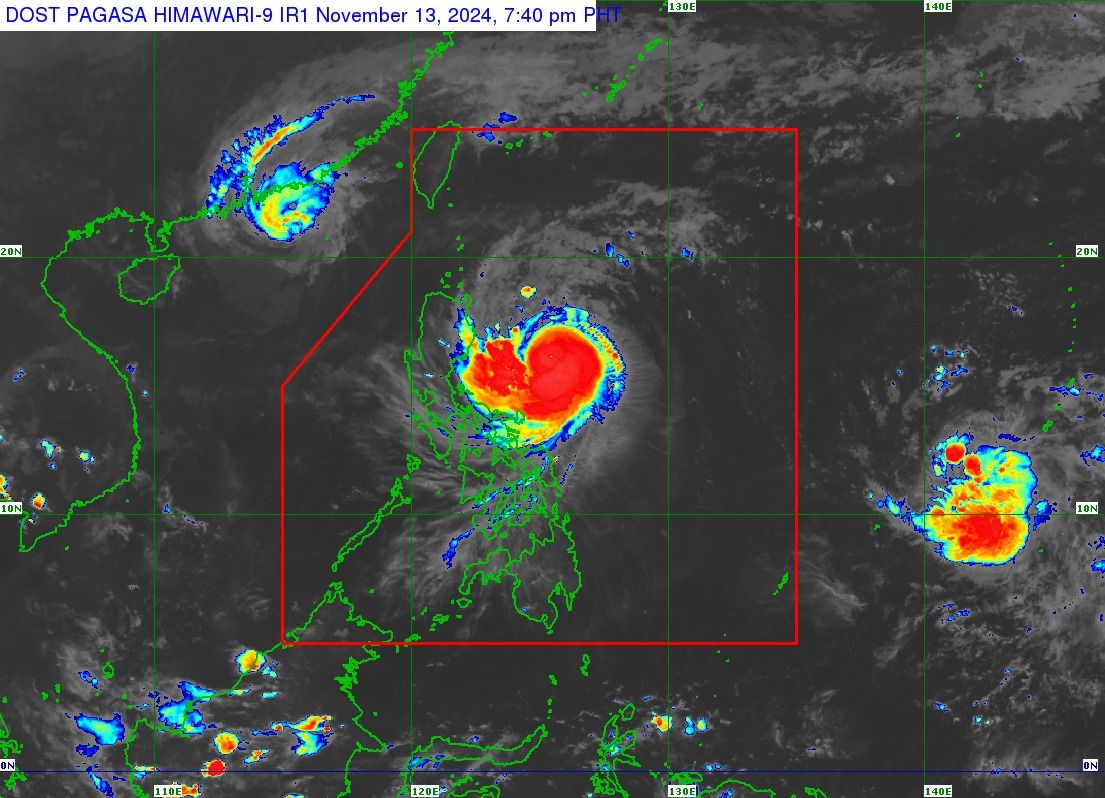
The Philippine Atmospheric, Geophysical and Astronomical Services Administration (PAGASA) said Typhoon “Ofel” (international name: Usagi) continued to intensify as it moved over the Philippine Sea east of Aurora on Wednesday evening, Nov. 13.
In its 8 p.m. bulletin, PAGASA said Ofel now has maximum sustained winds of 130 kilometers per hour (kph) near its center and gusts reaching 160 kph. Previously, it had maximum sustained winds of 120 kph and gusts of 150 kph.
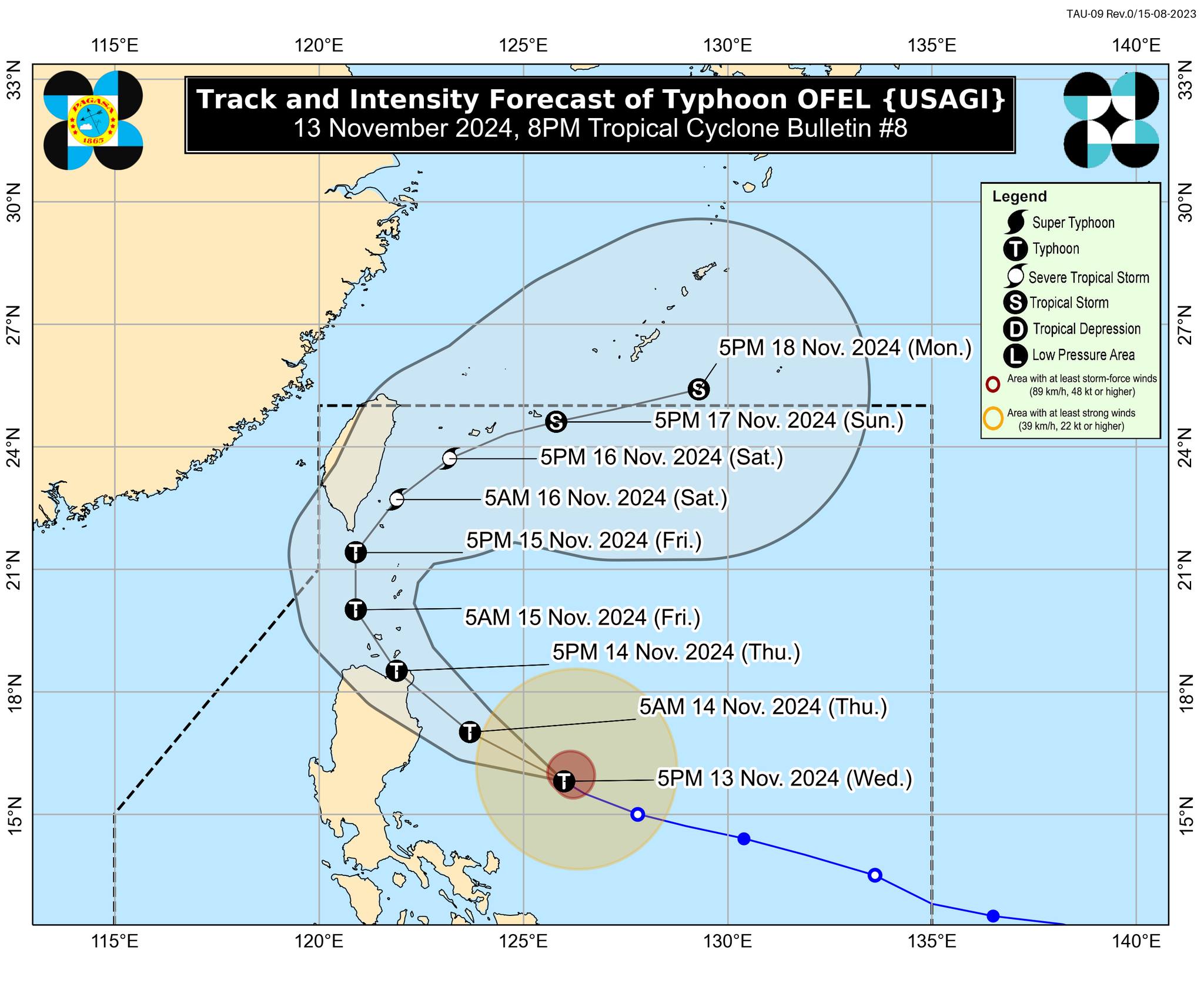
The typhoon is moving west-northwestward at 20 kph.
As of 7 p.m., the center of the typhoon was located 425 kilometers east of Baler, Aurora, and may reach the eastern coast of Luzon for a possible landfall over Cagayan or Isabela by Thursday afternoon, Nov. 14.
PAGASA warned that Ofel could make landfall at its peak intensity.
After landfall, Ofel may move over the Luzon Strait on Friday, Nov. 15, pass close to or make landfall over BabuyanIslands, and turn northeast towards the sea east of Taiwan on Saturday, Nov. 16.
PAGASA pointed out that, regardless of the exact landfall location, hazards are not limited to the landfall area but will also affect areas affected by the typhoon’s outer cloud bands.
It added that Ofel’s track could still change as it moves closer to the country.

Wind signals
In preparation for strong winds, PAGASA has raised Signal No. 2 over Cagayan (including Babuyan Islands), northern and eastern portions of Isabela (Maconacon, Divilacan, Palanan, San Pablo, Cabagan, Santa Maria, Santo Tomas, Tumauini, Ilagan City), Apayao, and northern part of Ilocos Norte (Carasi, Vintar, Burgos, Adams, Pagudpud, Bangui, Dumalneg).
Signal No. 1 is also in effect over Batanes, the rest of Isabela, Quirino, northern portion of Nueva Vizcaya (Kasibu, Ambaguio, Solano, Bayombong, Quezon, Bagabag, Diadi, Villaverde), Kalinga, Abra, Mountain Province, Ifugao, the rest of Ilocos Norte, and northern part of Aurora (Dilasag, Casiguran, Dinalungan, Dipaculao).
PAGASA warned that areas under Signal No. 2 could face a “minor to moderate” threat to life and property, while those under Signal No. 1 may experience “minimal to minor impacts” from strong winds.
It said the highest wind warning that may be issued during the passage of Ofel is Signal No. 4.
Rainfall outlook
PAGASA said intense to torrential rainfall (over 200 millimeters) may affect Cagayan and Isabela in the next 24 hours.
Heavy to intense rains (100 to 200 millimeters) could also affect Apayao and Kalinga, while moderate to heavy rainfall (50 to 100 millimeters) may prevail over Batanes, Ilocos Norte, Abra, Mountain Province, Ifugao, Quirino, Nueva Vizcaya, and Aurora.
The weather bureau warned that these conditions could lead to flooding and landslides, particularly in areas highly susceptible to such hazards and those with significant previous rainfall.