PAGASA: Storm outside PAR slightly intensifies; reaching super typhoon strength not ruled out

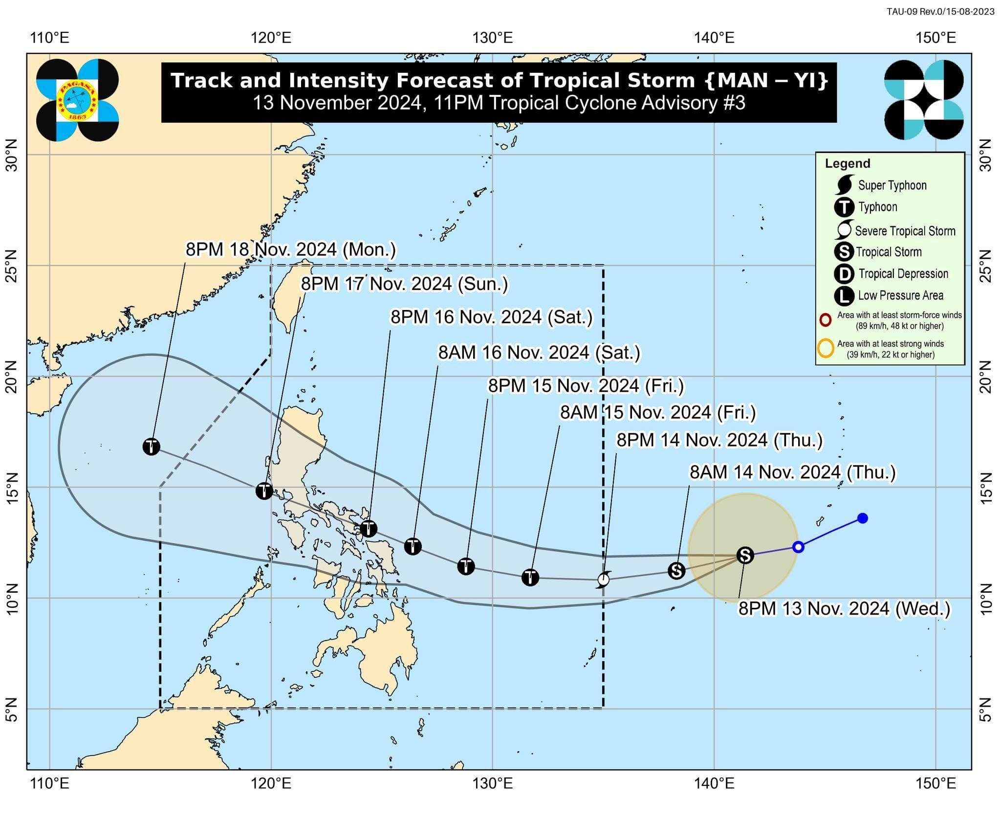
The tropical storm with an international name “Man-yi” has slightly intensified while moving toward the Philippine area of responsibility (PAR) on Wednesday evening, Nov. 13, said the Philippine Atmospheric, Geophysical and Astronomical Services Administration (PAGASA).
While the storm remains outside the (PAR), it is expected to approach the country in the coming days and could reach super typhoon strength before landfall over the eastern coast of Southern Luzon.
As of 10 p.m. on Wednesday, PAGASA said the center of Man-yi was located 1,705 kilometers east of Eastern Visayas.
It has maximum sustained winds of 75 kilometers per hour (kph) near its center and gusts reaching 90 kph.
While Man-yi is currently a tropical storm, PAGASA said it is expected to intensify into a severe tropical storm by Thursday evening, Nov. 14.
There is also a possibility that it could reach typhoon strength by Friday morning, Nov. 15, due to rapid intensification as it moves over the warm waters of the Philippine Sea.
PAGASA has also not ruled out the potential for Man-yi to reach super typhoon status before making landfall.
Over the next 12 houts, the storm is expected to continue its southwestward movement due to a high-pressure area south of Japan.
PAGASA said Man-yi may shift toward a more westward direction by Thursday, and is likely to enter the PAR in the evening. Once inside PAR, the storm will be named “Pepito.”
Though the storm is still several days away, PAGASA has warned that “most areas in Luzon” could be affected by heavy rainfall, strong winds, and storm surges once the storm enters PAR.
Given the uncertainty of the exact landfall location, PAGASA said it is important to prepare for the possibility of hazardous weather conditions even outside the direct path of the storm.