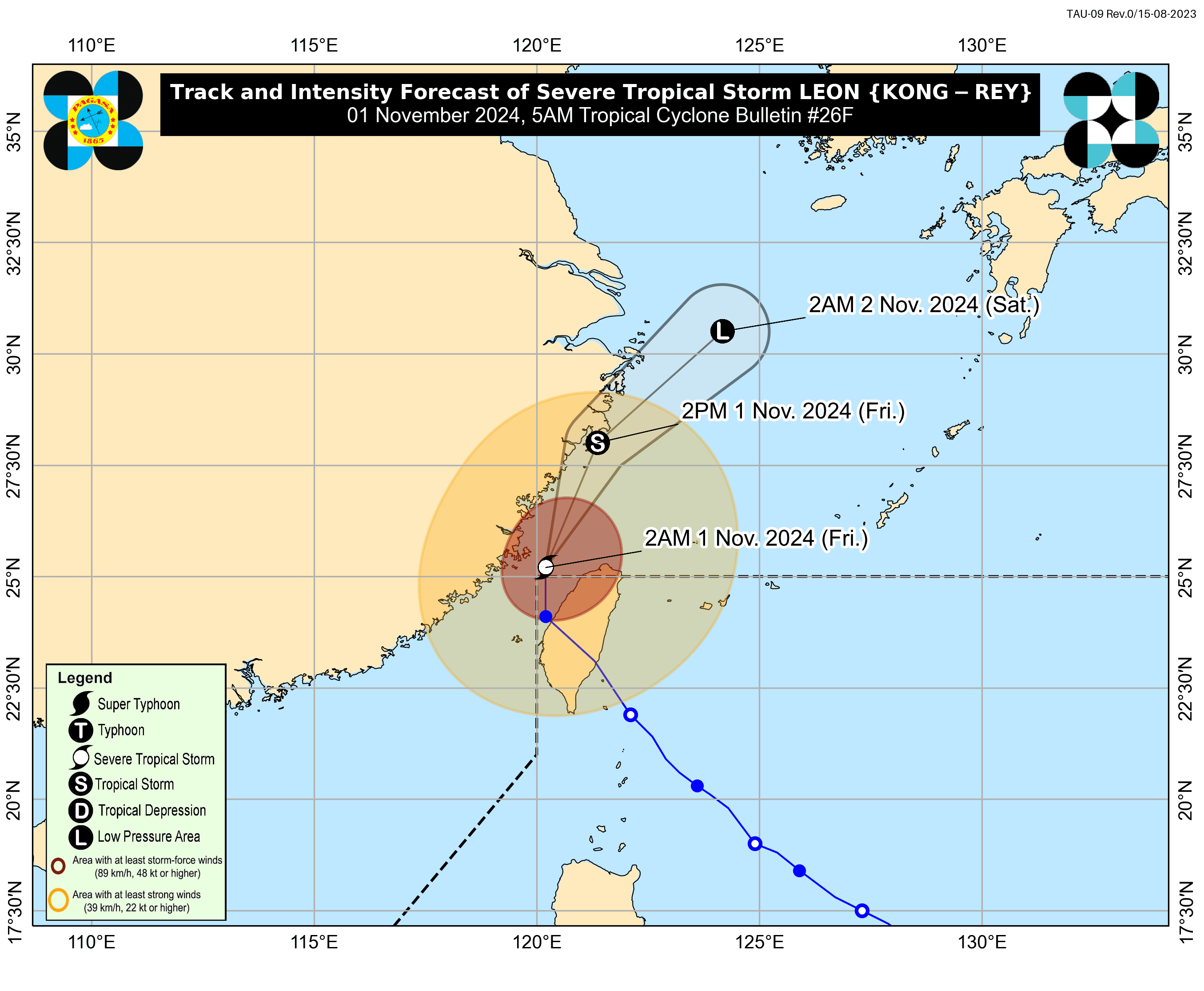
The Philippine Atmospheric, Geophysical and Astronomical Services Administration (PAGASA) said “Leon” (international name: Kong-rey) has weakened from a typhoon to a severe tropical storm and exited the Philippine Area of Responsibility (PAR) on Friday morning, Nov. 1.
As of 5 a.m., the center of the eye of the storm was located 550 kilometers north-northwest of Itbayat, Batanes, with maximum sustained winds of 100 kilometers per hour (kph) and gusts reaching 140 kph.
PAGASA lifted all tropical cyclone wind signals as of 11 p.m. on Thursday, Oct. 31.
However, strong to gale-force winds associated with Leon's circulation may still bring gusty conditions to Batanes, Babuyan Islands, northeastern mainland Cagayan, and eastern Isabela, particularly in coastal and upland areas.
In the next 24 hours, the trough or extension of Leon may also cause cloudy conditions with scattered rains and thunderstorms in Zambales, Bataan, Occidental Mindoro, and Palawan.
PAGASA warned that these areas may experience possible flash floods or landslides due to moderate to heavy rains.
Meanwhile, the rest of the country can expect partly cloudy to cloudy weather with isolated rain showers caused by localized thunderstorms.
The public is advised to remain vigilant for possible flash floods or landslides during severe thunderstorms.