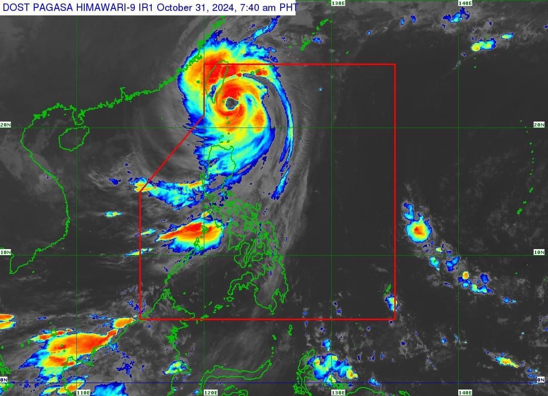
PAGASA: Super Typhoon Leon begins moving away from Batanes
At A Glance
- PAGASA said Leon is currently moving away from Batanes and heading towards Taiwan.
- The super typhoon has reached its peak intensity while passing near Batanes.
- Leon may exit the Philippine Area of Responsibility by Thursday evening or early Friday morning.

Super Typhoon “Leon” (international name: Kong-rey) has begun moving away from Batanes but the province remains under Signal No. 4, said the Philippine Atmospheric, Geophysical and Astronomical Services Administration (PAGASA) in its 8 a.m. bulletin on Thursday, Oct. 31.
As of 7 a.m., the eye of the super typhoon was located 110 kilometers north-northeast of Itbayat, Batanes, moving northwestward at 20 kilometers per hour (kph)
Leon maintained maximum winds of 195 kph near its center and gusts reaching 240 kph.
“Leon is now moving away from Batanes and heading towards Taiwan,” PAGASA said, adding that “the super typhoon has reached its peak intensity while passing close to Batanes.”
Wind warnings
As Leon moves away, Signal No. 5 has been lifted, but Signal No. 4 remains in effect in Batanes.
Likewise, Signal No. 3 is still raised in the northern portion of Babuyan Islands.
Signal No. 2 remains in place in the rest of Babuyan Islands, northern portion of mainland Cagayan (Camalaniugan, Lal-Lo, Pamplona, Gonzaga, Santa Teresita, Baggao, Buguey, Claveria, Gattaran, Lasam, Aparri, Ballesteros, Abulug, Allacapan, Sanchez-Mira, Santa Praxedes, Santa Ana), northern portion of Apayao (Pudtol, Luna, Santa Marcela, Calanasan, Flora), and northern portion of Ilocos Norte (Sarrat, Piddig, Bangui, Vintar, Burgos, Pagudpud, Bacarra, Adams, Pasuquin, Carasi, San Nicolas, Dumalneg, Laoag City).
Signal No. 1 also remains in effect in the rest of Cagayan, Isabela, the rest of Apayao, Abra, Kalinga, Mountain Province, Ifugao, northern portion of Benguet (Mankayan, Bakun, Buguias), the rest of Ilocos Norte, and Ilocos Sur.
Weather outlook
Although Leon is moving away, PAGASA said Batanes is expected to continue to experience intense to torrential rainfall (over 200 millimeters) on Thursday.
Heavy to intense rains (100 to 200 millimeters) may also persist in Babuyan Islands, Occidental Mindoro, and Calamian Islands.
Meanwhile, moderate to heavy rainfall (50 to 100 millimeters) may continue in Ilocos Norte, Ilocos Sur, Benguet, La Union, Pangasinan, Zambales, and Bataan.
PAGASA said the trough or extension of Leon may also bring scattered light to moderate rain showers to Metro Manila, Western Visayas, Negros Island Region, and the rest of Luzon.
Conditions are expected to improve on Friday, Nov. 1, with decreased rainfall and only moderate to heavy rains anticipated in Occidental Mindoro and Calamian Islands.
PAGASA said Leon may exit the Philippine Area of Responsibility by Thursday evening or early Friday morning.