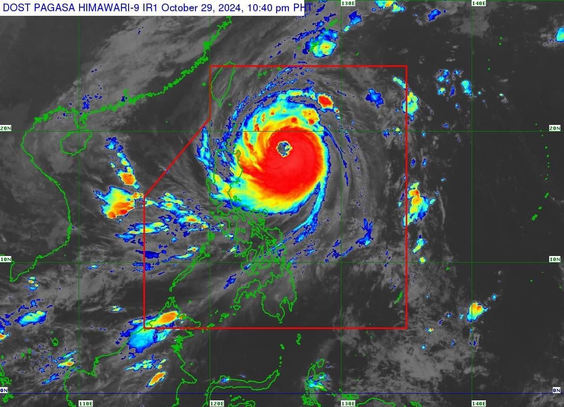
'Leon' continues to intensify as it approaches extreme N. Luzon; 8 areas under Signal No. 2
At A Glance
- As of 10 p.m., the center of the typhoon was located 450 kilometers east of Aparri, Cagayan, moving northwestward at 15 kph.
- Leon has maximum sustained winds of 155 kph near its center and gusts reaching 190 kph.
- It is expected to exit the Philippine Area of Responsibility on Thursday evening or early Friday morning.

The Philippine Atmospheric, Geophysical and Astronomical Services Administration (PAGASA) said on Tuesday, Oct. 29 that Typhoon “Leon” (international name: Kong-rey) has continued to strengthen while traversing the Philippines Sea and “will likely be at or near super typhoon intensity during its closest approach to Batanes.”
In its 11 p.m. bulletin, PAGASA said Leon has maximum sustained winds of 155 kilometers per hour (kph) near its center and gusts reaching 190 kph.
In a PAGASA press conference on Tuesday afternoon, Administrator Nathaniel Servando said that as Leon is undergoing rapid intensification, it could reach super typhoon status as early as Wednesday, Oct. 30.
A super typhoon has a maximum wind speed of over 185 kph.
PAGASA said Leon will be closest to Batanes between early morning and noon on Thursday, Oct. 31. However, a landfall in Batanes is also not ruled out.
As of 10 p.m., the center of the typhoon was located 450 kilometers east of Aparri, Cagayan, moving northwestward at 15 kph.
Wind signals
In anticipation of Leon’s strong winds, Signal No. 2 remains in effect in Batanes, Cagayan (including Babuyan Islands), northern and eastern portions of Isabela (Santo Tomas, Santa Maria, Quezon, San Mariano, Naguilian, Dinapigue, Delfin Albano, San Pablo, Ilagan City, Benito Soliven, Tumauini, Cabagan, Palanan, Quirino, Divilacan, Gamu, Mallig, Maconacon, Burgos, City of Cauayan, San Guillermo, Angadanan, Cabatuan, Luna, Reina Mercedes, Roxas, Aurora, San Manuel), Apayao, Kalinga, northern and eastern portions of Abra (Tineg, Lacub, Malibcong, Lagayan, San Juan, Lagangilang, Licuan-Baay, Daguioman), eastern portion of Mountain Province (Paracelis), and Ilocos Norte.
Signal No. 1 is also in place in the rest of Isabela, Quirino, Nueva Vizcaya, the rest of Mountain Province, Ifugao, Benguet, the rest of Abra, Ilocos Sur, La Union, eastern portion of Nueva Ecija (General Tinio, Gabaldon, Bongabon, Carranglan, Pantabangan, Laur, Rizal), Aurora, northern portion of Quezon (Infanta, General Nakar, including Polillo Islands), Camarines Norte, northern portion of Camarines Sur (Siruma, Tinambac, Lagonoy, Garchitorena, Caramoan), and northern and eastern portions of Catanduanes (Pandan, Gigmoto, Bagamanoc, Panganiban, Viga, Baras, Caramoran).
PAGASA still expects that Signal No. 3 or 4 may be raised, especially in Batanes and Babuyan Islands, as Leon continues to intensify and approach extreme Northern Luzon.
There is also a possibility that Signal No. 5 could be issued if Leon develops into a super typhoon.
Rainfall outlook
Based on PAGASA’s three-day rainfall forecast, moderate to torrential rainfall is expected in parts of Luzon and Visayas.
From Tuesday evening to Wednesday evening, intense to torrential rainfall (over 200 millimeters) may affect Batanes, Cagayan, and Babuyan Islands.
Heavy to intense rainfall (100 to 200 millimeters) is expected over Ilocos Norte, Apayao, Isabela, Occidental Mindoro, and Antique, while moderate to heavy rains (50 to 100 millimeters) may be experienced in Ilocos Sur, Abra, Kalinga, Calamian Islands, Romblon, Negros Occidental, and Aklan.
The trough or extension of Leon may also bring scattered light to moderate rain showers and thunderstorms to Metro Manila, Visayas, and the rest of Luzon.
From Wednesday evening to Thursday evening, intense to torrential will likely continue in Batanes and Babuyan Islands.
Heavy to intense rains may persist in mainland Cagayan and Occidental Mindoro, while moderate to heavy rainfall may continue to affect Ilocos Norte Abra, Zambales, Bataan, Bulacan, Rizal, Laguna, Cavite, Batangas, Calamian Islands, Romblon, Antique, and Aklan.
From Thursday evening to Friday evening, Nov. 1, moderate to heavy precipitation may prevail over Batanes, Zambales, Bataan, Cavite, Batangas, Calamian Islands, and Occidental Mindoro.
Leon is expected to exit the Philippine Area of Responsibility on Thursday evening or early Friday morning.