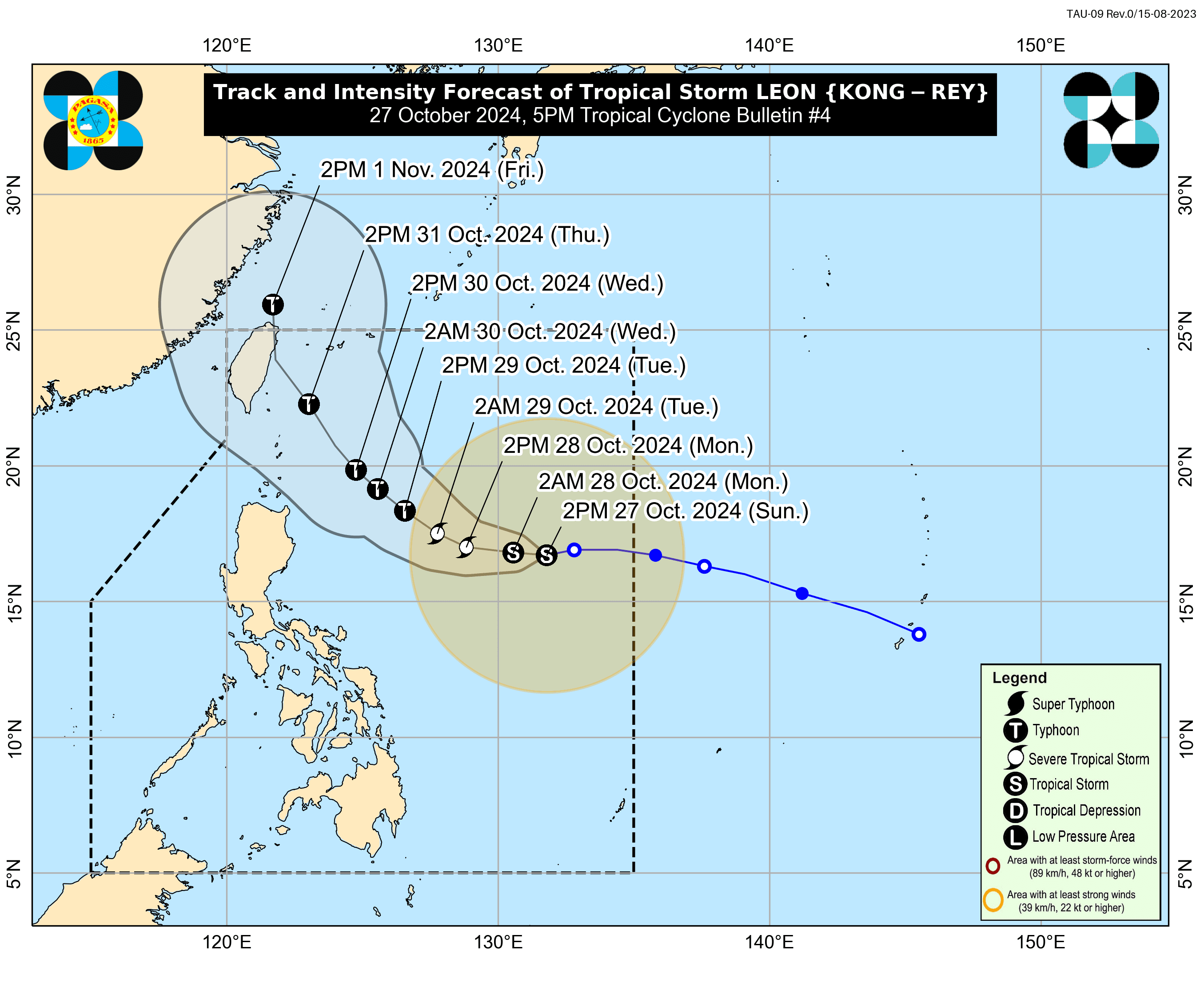
The Philippine Atmospheric, Geophysical and Astronomical Services Administration (PAGASA) on Sunday afternoon, Oct. 27 said Tropical Storm “Leon” (international name: Kong-rey) has slightly intensified while moving westward over the Philippine Sea.
In its 5 p.m. bulletin, PAGASA said Leon currently has maximum sustained winds of 75 kilometers per hour (kph) near the center and gustiness of 90 kph, up from 65 kph maximum winds and 80 kph gusts, previously.
As of 4 p.m., the center of the eye of the storm was located 1,000 kilometers east of Central Luzon.
PAGASA warned that Wind Signal No. 1 may be raised over parts of Cagayan Valley and northeastern Bicol Region by Sunday evening or Monday, Oct. 28.
The highest wind signal that could be raised is Signal No. 1 or 2, depending on the storm’s proximity during its north northwestward movement across the Philippine Sea.
While Leon is expected to remain distant from the Philippine landmass, its outer rainbands could impact the extreme northern part of Luzon.
It may also enhance the southwesterly wind flow, initially triggered by Tropical Storm “Trami” (formerly Kristine).
PAGASA said the trough or extension of Leon is expected to bring cloudy skies with scattered rains and thunderstorms to Catanduanes in the next 24 hours.
The enhancement of the southwesterly wind flow may lead to cloudy conditions, scattered rains, and thunderstorms across Western Visayas, Negros Island Region, Occidental Mindoro, and Palawan.
Meanwhile, Metro Manila and the rest of the country can expect partly cloudy to cloudy skies with isolated rain showers due to localized thunderstorms.
PAGASA said Leon may continue to intensify over the next 24 hours, reach severe tropical storm status by Monday, and typhoon intensity by Tuesday, Oct. 29.