


 Philippines
National
'Kristine' slowly moves toward Lingayen Gulf; Signal No. 3 lifted
Philippines
National
'Kristine' slowly moves toward Lingayen Gulf; Signal No. 3 lifted
'Kristine' slowly moves toward Lingayen Gulf; Signal No. 3 lifted


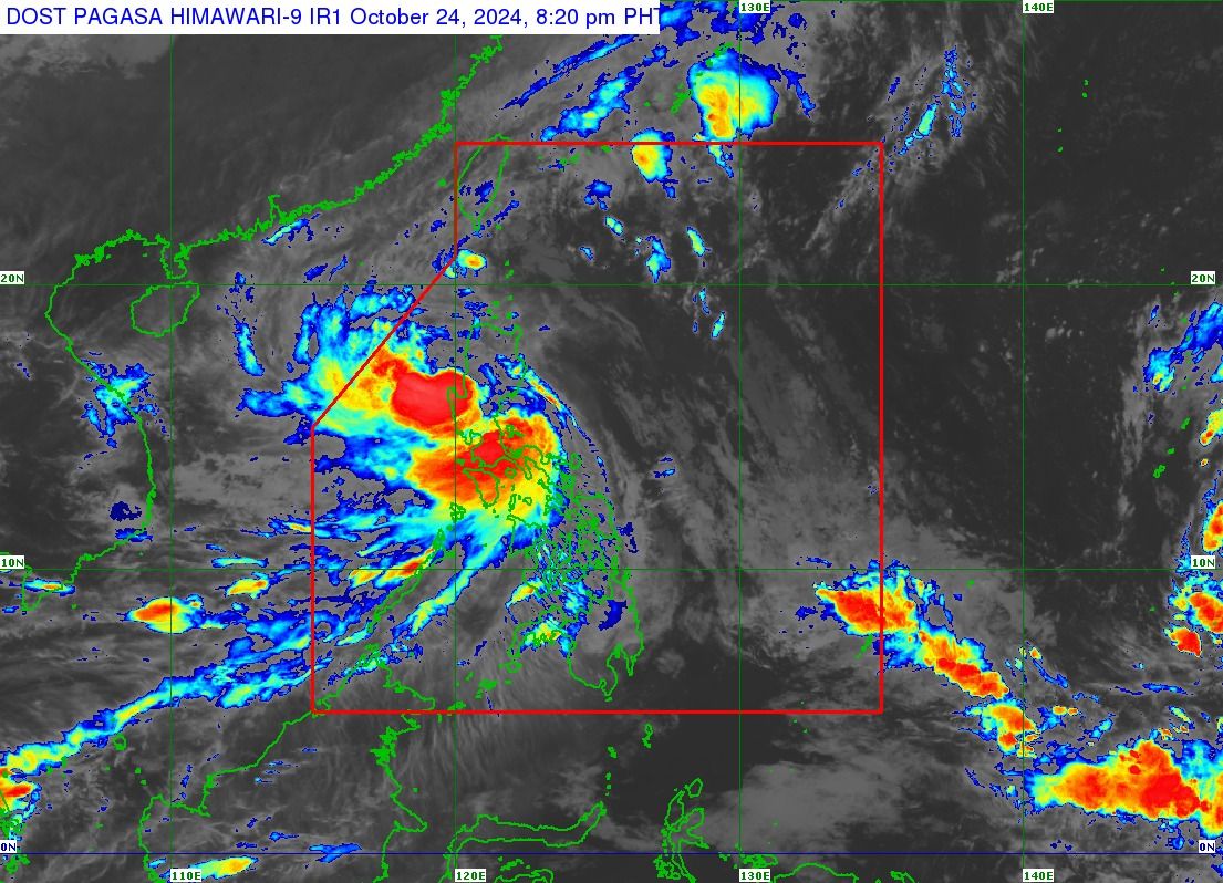
Severe Tropical Storm “Kristine” (international name “Trami”) is slowly moving toward the Lingayen Gulf and away from the country’s landmass, prompting the Philippine Atmospheric, Geophysical and Astronomical Services Administration (PAGASA) to lift Wind Signal No. 3.
As of 8 p.m. on Thursday, Oct. 24, only Wind Signals No. 2 and 1 remain in effect.
Signal No. 2 is in place in Metro Manila, Cagayan (including Babuyan Islands), Isabela, Quirino, Nueva Vizcaya, Apayao, Kalinga, Abra, Ifugao, Mountain Province, Benguet, Ilocos Norte, Ilocos Sur, La Union, Pangasinan, Aurora, Nueva Ecija, Tarlac, Zambales, Bataan, Pampanga, Bulacan, northern portion of Cavite (Ternate, Maragondon, Naic, Tanza, City of General Trias, Rosario, Cavite City, Noveleta, Kawit, Imus City, Bacoor City), northern portion of Rizal (Cainta, Taytay, Angono, San Mateo, Rodriguez, Tanay, City of Antipolo, Baras, Teresa, Morong), and northern portion of mainland Quezon (General Nakar).
Signal No. 1 is raised in Batanes, the rest of Rizal, Batangas, Laguna, the rest of Cavite, the rest of Quezon, Occidental Mindoro, Oriental Mindoro, Marinduque, Romblon, northern portion of mainland Palawan (El Nido, Taytay, Araceli, San Vicente, Dumaran, Roxas, including Calamian Islands, Cuyo, and Kalayaan Islands), Camarines Norte, Camarines Sur, Catanduanes, Albay, Sorsogon, Masbate (including Ticao and Burias Islands), Aklan, Capiz, Antique (including Caluya Islands), Iloilo, Bantayan Islands, western portion of Northern Samar (Lope de Vega, Rosario, Biri, San Isidro, Capul, San Vicente, Victoria, Lavezares, San Antonio, Mondragon, San Jose, Catarman, San Roque, Allen, Bobon), and northern portion of Samar (Calbayog City, Tagapul-An).
From Thursday evening to Friday evening, Oct. 25, intense to torrential rainfall (over 200 millimeters) may persist in Pangasinan, La Union, Zambales, Cavite, and Batangas.
Meanwhile, heavy to intense rainfall (100 to 200 millimeters) may continue to affect Metro Manila, Bataan, Rizal, and Occidental Mindoro.
Moderate to heavy rainfall (50 to 100 millimeters) may prevail over Cordillera Administrative Region, the rest of Ilocos Region, the rest of Central Luzon, Laguna, Quezon, Oriental Mindoro, Marinduque, Romblon, Palawan, Antique, Aklan, and Negros Occidental.
The trough or extension of Kristine may also bring scattered rains and thunderstorms to Zamboanga Peninsula, Lanao del Norte, Misamis Occidental, and the rest of Visayas.
Kristine has maintained maximum sustained winds of 95 kilometers per hour (kph) near the center and gusts reaching up to 145 kph.
As of 7 p.m., PAGASA said the center of severe tropical storm Kristine was over the coastal waters of Bacnotan, La Union, and is moving westward.
It is expected to exit the Philippine Area of Responsibility (PAR) by Friday afternoon, Oct. 25.
However, PAGASA said there is a possibility that Kristine may follow a looping path over the West Philippine Sea by Sunday or Monday, Oct. 27 or 28, which could result in its return to the PAR.
This scenario depends on the movement of a low-pressure area (LPA) monitored east of northeastern Mindanao, which is likely to develop into a tropical depression within the next 24 hours.