


'Kristine' intensifies into tropical storm


The Philippine Atmospheric, Geophysical and Astronomical Services Administration (PAGASA) said tropical cyclone “Kristine” (international name “Trami”) intensified into a tropical storm on Tuesday, Oct. 22.
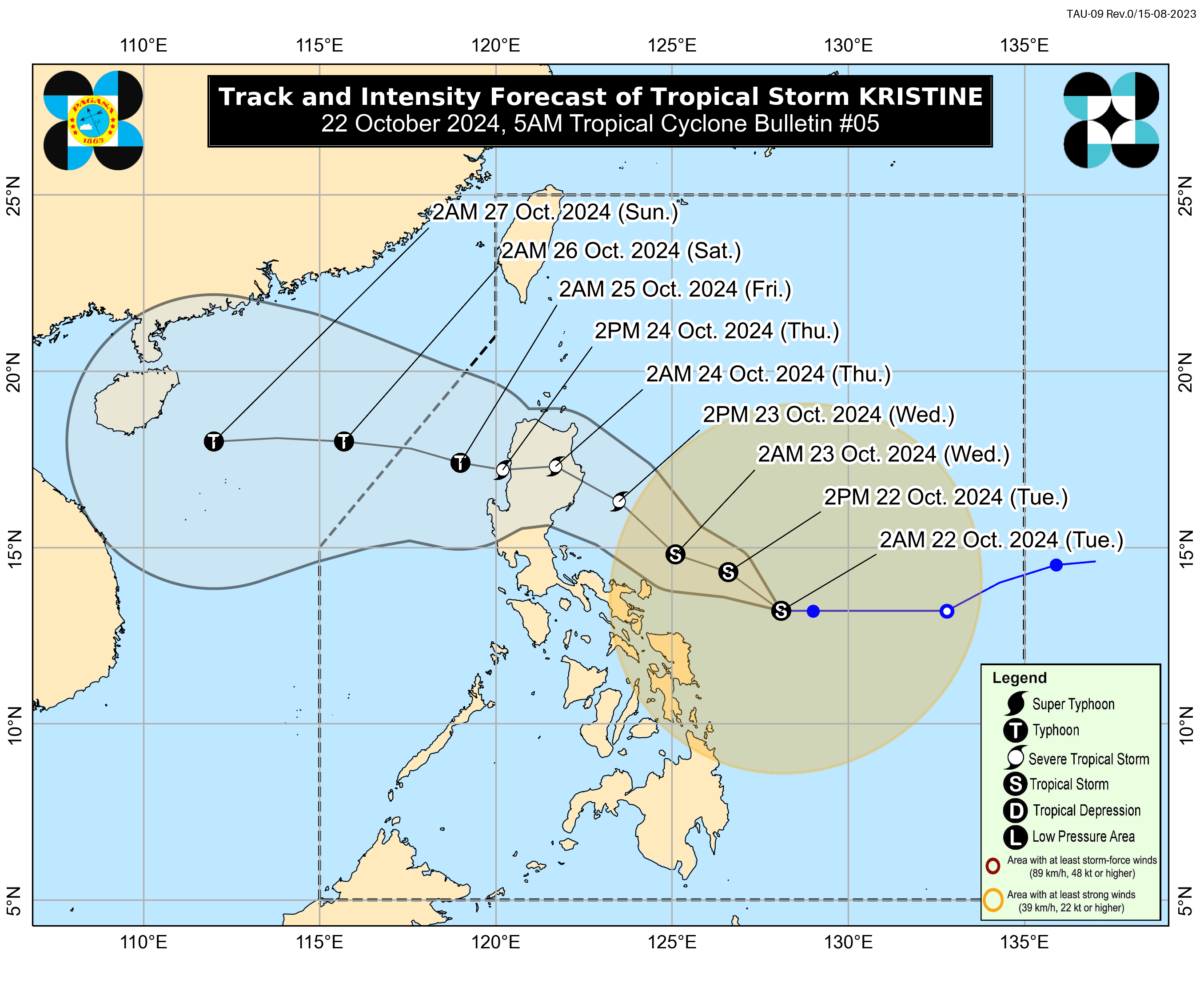
In its latest bulletin issued at 5 a.m., PAGASA said Kristine has maximum sustained winds of 65 kilometers per hour (kph) near the center and gusts reaching up to 80 kph.
As of 4 a.m., the center of the storm was located 390 kilometers east of Virac, Catanduanes. Kristine is expected to move westward at 15 kph.
Based on the PAGASA’s latest forecast track, Kristine may make landfall over Isabela by Wednesday evening, Oct. 23, and is projected to exit the Philippine Area of Responsibility by Friday evening, Oct. 25.
Kristine may make landfall as a severe tropical storm.
Initially, it was anticipated to make landfall as a typhoon over northeastern Cagayan on Friday.
PAGASA said that changes in the forecast track are possible, depending on the movements of surrounding weather systems in the coming days.
Heavy rains, strong winds
PAGASA said the highest tropical cyclone wind signal that may be raised during the passage of Kristine is still Signal No. 4, given the potential for rapid intensification.
As of 5 a.m., Signal No. 1 remains in effect over the eastern and central portions of mainland Cagayan, Isabela, Quirino, southern portion of Nueva Vizcaya, Aurora, eastern portion of Rizal, eastern portion of Laguna, northern and eastern portions of Quezon (including Polillo Islands), Marinduque, Romblon, Camarines Norte, Camarines Sur, Catanduanes, Albay, Sorsogon, Masbate (including Ticao and Burias Islands), Eastern Samar, Northern Samar, Samar, Leyte, Biliran, Southern Leyte, Dinagat Islands, and Surigao del Norte (including Siargao-Bucas Grande group of islands).
Due to Kristine's vast circulation, rainfall is expected to affect many areas across the country.
In the next 24 hours, Kristine may bring moderate to intense rainfall to Bicol Region, Eastern Visayas, Isabela, Quirino, Aurora, and Quezon.
Moderate to heavy rains from the trough or extension of Kristine may also affect Metro Manila, the rest of Luzon, Visayas, Zamboanga Peninsula, Northern Mindanao, Basilan, Sulu, and Tawi-Tawi.
The rest of Mindanao may experience isolated rain showers or thunderstorms due to Kristine’s trough.
PAGASA warned of possible flash floods and landslides throughout the archipelago.