


'Julian' re-enters Philippine area of responsibility


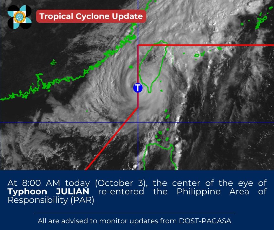
Typhoon “Julian” (international name “Krathon”) re-entered the Philippine Area of Responsibility (PAR) at 8 a.m. on Thursday, Oct. 3, said the Philippine Atmospheric, Geophysical and Astronomical Services Administration (PAGASA).
Julian had initially left the PAR on Oct. 1.
In its 5 a.m. live weather forecast, PAGASA Weather Specialist Benison Estareja said the typhoon may make landfall over southwestern Taiwan after re-entering the PAR.
He said the outer circulation of the typhoon is relatively close to Batanes, thus Tropical Cyclone Wind Signal No. 1 remains hoisted over the province. Julian has maximum sustained winds of 140 kilometers per hour (kph) near the center and gusts of up to 170 kph as of Thursday morning.
Despite its re-entry into the PAR, Julian is not expected to significantly affect the rest of the country, aside from Batanes.
“After landfall, Julian is forecast to move erratically over Taiwan while rapidly weakening due to land interaction,” PAGASA said.
The typhoon may weaken into a Low Pressure Area over Taiwan and is expected to exit the PAR by Friday, Oct. 4.
Over the next 24 hours, scattered light to moderate rains and thunderstorms may prevail over Batanes and Babuyan Islands due to Julian.
Its trough or extension may also bring scattered light to moderate rains and thunderstorms to Ilocos Region, Cordillera Administrative Region, the rest of Cagayan Valley, and Central Luzon.
In addition, scattered light to moderate rains and thunderstorms may affect Davao Region, Soccsksargen, and Caraga due to easterlies, or warm winds from the Pacific Ocean.
The rest of the country will be partly cloudy to cloudy with isolated rain showers due to localized thunderstorms.
Estareja said PAGASA has not monitored any other LPAs or tropical cyclones near or inside the country’s area of responsibility as of Thursday.
He added that the country may remain cyclone-free until the weekend.