


 Philippines
National
Typhoon Carina set to exit Philippine area of responsibility, still enhancing 'habagat'
Philippines
National
Typhoon Carina set to exit Philippine area of responsibility, still enhancing 'habagat'
Typhoon Carina set to exit Philippine area of responsibility, still enhancing 'habagat'


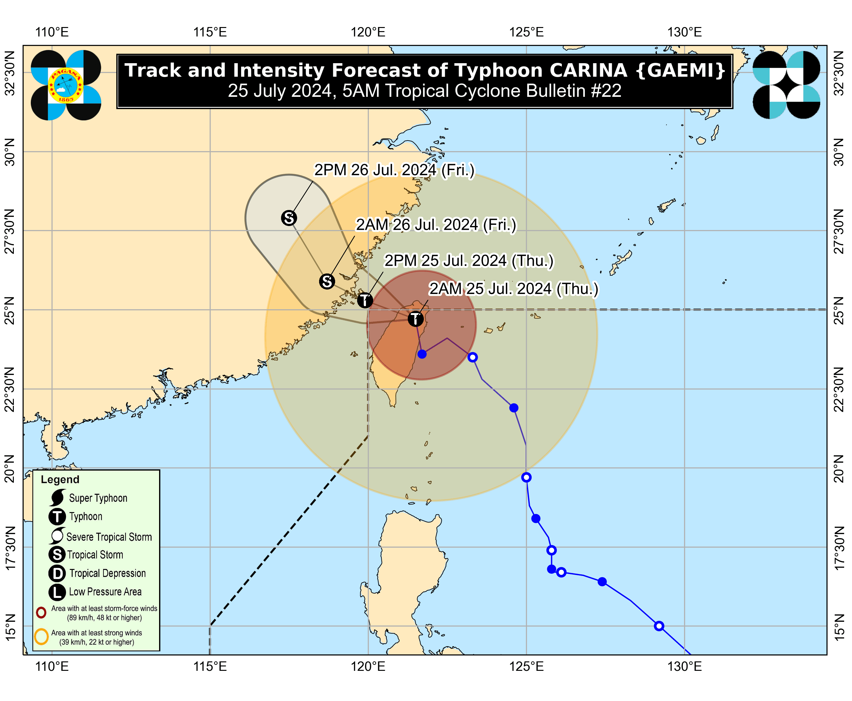
The Philippine Atmospheric, Geophysical and Astronomical Services Administration (PAGASA) on Thursday morning, July 25, said typhoon “Carina” (international name “Gaemi”) is approaching the northern boundary of the country’s area of responsibility after crossing Taiwan.
Based on the 5 a.m. bulletin, the typhoon was located 465 kilometers north of Itbayat, Batanes, moving northward at 20 kilometers per hour.
If it maintains this speed and direction, Carina will be outside the Philippine area of responsibility in the next few hours.
After crossing the rugged terrain of Taiwan, PAGASA said typhoon Carina further weakened, with maximum sustained winds of 150 kph near the center and gusts of up to 185 kph.
Tropical cyclone wind warnings have been lowered, with only Signal No. 1 remaining over Batanes, and all other wind signals lifted.
“Typhoon Carina is now less likely to directly bring heavy rainfall over any portion of the country. However, the southwest monsoon enhanced by Carina will bring moderate to intense rainfall over various localities in the western portion of Luzon today through Saturday (July 27),” PAGASA said.
In its 11 p.m. bulletin on Wednesday, July 24, PAGASA said heavy to intense monsoon rains may persist in Zambales, La Union, Pangasinan, and Benguet, while moderate to heavy rains are likely over Metro Manila, Bulacan, Pampanga, Cavite, Batanes, Babuyan Islands, the rest of Ilocos Region, Abra, Bataan, and Occidental Mindoro on Thursday.
By Friday, July 26, moderate to heavy rains due to habagat may affect Zambales, Bataan, Pangasinan, and Benguet.
On Saturday, Zambales and Bataan may continue to experience moderate to heavy rains.