


 Philippines
National
'Jenny' slows down, may become a severe tropical storm on Oct. 1 — PAGASA
Philippines
National
'Jenny' slows down, may become a severe tropical storm on Oct. 1 — PAGASA
'Jenny' slows down, may become a severe tropical storm on Oct. 1 — PAGASA


The Philippine Atmospheric, Geophysical and Astronomical Services Administration (PAGASA) on Saturday, Sept. 30, said that Tropical Storm Jenny had reduced its speed.
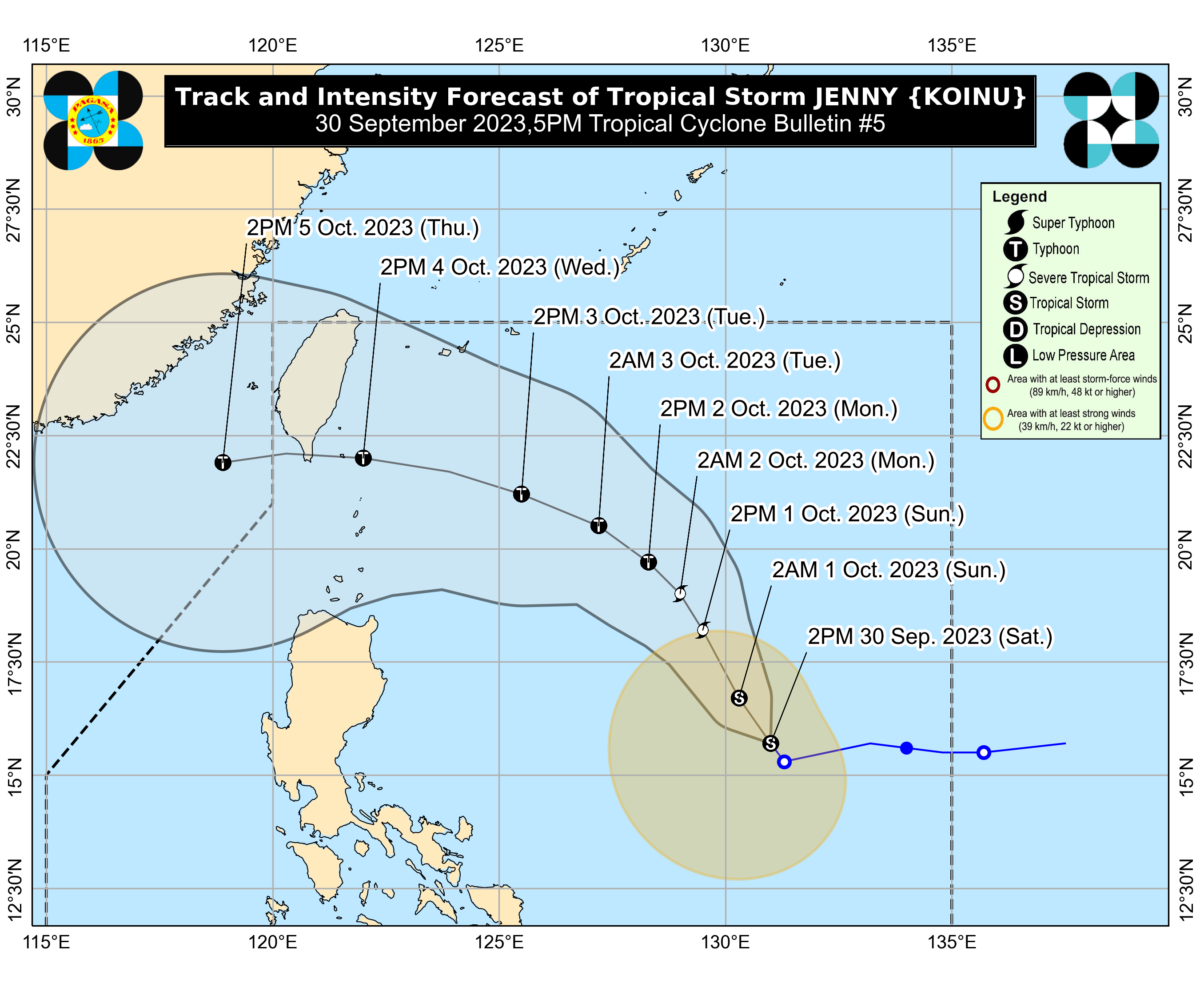
PAGASA reported that "Jenny" was moving northwestward at 10 kilometers per hour.
As of 4 p.m., its center was located 995 km east of Central Luzon, according to PAGASA.
"Jenny" still had maximum sustained winds of 65 kilometers per hour near the center, with gusts of up to 80 kilometers per hour and a central pressure of 1000 hPa, as reported by PAGASA.
PAGASA mentioned that there were still no Tropical Cyclone Wind Signals (TCWS) in effect at this time.
The weather bureau also stated that “Jenny” is not “directly affecting the country at this time.”
“However, due to the proximity of the track forecast to Extreme Northern Luzon, heavy rainfall over Batanes and Babuyan Islands may be experienced on Tuesday or Wednesday,” PAGASA added.
Based on its forecast, PAGASA said that “Jenny” would steadily intensify throughout the forecast period and might become a “severe tropical storm” on Sunday, Oct. 1.
PAGASA also noted that this tropical cyclone may also reach the "typhoon category" late on Monday, Oct. 2, or on Tuesday, Oct. 3. (Lizst Torres Abello)