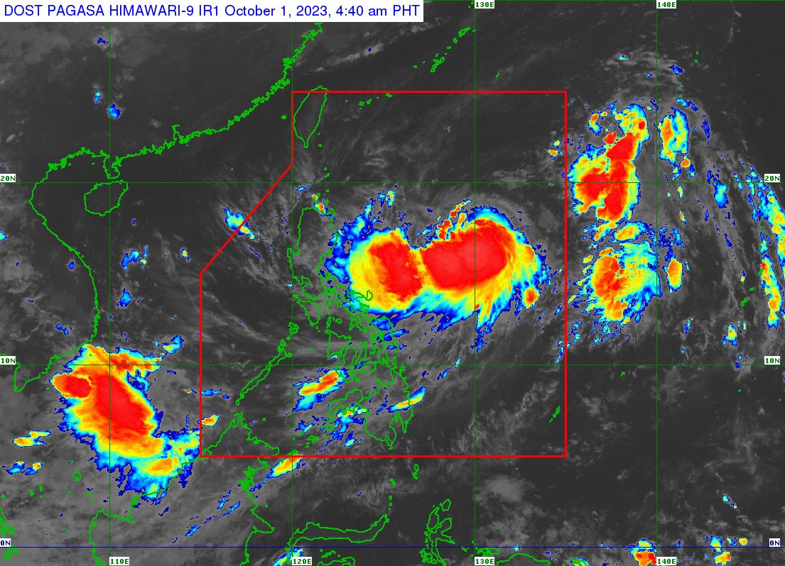
'Jenny' further intensifies; wind signals may be raised soon

Tropical storm Jenny (international name: Koinu) continued to intensify as it traversed the Philippine Sea on Sunday, Oct. 1, said the Philippine Atmospheric, Geophysical and Astronomical Services Administration (PAGASA).
In its 5 a.m. bulletin, PAGASA said Jenny was last located 835 kilometers east of Central Luzon, moving northwestward at 20 kph.
Weather specialist Daniel James Villamil said Jenny may continue to move northwestward until Monday, Oct. 2, then turn west-northwestward on Tuesday, Oct. 3 toward the Luzon Strait.
It may move westward on Wednesday, Oct. 4, then pass over the Bashi Channel between Batanes and the southern portion of Taiwan between Wednesday evening and Thursday morning, Oct. 4 and 5.
“However, a landfall or close approach scenario over extreme Northern Luzon is still not ruled out since these scenarios are within the forecast confidence cone,” he pointed out.
Wind signals
Jenny further intensified on Sunday with maximum sustained winds of 85 kilometers per hour (kph) near the center and gusts of up to 105 kph.
Villamil said PAGASA may raise tropical cyclone wind signals over extreme Northern Luzon as early as Sunday evening due to the anticipated onset of strong winds from Jenny.
“However, hoisting [of wind signals] may happen earlier should there be changes in the forecast scenario,” he added.
He said Jenny may intensify steadily and become a severe tropical storm within the day, and further into a typhoon by Monday evening or Tuesday, Oct. 2 or 3.
Rainy due to Jenny, ‘habagat’
Villamil noted that the trough or extension of Jenny is already bringing scattered rain showers and thunderstorms to Isabela, Aurora, Quezon, and Bicol Region.
“Based on the forecast track, heavy rainfall may be experienced over Batanes, Babuyan Islands, and the northern portions of mainland Cagayan, Apayao, and Ilocos Norte on Wednesday or Thursday,” he added.
In addition to Jenny’s rains, the enhanced southwest monsoon, or “habagat,” may bring moderate to intense rains over Palawan by Monday, and over northern Palawan, including Calamian and Cuyo Islands, and Occidental Mindoro by Tuesday.
“Under these conditions, flooding and rain-induced landslides are possible, especially in areas that are highly or very highly susceptible to these hazards,” PAGASA warned.