


Marcos on China's new map: We'll defend PH territory


President Ferdinand "Bongbong" Marcos Jr. said the Philippines will respond to China's new map featuring the 10-dash line that occupies the entire South China Sea but did not divulge how.
Instead, Marcos said the country will continue to stand its ground and defend its territory, leveraging the 2016 arbitral ruling favoring the country over the West Philippine Sea.
"Ngayon (Now), of course, we'll continue to defend our territorial sovereignty, our territorial rights. We have not changed our approach, it is other countries around us that have changed their approach," he said on Friday, Sept. 1.
"We received the news that now the 9-dash line has been extended to the 10-dash line. We have to respond to all of these and we will," Marcos stressed.
"But again these are operational details that I would prefer not to talk about," he added.
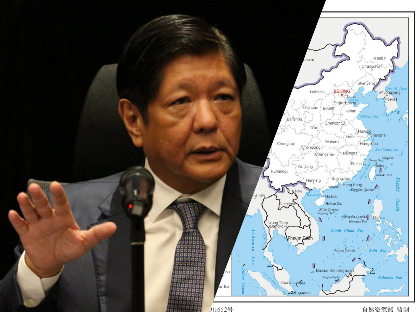
The President was reacting to Beijing's newly-released map, which features a 10-dash line that signifies that China owns the entire South China Sea, overlapping with the exclusive economic zones (EEZ) of the Philippines, Malaysia, Indonesia, Vietnam and Brunei.
He emphasized that the Philippines has not changed its approach in defending its territorial sovereignty.
It will continue to cite the arbitral ruling that favored the Philippines over the West Philippine Sea claims as it gives the country a "very solid ground" in the territorial dispute.
"Because we have stayed true to the rules-based international law, especially the UNCLOS (United Nations Convention on the Law of the Sea), and that I think puts us at very solid ground in terms of our claims for territorial sovereignty, maritime territory," Marcos said.
"And this has been validated and supported by many many countries around the world and we should take strength in that and I believe that again is a very big help to the Philippines in continuing to defend our maritime borders," he added.
On Aug. 31, the Philippine government, through the Department of Foreign Affairs, rejected the 2023 version of China’s Standard Map issued by the Ministry of Natural Resources of the People's Republic of China on Aug. 28, 2023, because of its inclusion of the nine-dashed line (now a ten-dashed line) that supposedly shows China's boundaries in the South China Sea.
The DFA said that the "latest attempt to legitimize China's purported sovereignty and jurisdiction over Philippine features and maritime zones has no basis under international law, particularly the 1982 United Nations Convention on the Law of the Sea (UNCLOS)."
READ MORE: 'No international law basis': PH rejects China's 2023 map