


 Philippines
National
Tropical storm east of Luzon may enter PAR Aug. 30; will be named 'Hanna'
Philippines
National
Tropical storm east of Luzon may enter PAR Aug. 30; will be named 'Hanna'
Tropical storm east of Luzon may enter PAR Aug. 30; will be named 'Hanna'


At A Glance
- "On the forecast track, the storm is forecast to remain far from the Philippine landmass and may exit the PAR on Friday while approaching the Ryukyu Islands," PAGASA said.
- However, the storm may enhance the southwest monsoon, or "habagat," on Wednesday or Thursday, Aug. 31.
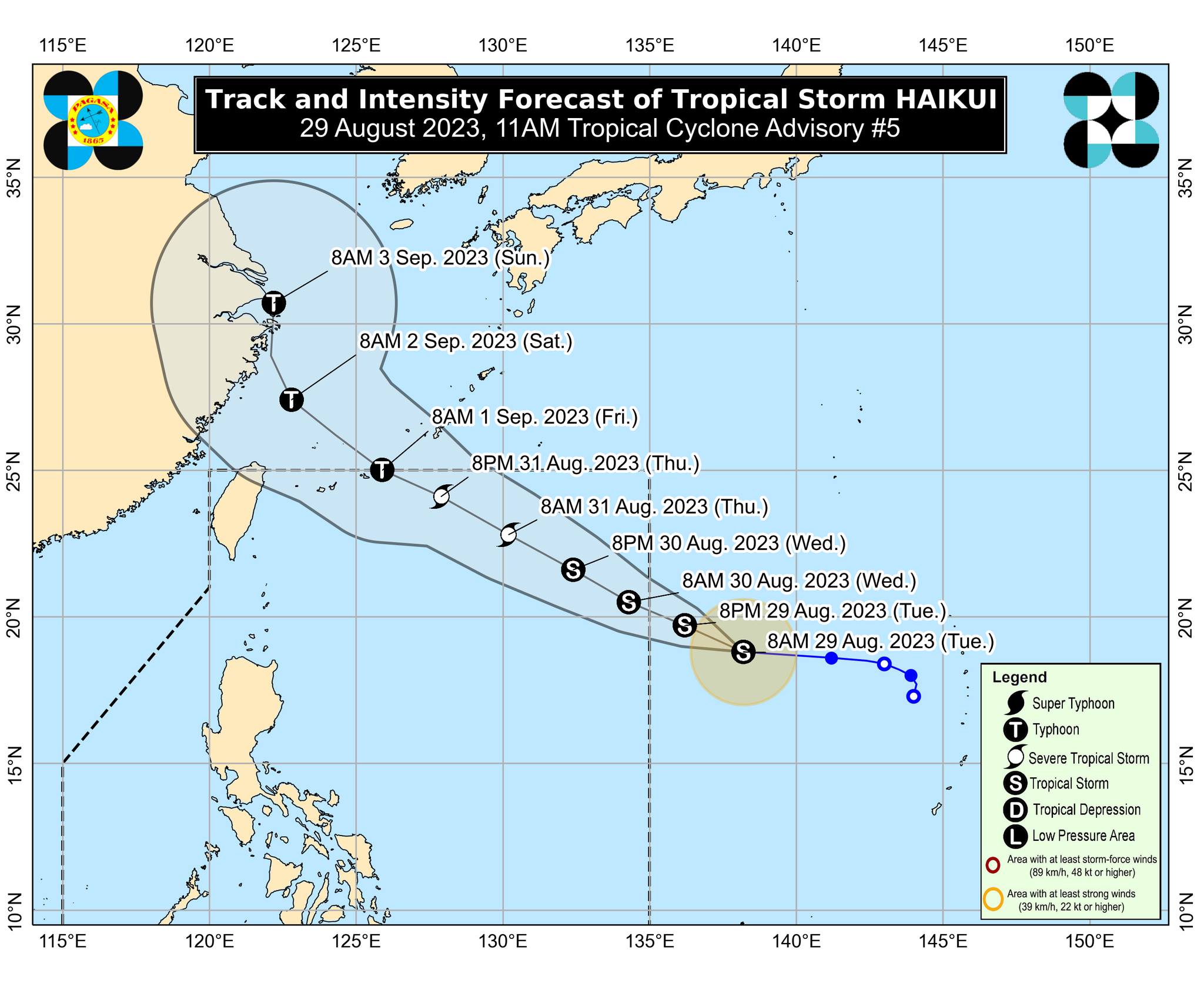
The Philippine Atmospheric, Geophysical and Astronomical Services Administration (PAGASA) on Tuesday, Aug. 29 said the tropical storm with the international name “Haikui” will likely enter the country’s area of responsibility by Wednesday, Aug. 30.
The tropical storm, which was last located 1,660 kilometers east of extreme Northern Luzon, will be given a local name “Hanna” once inside the Philippine area of responsibility (PAR).
It is currently moving west-northwestward at 20 kilometers per hour (kph) while packing maximum sustained winds of 75 kph near the center and gusts of up to 90 kph.
“On the forecast track, the storm is forecast to remain far from the Philippine landmass and may exit the PAR on Friday while approaching the Ryukyu Islands,” PAGASA said.
However, the storm may enhance the southwest monsoon, or “habagat,” on Wednesday or Thursday, Aug. 31.
“This may result in the continuation of occasional or monsoon rains over the western portion of Luzon and Visayas throughout this week,” PAGASA said, as typhoon Goring (international name: Saola) is also strengthening the effect of the habagat.
Haikui may continue to intensify within the next five days and reach typhoon status while inside the PAR.
It may reach its peak intensity on Friday evening, Sept. 1 as it moves outside PAR, PAGASA said.