


 Philippines
National
Signal No. 2 raised over northeastern Cagayan as 'Goring' undergoes rapid intensification
Philippines
National
Signal No. 2 raised over northeastern Cagayan as 'Goring' undergoes rapid intensification
Signal No. 2 raised over northeastern Cagayan as 'Goring' undergoes rapid intensification


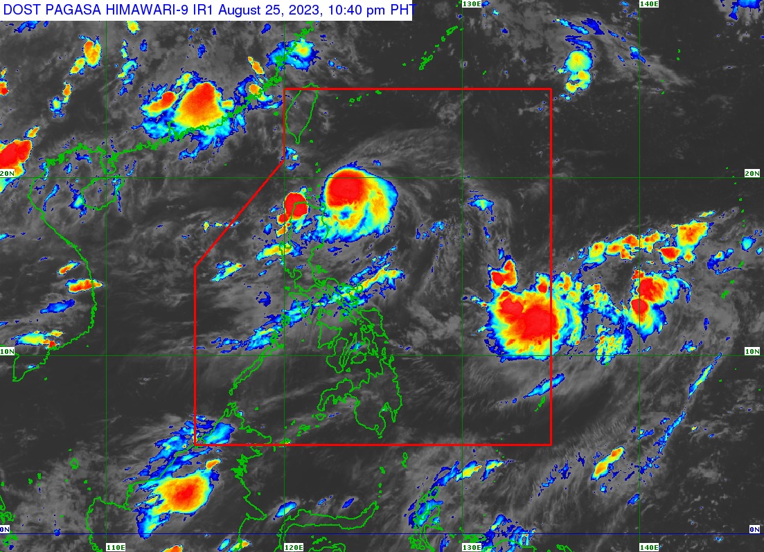
The Philippine Atmospheric, Geophysical and Astronomical Services Administration (PAGASA) said “Goring” turned into a typhoon on Friday evening, Aug. 25, only a few hours after it became a severe tropical storm.
In its 11 p.m. bulletin, PAGASA said Goring was packing maximum sustained winds of 120 kilometers per hour (kph) near the center and gusts of up to 150 kph, up from 110 kph winds and 135 kph gusts on Friday afternoon.
It was moving south-southwestward at 10 kph and was last located 205 kilometers (km) east of Calayan, Cagayan.
In anticipation of Goring’s strong winds, tropical cyclone wind signal No. 2 was hoisted over the northeastern portion of mainland Cagayan, while signal No. 1 was raised over Batanes, Babuyan Islands, eastern portion of mainland Cagayan, eastern portion of Isabela, and northern portion of Aurora.
‘Goring’ may become super typhoon
PAGASA said that because of the highly favorable environment, there is a possibility that Goring may intensify into a super typhoon by Monday, Aug. 28.
“Over the next two days, Goring is forecast to move generally southward to southeastward over the waters east of Cagayan Valley,” PAGASA said.
“Afterwards, the typhoon will make a northeastward to northward turn on Monday before accelerating northwestward on Tuesday (Aug. 29) and Wednesday (Aug. 30) towards the sea east of Taiwan,” it added.
Heavy rains
On Saturday, Aug. 26, PAGASA said intense rains will affect the extreme northeastern portion of mainland Cagayan, while heavy rains will prevail over Babuyan Islands, the northwestern and eastern portions of mainland Cagayan, northeastern portion of Isabela, Abra, Apayao, Ilocos Norte, and Ilocos Sur.
From Saturday evening to Sunday evening, Aug. 27, intense rains will persist in the extreme northeastern portion of mainland Cagayan, while heavy rains will continue in Babuyan Islands, the northwestern and eastern portions of mainland Cagayan, eastern portion of Isabela, Ilocos Norte, and the northern portion of Aurora.
“Forecast rainfall is generally higher in elevated or mountainous areas,” PAGASA said.
The southwest monsoon, or “habagat,” enhanced by Goring, may also bring occasional heavy to intense rains over Zambales, Bataan, and Occidental Mindoro on Saturday.
By Sunday, monsoon rains may prevail over Zambales, Bataan, Cavite, Batangas, Occidental Mindoro, northern part of Palawan, including Calamian and Cuyo Islands, and Antique.
“Under these conditions, flooding and rain-induced landslides are possible especially in areas that are highly or very highly susceptible to these hazards as identified in hazard maps and in localities that experienced considerable amounts of rainfall for the past several days,” PAGASA warned.