


'Goring', enhanced 'habagat' to bring rains, says PAGASA


Tropical storm Goring (international name: Saola) and the enhanced southwest monsoon, or “habagat,” may bring rains over some areas of Luzon and Visayas this holiday weekend, the Philippine Atmospheric, Geophysical and Astronomical Services Administration (PAGASA) said on Friday, Aug. 25.
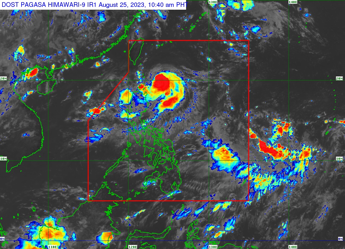
In its 11 a.m. bulletin, PAGASA said Goring continues to move slowly south-southwestward and was last located 225 kilometers (km) east-southeast of Basco, Batanes or 270 km east of Calayan, Cagayan.
It also further intensified and now has maximum sustained winds of 85 kph near the center and gusts of up to 105 kph.
‘Goring’ to dump heavy rains
PAGASA said heavy rains will affect Batanes, Babuyan Islands, and the northeastern portion of mainland Cagayan until Saturday noon, Aug. 26.
From Saturday noon to Sunday noon, Aug. 27, intense rains may affect the eastern part of mainland Cagayan, Isabela, and the northern part of Aurora, while heavy rains may prevail over Babuyan Islands, Ilocos Norte, Ilocos Sur, and the rest of mainland Cagayan and Isabela.
Meanwhile, heavy rains may persist in Ilocos Norte, Ilocos Sur, northern part of Aurora, and the eastern portions of Cagayan and Isabela from Sunday noon to Monday noon, Aug. 28.
“Forecast rainfall is generally higher in elevated or mountainous areas,” PAGASA said.
The southwest monsoon, or “habagat,” enhanced by Goring, may also bring occasional rains over Zambales, Bataan, and Occidental Mindoro on Saturday.
By Sunday, monsoon rains may prevail over Zambales, Bataan, Cavite, Batangas, Occidental Mindoro, northern part of Palawan, including Calamian and Cuyo Islands, and Antique.
“Under these conditions, flooding and rain-induced landslides are possible especially in areas that are highly or very highly susceptible to these hazards as identified in hazard maps and in localities that experienced considerable amounts of rainfall for the past several days,” PAGASA warned.
Signal No. 1
Due to the anticipated strong winds from Goring, tropical cyclone wind signal No. 1 remains hoisted over Batanes, the eastern portion of Babuyan Islands (Babuyan Island, Camiguin Island), eastern portion of mainland Cagayan (Santa Ana, Gonzaga, Lal-Lo, Gattaran, Baggao, Peñablanca, Santa Teresita, Buguey, Camalaniugan, Aparri), and the eastern portion of Isabela (Maconacon, Divilacan, Palanan, Dinapigue, San Mariano, San Pablo, Cabagan, Tumauini, Ilagan City).
“Minimal to minor impacts from strong winds are possible within any of the areas where wind signal No.1 is hoisted,” PAGASA said.
Gusty conditions due to the enhanced habagat may also affect Aurora, Bataan, Metro Manila, Cavite, Laguna, Batangas, Rizal, Quezon, Bicol, Dinagat Islands, and most of Mimaropa (Oriental Mindoro, Occidental Mindoro, Marinduque, Romblon, Palawan) and Visayas on Saturday.
On Sunday, gusty conditions may prevail over Aurora, Bataan, Metro Manila, Cavite, Laguna, Batangas, Rizal, Quezon, Oriental Mindoro, Occidental Mindoro, Marinduque, Romblon, Palawan, Bicol, Visayas, Dinagat Islands, and Surigao del Norte.
Super typhoon status not ruled out
Goring is still unlikely to make landfall, but the possibility of it becoming a super typhoon has not been ruled out as of Friday.
PAGASA said the tropical storm may move south-southwestward or southward over the waters east of Northern Luzon until Saturday evening, then turn south or southeastward until Sunday afternoon.
The tropical cyclone will then loop northward before turning northwest towards the Luzon Strait on Tuesday, Aug. 29.
Goring is expected to move slowly for most of the forecast period.
PAGASA also said that because of the highly favorable environment, Goring may rapidly intensify and reach typhoon status by Saturday, before reaching its peak intensity on Sunday evening.
It may maintain its strength until the end of the forecast period, but the possibility of the weather disturbance becoming a super typhoon is still not ruled out.