


Signal No. 1 up over 4 areas as 'Goring' slightly intensifies
Super typhoon status not ruled out


At A Glance
- Signal No. 1 was hoisted over Batanes, the eastern portion of Babuyan Islands, eastern portion of mainland Cagayan, and northeastern portion of Isabela.
- Heavy rains are expected in Batanes, Babuyan Islands, and the northeastern portion of mainland Cagayan on Friday, and in Babuyan Islands, the eastern parts of mainland Cagayan, and Isabela on Saturday, Aug. 26.
- The southwest monsoon, or "habagat," enhanced by Goring may also bring occasional rains to the western portions of Central and Southern Luzon on Saturday.
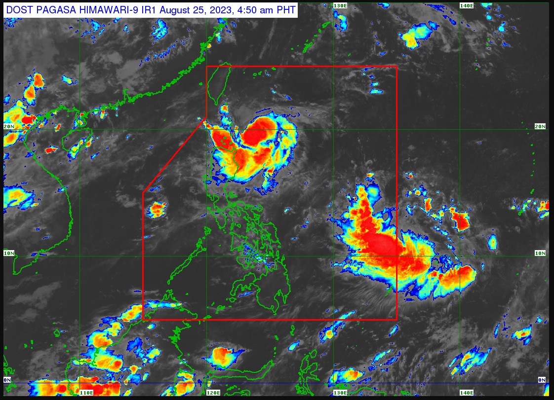
Tropical cyclone wind signal No. 1 was raised over some areas of extreme Northern Luzon as tropical storm Goring (international name: Saola) intensified further on Friday, Aug. 25, the Philippine Atmospheric, Geophysical and Astronomical Services Administration (PAGASA) said in its 5 a.m. bulletin.
Signal No. 1 was hoisted over Batanes, the eastern portion of Babuyan Islands, eastern portion of mainland Cagayan, and northeastern portion of Isabela.
Goring continues to move slowly southwestward and was last located 220 kilometers (km) east-southeast of Basco, Batanes.
It has maximum sustained winds of 75 kph near the center and gusts of up to 90 kph.
Rains due to ‘Goring’, enhanced ‘habagat’
Heavy rains are expected in Batanes, Babuyan Islands, and the northeastern portion of mainland Cagayan on Friday, and in Babuyan Islands, the eastern parts of mainland Cagayan, and Isabela on Saturday, Aug. 26.
“Forecast rainfall is generally higher in elevated or mountainous areas,” PAGASA said.
“Under these conditions, flooding and rain-induced landslides are possible especially in areas that are highly or very highly susceptible to these hazards as identified in hazard maps and in localities that experienced considerable amounts of rainfall for the past several days,” it warned.
The southwest monsoon, or “habagat,” enhanced by Goring may also bring occasional rains to the western portions of Central and Southern Luzon on Saturday.
Monsoon rains may also begin to affect the western part of Visayas on Sunday, Aug. 27.
Super typhoon status not ruled out
Goring is still unlikely to make landfall, but the possibility of it becoming a super typhoon has not been ruled out as of Friday.
PAGASA said the tropical storm may move south-southwestward or southward over the waters east of Northern Luzon until Saturday afternoon, then turn southeastward until Sunday afternoon.
It will then loop northward before turning northwest towards the Luzon Strait on Tuesday, Aug. 29.
Goring is expected to move slowly for most of the forecast period.
PAGASA also said that because of the highly favorable environment, Goring may rapidly intensify and reach typhoon status by Saturday, before reaching its peak intensity on Sunday evening.
Following that, it is expected to maintain its strength until the end of the forecast period.
However, the possibility of it becoming a super typhoon is still not ruled out.