


'Goring' intensifies into storm


At A Glance
- The trough or extension of tropical storm Goring may bring scattered rain showers and thunderstorms to the Cagayan Valley and Cordillera Administrative Region in the next 24 hours.
- Starting on Sunday or Monday, Aug. 27 or 28, the tropical depression may intensify the effect of the southwest monsoon, or "habagat," which could lead to occasional rains over the western parts of Central and Southern Luzon, including Metro Manila.
Cyclone Goring (international name: Saola) has intensified into a tropical storm Thursday afternoon, Aug. 24, said the Philippine Atmospheric, Geophysical and Astronomical Services Administration (PAGASA).
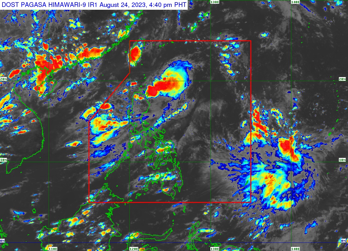
In its 5 p.m. bulletin, PAGASA said Goring was last located 265 kilometers (km) east of Basco, Batanes.
It is moving northwestward at 10 kilometers per hour (kph), while packing maximum sustained winds of 75 kph near the center and gusts of up to 90 kph.
Enhanced ‘habagat’
PAGASA said tropical depression Goring is less likely to bring heavy rainfall over the country in the next three days.
However, given the tropical cyclone’s proximity to land, any westward shift in the track forecast could bring about heavy rains over parts of the Cagayan Valley in the next three days.
The trough or extension of Goring was already bringing scattered rain showers and thunderstorms to the Cagayan Valley and Cordillera Administrative Region as of Thursday afternoon.
PAGASA said starting on Sunday or Monday, Aug. 27 or 28, the tropical depression may intensify the effect of the southwest monsoon, or “habagat,” which could lead to occasional rains over the western parts of Central and Southern Luzon, including Metro Manila.
Wind signals likely to be raised
PAGASA said the current forecast scenario indicates that the hoisting of tropical cyclone wind signals over some areas of Northern Luzon may begin Thursday evening or Friday, Aug. 25, in anticipation of the onset of Goring’s severe winds.
“However, the hoisting may happen earlier should there be changes in the forecast scenario,” it pointed out.
PAGASA also warned that the possible enhancement of the southwest monsoon could cause gusty conditions beginning on Sunday or Monday over most of Southern Luzon, Visayas, and Mindanao
“The gusty conditions are more likely in coastal and upland or mountainous areas exposed to winds,” it said.
‘Looping track’
Weather specialist Loriedin Dela Cruz-Galicia said Goring may remain over the Philippine Sea for the next five days, but a possible landfall over the islands of extreme Northern Luzon is not ruled out.
Dela Cruz-Galicia explained that a high-pressure area near Japan is influencing the tropical depression’s “looping track.”
PAGASA said Goring may move west-southwestward before turning southward while over the waters off the eastern coast of Cagayan Valley.
“Over the next five days, the tropical cyclone will follow a generally looping track and may likely return to a more northward movement by late Monday or Tuesday (Aug. 29),” it said.
Goring may also gradually intensify during the forecast period, reaching severe tropical storm status in the next 36 hours.
PAGASA said it may further intensify into a typhoon by Sunday, during the southward segment of its looping track.
“While current intensity forecast indicates the progression towards typhoon category, the inherent volatility of attaining super typhoon category remains a possibility,” PAGASA said.