


5 Luzon areas under Signal No. 1 due to typhoon Jenny


The Philippine Atmospheric, Geophysical and Astronomical Services Administration (PAGASA) raised tropical cyclone wind signal number 1 over five areas in Luzon as typhoon Jenny (international name: Koinu) further intensified on Monday, Oct. 2.
Signal No. 1 was hoisted over Batanes, Cagayan including Babuyan Islands, northern and eastern portions of Isabela (Maconacon, Divilacan, Palanan, Santa Maria, San Pablo, Tumauini, Cabagan, Ilagan City, San Mariano, Santo Tomas), Apayao and the northern portion of Ilocos Norte (Carasi, Vintar, Burgos, Dumalneg, Bangui, Pagudpud, Adams).
“The most likely highest wind signal that will be hoisted is Wind Signal No. 2, although the potential for Wind Signal No. 3 is not ruled out at this time,” PAGASA said.
Landfall potential ‘decreasing’
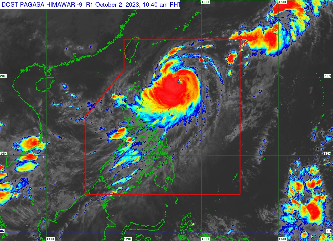
In its 11 a.m. bulletin, PAGASA said Jenny has maximum sustained winds of 140 kilometers per hour (kph) near the center and gusts of up to 170 kph.
It was last spotted 635 kilometers east-southeast of Basco, Batanes, moving northwestward at 15 kph.
“Jenny is forecast to move generally northwestward until tomorrow (Oct. 3) before turning west-northwestward or westward thereafter,” PAGASA said.
“On the track forecast, Jenny will make landfall over the southern portion of Taiwan on Thursday afternoon or evening (Oct. 5) then exit the Philippine area of responsibility (PAR) over the Taiwan Strait between Thursday evening or Friday morning (Oct. 6),” it added.
PAGASA pointed out that a landfall or close approach to Batanes remains possible, but the likelihood is “decreasing.”
Jenny may intensify steadily throughout the forecast period may reach its peak intensity on Tuesday.
However, a gradual weakening trend by mid-Wednesday, Oct. 4 is seen “due to a potential for dry air entrainment and increased wind shear prior to landfall over Taiwan.”
Heavy rains
PAGASA warned of moderate to heavy rains (50 to 100 millimeters) that may affect Batanes, Babuyan Islands, Ilocos Norte, Ilocos Sur, and the northern portion of mainland Cagayan until Tuesday noon.
From Tuesday noon to Wednesday noon, Batanes may experience heavy to intense rains (100 to 200 millimeters), while moderate to heavy rains may persist in Babuyan Islands, Ilocos Norte, Ilocos Sur, and the northern portions of mainland Cagayan and Apayao.
PAGASA said typhoon Jenny may also enhance the southwest monsoon, or “habagat,” and bring occasional to monsoon rains over the western portions of Central Luzon, Southern Luzon, Visayas, and Mindanao in the next three days.
Moderate to heavy monsoon rains may prevail over Zambales, Bataan, Occidental Mindoro, Antique, and the northern portion of Palawan, including Calamian, Cuyo, and Kalayaan Islands on Tuesday.
On Wednesday, moderate to heavy monsoon rains may persist in Metro Manila, Zambales, Bataan, Pampanga, Bulacan, Cavite, Batangas, Occidental Mindoro, and Calamian and Kalayaan Islands.