


10 years later: The 7.2-magnitude Bohol quake


On Sunday, Oct. 15, 2023, hundreds of families will remember the passing of their loved ones, and the destruction caused by one of the strongest earthquakes in Philippine history.
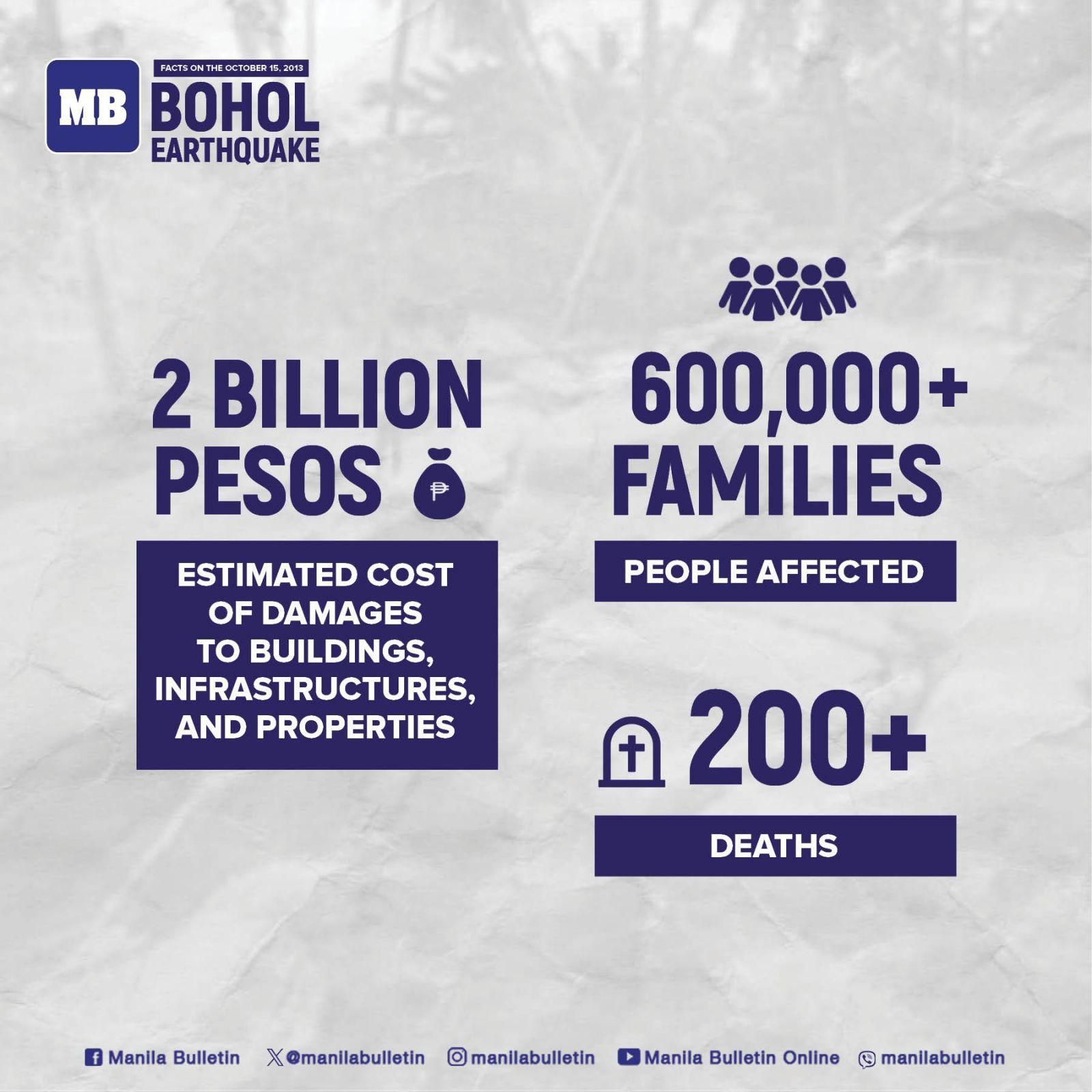
Ten years ago, on Oct. 15, 2013, a devastating earthquake hit Bohol and neighboring island-provinces, causing over 200 deaths and 976 injuries, and affecting over 600,000 families.
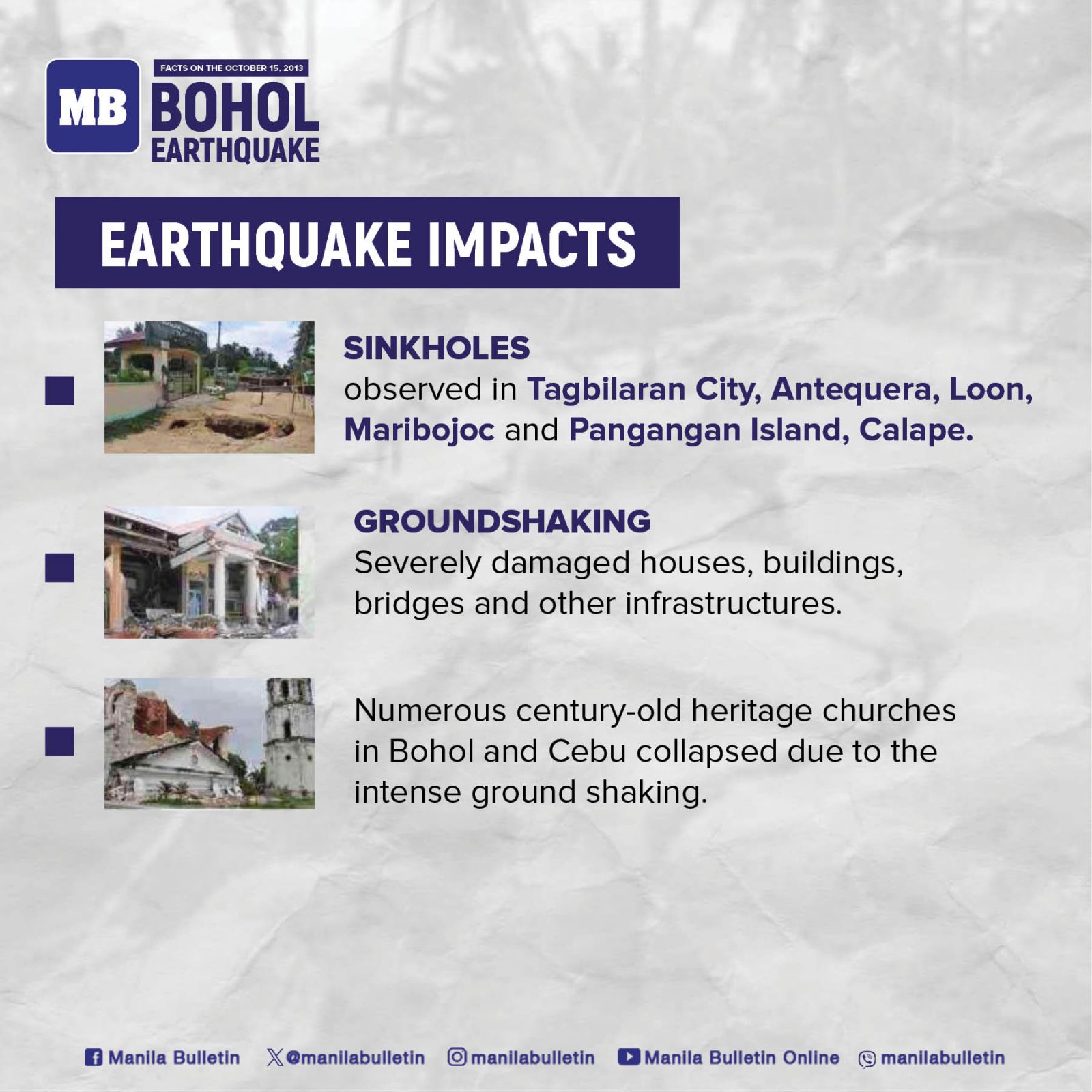
The ground shaking at 8:12 a.m. caused significant damage to century-old heritage churches in Bohol and Cebu, including the famous Baclayon church, as well as collapsed houses, hospitals, and schools, while numerous roads were damaged.
Forty-one bridges had also collapsed, including the Abatan Bridge, which connected Cortes town and Tagbilaran City.
The Philippine Institute of Volcanology and Seismology (Phivolcs) traced the epicenter of the earthquake 6 kilometers southwest of Sagbayan, Bohol.
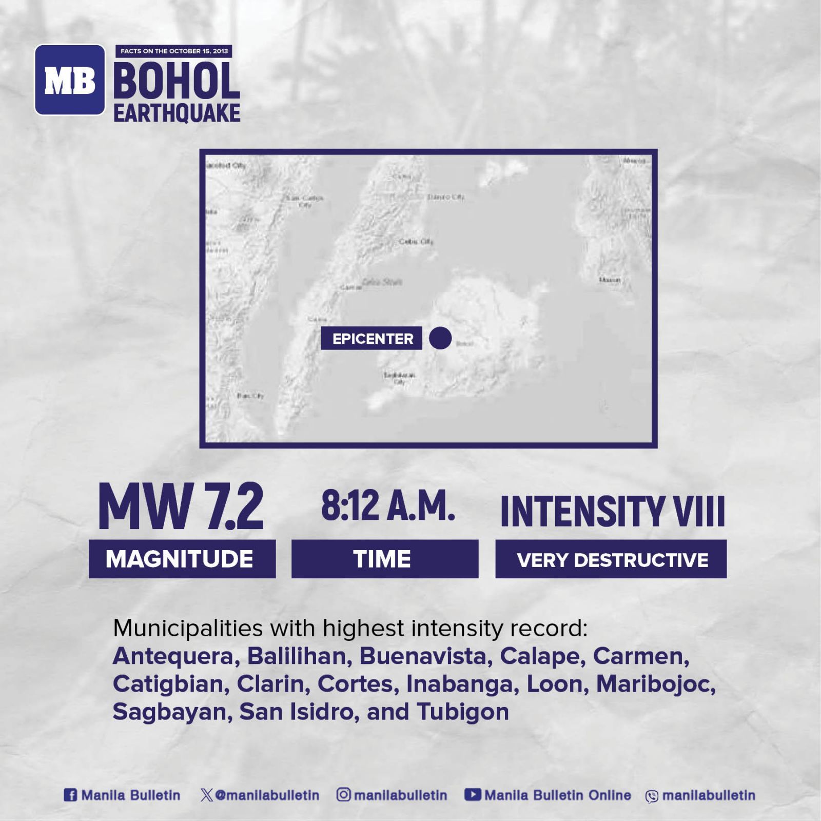
It was shallow at a depth of 12 kilometers, thus the strong shaking.
This earthquake’s highest recorded intensity was Intensity VIII, which meant it was “very destructive.”
Landslides, sinkholes, lateral spreading in several areas in Bohol were observed.
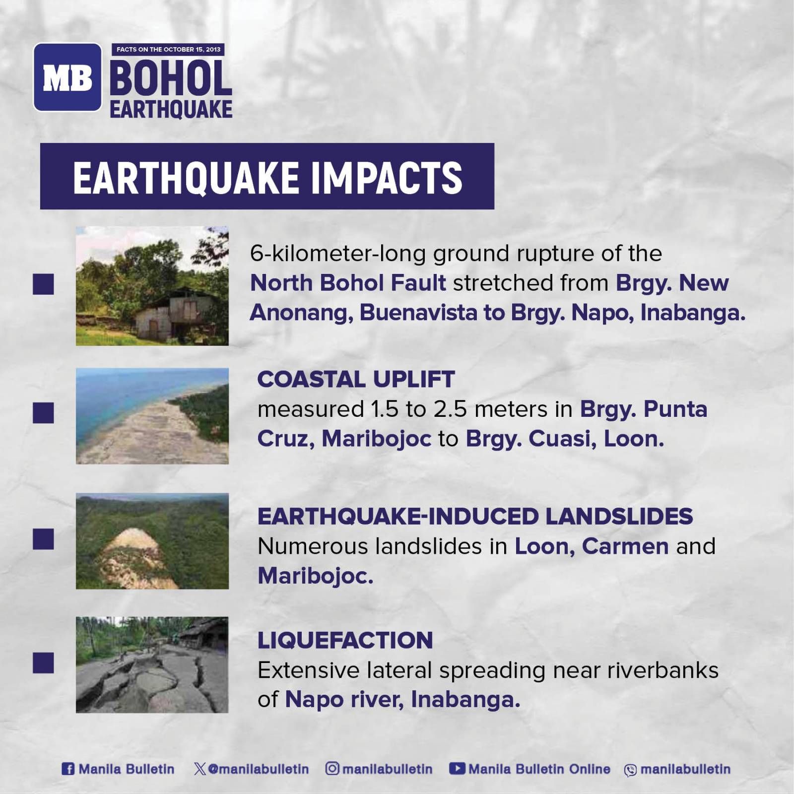
Phivolcs noted a six-meter ground rupture of the North Bohol Fault, which caused an estimated cost of P2 billion in property damages.
Bohol is an island located south of Manila and had an approximate population of 1.2 million when the 7.2-magnitude quake hit. (Lizst Torres Abello)