


PAGASA monitoring two potential tropical cyclones


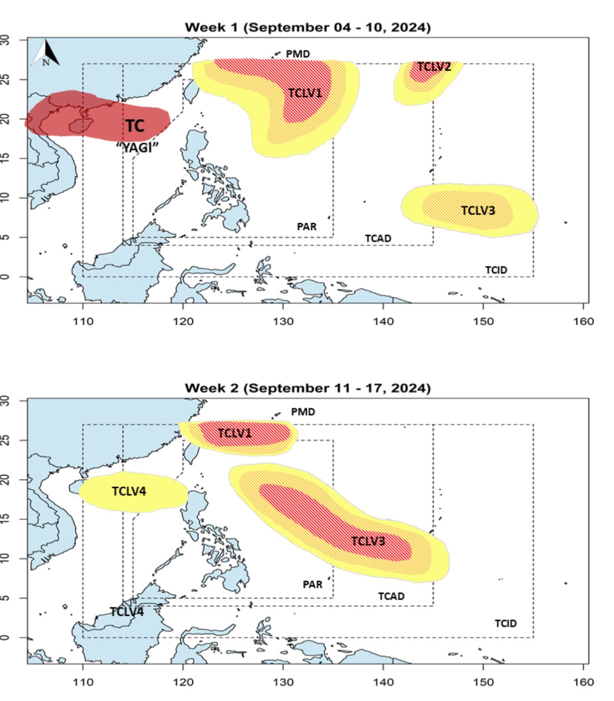
The Philippine Atmospheric, Geophysical and Astronomical Administration (PAGASA) on Thursday, Sept. 5 said two potential weather disturbances may develop into tropical cyclones next week.
PAGASA Weather Specialist Benison Estareja said two low pressure areas (LPAs), which may later develop into tropical cyclones, may form between Saturday and Monday, Sept. 6 and 9.
As of Thursday, Estareja said an LPA has been monitored outside the PAR but is not expected to develop into a tropical cyclone and may remain stationary.
However, he said there are cloud clusters east of Luzon where an LPA may form, which could develop into a tropical cyclone by early next week.
If it develops into a tropical depression inside the PAR, it will be given the name “Ferdie.”
“It is expected to move north-northeast and gradually move away from land, meaning it will have minimal impact on the southwest monsoon (habagat) on Monday (Sept. 9) and Tuesday (Sept. 10),” Estareja explained in Filipino.
Between Saturday and Monday, he said another LPA could form southeast of Guam and move westward towards the PAR.
Starting Wednesday, Sept. 11, the LPA could potentially move northwest and develop into a tropical depression, Estareja said.
It may enter the PAR later next week, and if it does, it will be assigned the name “Gener,” he added.
Estareja said the potential cyclone Gener may continue its westward track, which minimizes the likelihood of landfall.
However, if it follows this forecast track, it could enhance the habagat later next week.
He added that the forecast track of the potential weather disturbances may still change and urged the public to stay informed through PAGASA’s official updates.