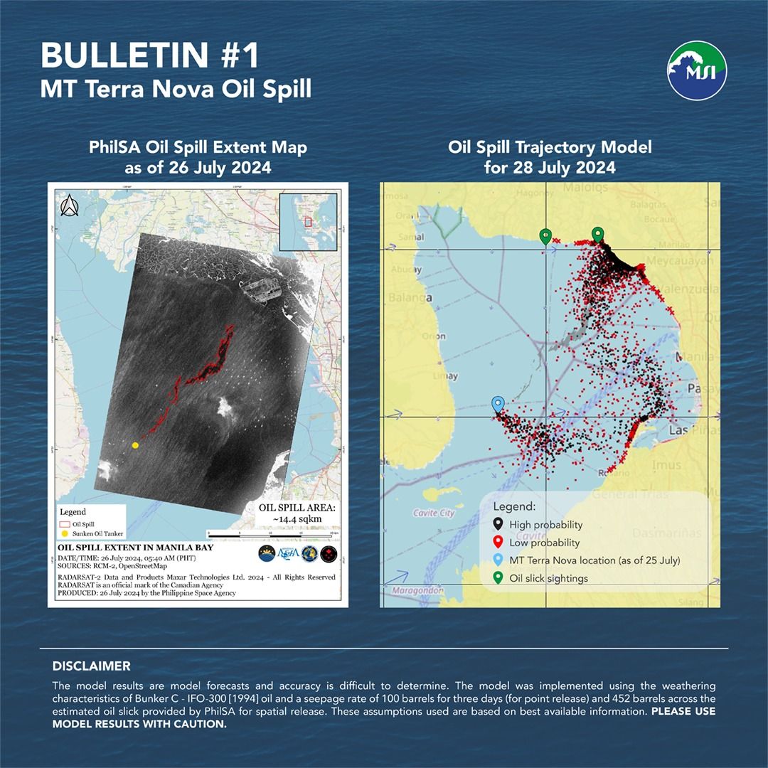
Bataan oil spill trajectory model shows possible impact on Bulacan, Cavite coasts

The trajectory model for the Bataan oil spill suggests that the slick could reach the coasts of Bulacan and Cavite, influenced by the prevailing weather and ocean conditions, based on a joint analysis led by the Department of Environment and Natural Resources, Philippine Space Agency (PhilSA), and University of the Philippines-Marine Science Institute (UP-MSI).
In the first bulletin on the MT Terra Nova oil spill issued on Sunday, July 28, via the UP-MSI Facebook page, the model indicates that the oil slick could potentially move northwards towards Bulacan, a projection confirmed by oil slick sightings observed by PhilSA at 5:40 a.m. on July 26.
Given the ongoing oil release from the tanker and the eastward shift in winds on July 28, coastal areas of Cavite City may also be affected, it said.
UP-MSI said the models are designed to inform the public about the potential direction of the oil spill and assist in guiding response efforts on the ground.
However, it also said that the models come with some levels of uncertainty due to their assumptions and limitations, and should therefore be used cautiously.
It explained that the General NOAA Operational Modeling Environment (GNOME) model predicts the fate and transport of pollutants, including oil spills.
For the MT Terra Nova spill, the model incorporates surface velocity fields from the Global Ocean Physics Analysis and Forecast and surface wind data from the National Center for Environmental Prediction Global Forecast System.
The spill's location is based on the MT Terra Nova's position as of July 25, provided by the Philippine Coast Guard, and the oil spill extent map from PhilSA dated July 26.
The MT Terra Nova capsized and sank in Bataan's waters shortly after midnight on July 25, causing a leak of 1.4 million liters of industrial fuel oil into Bataan and Manila Bay.