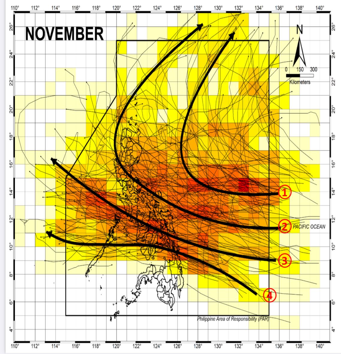
One or two tropical cyclones may enter or develop inside the Philippine Area of Responsibility (PAR) this month, said the Philippine Atmospheric, Geophysical and Astronomical Services Administration (PAGASA) on Friday, Nov. 1.
PAGASA Weather Specialist Benison Estareja said the next tropical cyclone names are “Marce” and “Nika.”
He said there remains a possibility of these cyclones intensifying into typhoons or even super typhoons.
READ MORE: https://mb.com.ph/2024/10/28/records-show-stronger-landfalling-cyclones-in-the-last-quarter
According to PAGASA’s climatological data from 1948 to 2015, Estareja said there were four typical cyclone tracks inside the PAR in November.
These cyclones often make landfall in Luzon, Visayas, and Caraga, with decreasing chances of “recurve” paths in the Philippine Sea, he added.
One common track involves tropical cyclones forming in the western Pacific that enter the PAR but then recurve towards the northeastern part, typically not making landfall before heading toward Japan or Korea.
Another track includes landfalling tropical cyclones that traverse Southern to Northern or Central Luzon, and recurve towards Japan or Korea after crossing the landmass.
Moreover, some landfalling tropical cyclones pass through the central Philippines, moving toward Vietnam.
Meanwhile, other cyclones traverse the southern Visayas before continuing to Thailand.