


Palace elated over inclusion of WPS on Google Maps


Malacañang expressed elation over the inclusion of the West Philippine Sea (WPS) on Google Maps, saying it came amid claims that it was only an illusion.
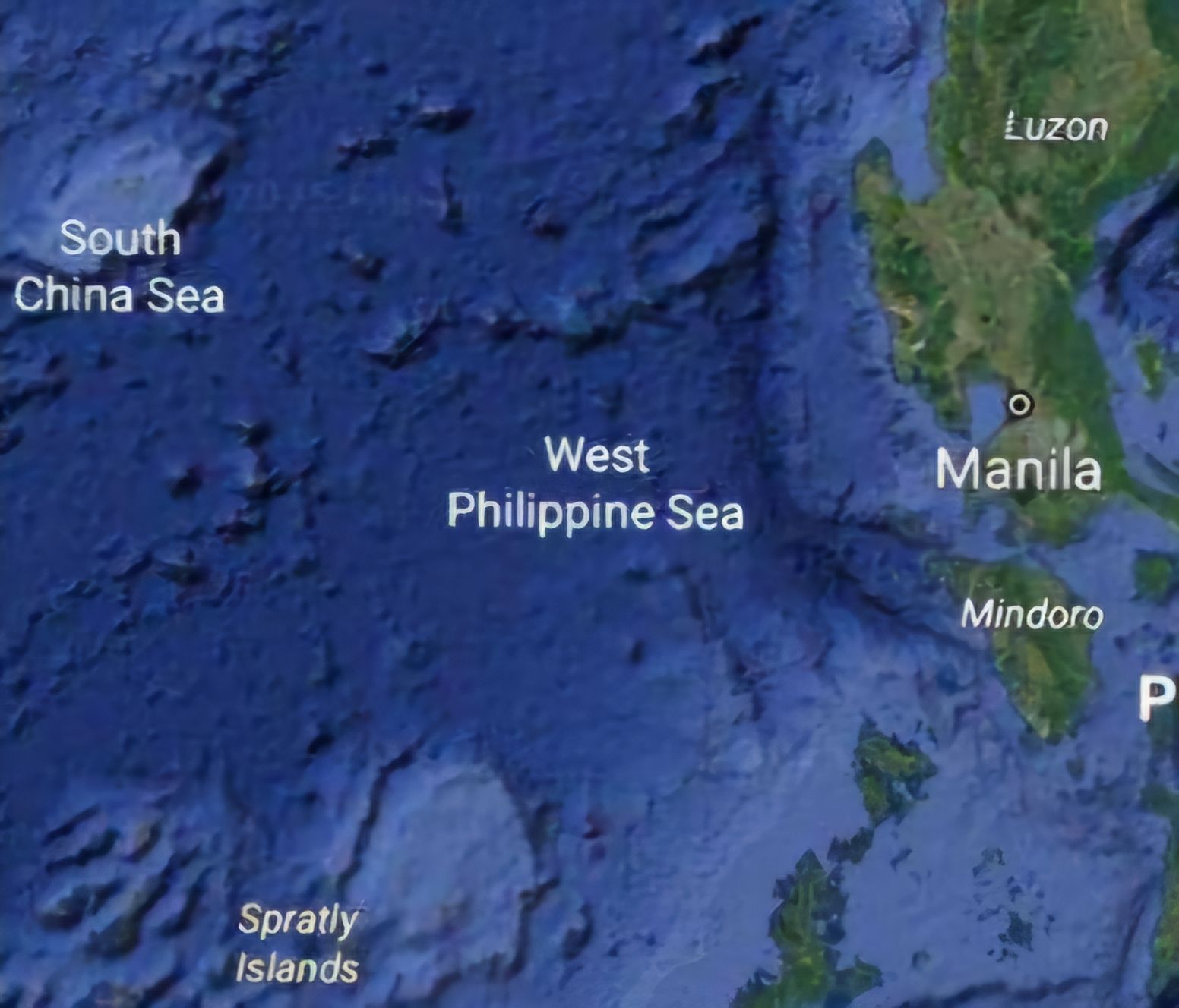
"Definitely po, masaya po ito, nakakatuwa po ito (Definitely this is a delight, we are elated)," Palace Press Officer and Communications Undersecretary Claire Castro said on Monday, April 21, when sought for the Palace's reaction on the inclusion of the WPS on Google Maps.
Castro said this is not only for the administration, but for the entire country, as it continues to protect and fight for it.
"Masaya na makilala ang West Philippine Sea, kahit na ang iba ay sinasabing gawa-gawa lamang daw ang West Philippine Sea (We are elated that the West Philippine Sea is being recognized even amid claims that this is just an illusion)," the Palace official said.
Castro reiterated the National Maritime Council's statement on the recent development, saying that the "initiative was a reflection that the WPS is being accepted as part of sovereignty and jurisdiction of the Philippines."
She stressed that it was also in accordance with the 1982 United Nations Conventions on the Law of the Sea (UNCLOS) and the 2016 South China Sea Arbitral Award strengthened by the Republic Act 12064 o ang Philippine Maritime Zones Act.
The Palace official said the inclusion of the WPS on a global platform like Google Maps helps inform the world about the maritime entitlement of the Philippines.
In its statement on April 18, the NMC said it would "help encourage consistency in the term’s use by the international community and facilitate the upholding of the freedom of navigation in the West Philippine Sea, which is largely composed of the Philippines’ Exclusive Economic Zone (EEZ)."